Maps of Northeast

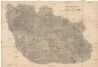
[Karte vom Preussische Staate und den angränzenden Ländern, östlich von Berlin]
1 : 280000 Čechy severní (Česko) Engelhardt, F. B. Bembé Simon Schropp und Comp.
Umgegend von Prag
Detail-Operations-Karte für den Krieg in Böhmen 1866
1 : 290000 Česko
Umgegend von Prag
1 : 325000 Praha-oblast (Česko) Engelhardt, Friedrich Bernhard Simon Schropp'sche Hof-Landkartenhandlung
Umgegend von Prag
1 : 325000 Praha-oblast (Česko) Engelhardt, Friedrich Bernhard Simon Schropp'sche Hof-Landkartenhandlung
[Severní Čechy]
Čechy severní (Česko)
[Železniční tratě severovýchodních Čech]
Polsko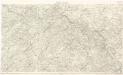
Detail - Karte des nordöstlichen Böhmens

Uebersichts-Karte des Eisenbahnzuges der Süd-Norddeutschen Verbindungsbahn von Pardubitz nach Reichenberg
Liberec (Česko : oblast)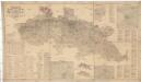
Spezial Karte für Verkehr, landwirtschaftliche, Montan u. gewerbliche Industrie des Bezirkes der Handels und Gewerbekammer Reichenberg
1 : 150000 Liberec-oblast (Česko) Daniel, N. N. Daniel
Naleziště nejstarší keramiky v Čechách jako stopa prvního osídlení
Čechy (Česko)
Církevní mapa biskupství Litoměřického

Budweis - Prag - Badenbach, Budweis - Pilsen- Komotau
Chomutov (Česko) K. k. Österreichische Staatsbahnen
Středočeský kraj

Sect. 20: Görlitz, uit: Geologische Karte des Deutschen Reichs in 27 Blaettern / [von] Richard Lepsius ; Red. von C. Vogel
1 : 500000 Annotatie: Blad 18 ontbreekt; Een aantal bladen op linnen; Een aantal bladen gereviseerd 1913-1914; Annotatie geografische gegevens: Met schaalstokken o.a. in kilometers; Legenda Carl Vogel 1828-1897 Gotha : Justus Perthes
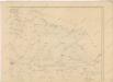
Strassenprofilkarte von Nord und Mittel Böhmen

Středočeský kraj
[Nordostböhmen]
1 : 750000 Čechy severovýchodní (Česko)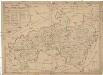
Mappa dioeceseos Litomericensis
1 : 185000 Litoměřice-oblast (Česko) Kreibich, František Jakub Jindřich
Prag mit den Umgebungen
1 : 570000 Praha (Česko) Kettner, Carl C. W. Enders
Prag mit den Umgebungen
1 : 570000 Praha-oblast (Česko) Enders, C. W. C.W. Enders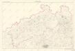
Severočeský kraj

Koenigreich Boehmen...
Hydrografische Uibersichtskarte der Flüsse, Bäche und sonstigen Gewässer im Königreiche Boehmen

[Česko]
Česko
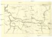
Uibersichtskarte für die Turnau-Kraluper Eisenbahn
1 : 423000 Kralupy nad Vltavou-oblast (Česko)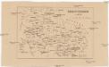
Knížectví Frydlantské r. 1633
1 : 1000000 Frýdlant-oblast (Česko) Sedláček, August České museum
Kraj pražský

Karte des Netzes der österr. Nordwest- und Süd-Norddeutschen-Verb.-Bahn im nördl. Böhmen
1 : 500000 Královéhradecký kraj (Česko : 2000)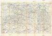
![[Karte vom Preussische Staate und den angränzenden Ländern, östlich von Berlin]](https://images-2.georeferencer.com/images/iiif/372857966406/full/,300/0/native.jpg)

