Maps of Czech Republic
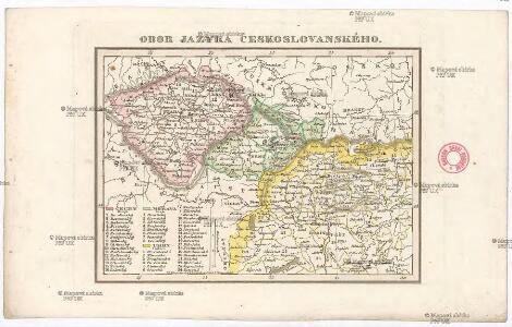
Obor jazyka českoslovanského
Česko Schmidt, Eduard Berra, Marco
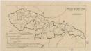
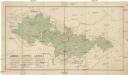
Sbírka map a diagramů použitých na mírových konferencích v Paříži v letech 1919 - 1920
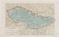
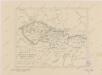
Pays Tcheques
1 : 1850000 Československo Larouse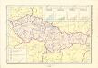
Historický atlas revolučního hnutí
Sbírka map a diagramů použitých na mírových konferencích v Paříži v letech 1919 - 1920
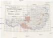
Přehled kladu mapových listů měř. 1:10 000, 25 000, 50 000, 100 000
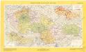
Sbírka map a diagramů použitých na mírových konferencích v Paříži v letech 1919 - 1920
Českoslov. stát malý
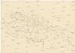
Československo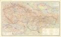
Čechoslovakija

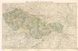
Völker-, Telegrafen- und Eisenbahn- Karte des Keiserthumes Öesterreich
Republika Československá
Sbírka map a diagramů použitých na mírových konferencích v Paříži v letech 1919 - 1920
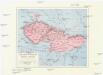
Les Pays Tchéques
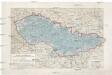
Morava (Česko) Conseil National Tschécoslovaque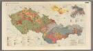
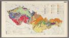
Quaternary Cover and Mantle of Weathered Material.
1 : 1000000 Czechoslovakia. Ústřední správa geodézie a kartografie.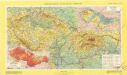
Československá socialistická republika
Země národa českoslovanského
Česko Boháč, Antonín Trávníček, František Společnost Národopisného musea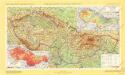
Československá socialistická republika
Československá socialistická republika

Finland. Poland. Austria, Czechoslovakia, and Hungary. Yugoslavia.
1 : 4127000 Hammond, C.S.
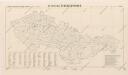
Postup při tisku příruční mapy školní ČSR
Mapa republiky Československé
Bez titulu: Československo
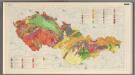
Geology.
1 : 1000000 Czechoslovakia. Ústřední správa geodézie a kartografie.
Czechoslovakia. Pergamon World Atlas.
1 : 1250000 Polish Army Topography Service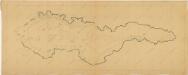
Bez titulu: Československo
Österreichische Karte 1:25 000
1 : 25000 Rakousko Militärgeographisches Institut
Österreichische Karte 1:25 000
1 : 25000 Rakousko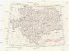
[Oesterreichisch-Ungarischen Monarchie]
1 : 25000 Rakousko-Uhersko Militärgeographisches Institut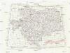
[Oesterreichisch-Ungarischen Monarchie]
1 : 50000 Rakousko-Uhersko K. u. k. Militärgeographisches Institut