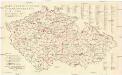
Maps of Czech Republic

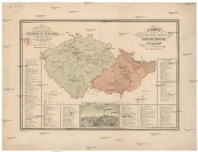
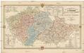
Cukrovárny v Čechách na Moravě a v Slezsku
Česko Čech, Karel Otakar Karel Ot. Čech
Cukrovárny v Čechách na Moravě a v Slezsku
Česko Čech, Karel Otakar Taafe, Ludvík Karel Ot. Čech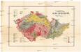
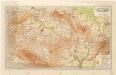
Přehledná mapa geologická zemí Koruny české
Česko Woldřich, Jan Nepomuk Frant. Bačkovský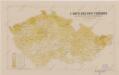
Sbírka map a diagramů použitých na mírových konferencích v Paříži v letech 1919 - 1920
Montanistische Geschäftskarte von Böhmen, Mähren und Öster. Schlesien
1 : 650000 Česko Schmidt, Johann Ferdinand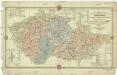
Montanistische Geschäftskarte von Böhmen, Mähren und Öster. Schlesien
1 : 660000 Česko Schmidt, Johann Friedrich Julius
Montanistische Geschäftskarte von Böhmen, Mähren und Öster. Schlesien
1 : 650000 Česko Schmidt, Johann Ferdinand Taafe, Ludvík
Montanistische Geschäftskarte von Böhmen, Mähren und Öster. Schlesien
Česko Schmidt, Johann Ferdinand Taafe, Ludvík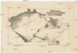
Carte de la germanisation des pays tchéques
1 : 1700000 Česko Kapras, Jan Hocke, Jan Service cartographique de l'Armée Tchécoslovaque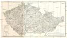
Oro Hydro Graphische General Charte vom Boehmen Maehren und Oestr. Schlesien
1 : 500000 Česko
Vilímkovy místopisné mapy zemí Koruny České
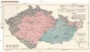
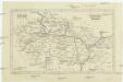
Mapa volebních okresů zemí Koruny české
Česko nákladem Tiskového a vydavatelského družstva Samostatnosti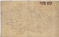
Poutní místa
Česko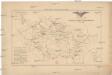
Přehled sokolských jednot českoslovanských v roce 1886
Česko Scheiner, Josef
[Slepá mapa Česka]
1 : 752000 Česko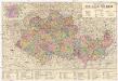
Protektorat Böhmen-Mähren
1 : 500000 Praha (Česko) Edvard Fastr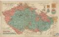
Das Deutsche Sprachgebiet in den Sudetenländern
Tschechische Republik 2001. Slowaken (slovenská národnost)
Tschechische Republik ethnische Gruppe, Slowaken Hofinger, Veronika
[Protektorát Čechy a Morava]
1 : 400000 Protektorát Čechy a Morava Machát, František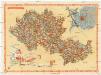
Carte économique de la Boheme et de la Moravie
Morava (Česko) V. Neubert & Sons Press
Isotermy v zemi České a Moravskoslezské
Grossdeutsches Reich Sudetenländer
Čechy, Morava a Slezsko
Česko Wagner, Jan Eduard sklad Jaroslava Pospíšila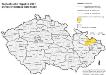
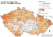
Tschechische Republik 2001. Schlesier (slezská národnost)
Tschechische Republik ethnische Gruppe, Schlesier Hofinger, Veronika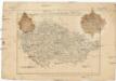
General-Karte von Boehmen Maehren und oesterreichischer Antheil von Schlesien
Česko Schlieben Ausfeld, Johann Carl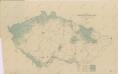
Mapa poněmčování zemí koruny České

Čechy, Morava a Slezsko
Morava (Česko) Studnička, Alois Karel Janský
Sprachenkarte der Tschechoslovakien Republik.
Česko Sobota, Emil Hocke, Jan Deutschpolitischen Arbeitsstelle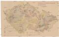
Mechanisch-physikalische Bodenkarte der Sudetenländer
1 : 750000 Česko Niethammer, A.
Mapa o stavu vozovek československých silnic
1 : 650000 Česko Autoklub RČS