Maps of Czech Republic

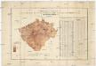
Království České
1 : 600000 Česko Gräf, K. Müller, A. Výmarský ústav zeměpisný
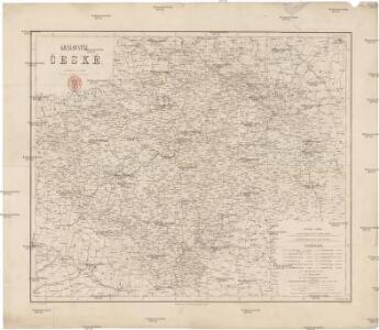
Království České
1 : 600000 Čechy (Česko) Gräf, K. Biedermann, E. Ústav zeměpisný
Království České
1 : 600000 Čechy (Česko) Gräf, K. Biedermann, E. Ústav zeměpisný
Království České
1 : 600000 Česko Gräf, K. Müller, A. Výmarský ústav zeměpisný
Místopisná mapa království českého

Mappa totius regni Bohemiae
1 : 700000 Čechy (Česko) Bock-Polach, Josef Ferdinand Müller, Johann Christoph
Mappa totius regni Bohemiae
1 : 700000 Čechy (Česko) Bock-Polach, Josef Ferdinand Ponheimer, Kilian
Automobil-Karte von Böhmen
1 : 560000 Čechy (Česko) Bayer, J. L Klement's Nachfolger
Kirchen Karte des königreiches Böhmen

Bohemia in XVI circulos divisa, notitiis plurimis illustrata
1 : 350000 Česko Bock-Polach, Josef Ferdinand Müller, Johann Christoph Artaria
Mapa Českého království
1 : 418000
Přehledná železniční mapa království Českého


Post Charte vom Königreiche Böhmen
1 : 1200000 Česko
Post Charte vom Königreiche Böhmen
1 : 1200000 Česko
Post charte vom Königreiche Böhmen
1 : 1200000 Česko
Post charte vom Königreiche Böhmen
1 : 1200000 Česko
Post Charte vom Königreiche Böhmen
1 : 1200000 Česko
Post Charte vom Königreiche Böhmen
1 : 1200000 Česko
Post Charte vom Königreiche Böhmen
1 : 1200000 Česko
Post Charte vom Königreiche Böhmen
1 : 1200000 Česko
Post Charte vom Königreiche Böhmen
1 : 1200000 Česko
Post Charte vom Königreiche Böhmen
1 : 1200000 Česko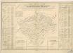
Orientirungs - Karte in der neuen gerichtlichen und politischen Eintheilung des Königreichs Böhmen

Charte vom Königreiche Böheim
1 : 550000 Česko Kreibich, František Jakub Jindřich David, Martin Alois in der A.G. Schneider u. Weigelschen Kunst- u. Landkartenhandlung
Charte vom Königreiche Böheim
1 : 569000 Česko Kreibich, František Jakub Jindřich David, Martin Alois in der A.G. Schneider u. Weigelschen Kunst- u. Landkartenhandlung
Charte vom Königreiche Böheim
1 : 569000 Česko Kreibich, František Jakub Jindřich David, Martin Alois A.G. Schneider u. Weigelschen Kunst u. Landkartenhandlung
Mappa geographica totius Regni Bohemiae in 12. circulos divisae, annexis comitatu Glacensi et districtu Egerano nec non aliis principatib. finitimis
1 : 730000 Kladsko-oblast (Polsko) Lotter, Tobias Conrad T. C. Lotter
[Mapa hustoty železniční sítě v Čechách]
1 : 1000000 Čechy (Česko) Novák, Fr.