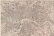
Maps of Lambeth

Insurance Plan of London South East District Vol. J: sheet 42
1 : 480 This detailed 1903 plan of London is one of a series of nineteen sheets in an atlas originally produced to aid insurance companies in assessing fire risks. The building footprints, their use (commercial, residential, educational, etc.), the number of floors and the height of the building, as well as construction materials (and thus risk of burning) and special fire hazards (chemicals, kilns, ovens) were documented in order to estimate premiums. Names of individual businesses, property lines, and addresses were also often recorded. Together these maps provide a rich historical shapshot of the commercial activity and urban landscape of towns and cities at the time. The British Library holds a comprehensive collection of fire insurance plans produced by the London-based firm Charles E. Goad Ltd. dating back to 1885. These plans were made for most important towns and cities of the British Isles at the scales of 1:480 (1 inch to 40 feet), as well as many foreign towns at 1:600 (1 inch to 50 feet). Chas E Goad Limited Chas E Goad Limited
London South East Vol. J: sheet 18
1 : 480 This detailed 1897 plan of London is one of a series of twenty-seven sheets in an atlas originally produced to aid insurance companies in assessing fire risks. The building footprints, their use (commercial, residential, educational, etc.), the number of floors and the height of the building, as well as construction materials (and thus risk of burning) and special fire hazards (chemicals, kilns, ovens) were documented in order to estimate premiums. Names of individual businesses, property lines, and addresses were also often recorded. Together these maps provide a rich historical shapshot of the commercial activity and urban landscape of towns and cities at the time. The British Library holds a comprehensive collection of fire insurance plans produced by the London-based firm Charles E. Goad Ltd. dating back to 1885. These plans were made for most important towns and cities of the British Isles at the scales of 1:480 (1 inch to 40 feet), as well as many foreign towns at 1:600 (1 inch to 50 feet). Chas E Goad Limited Chas E Goad Limited
London XI.25 - OS London Town Plan
1 : 1056 Topographic maps Ordnance Survey Ordnance Survey
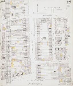
Insurance Plan of London South East District Vol. J: sheet 43
1 : 480 This detailed 1903 plan of London is one of a series of nineteen sheets in an atlas originally produced to aid insurance companies in assessing fire risks. The building footprints, their use (commercial, residential, educational, etc.), the number of floors and the height of the building, as well as construction materials (and thus risk of burning) and special fire hazards (chemicals, kilns, ovens) were documented in order to estimate premiums. Names of individual businesses, property lines, and addresses were also often recorded. Together these maps provide a rich historical shapshot of the commercial activity and urban landscape of towns and cities at the time. The British Library holds a comprehensive collection of fire insurance plans produced by the London-based firm Charles E. Goad Ltd. dating back to 1885. These plans were made for most important towns and cities of the British Isles at the scales of 1:480 (1 inch to 40 feet), as well as many foreign towns at 1:600 (1 inch to 50 feet). Chas E Goad Limited Chas E Goad Limited
London South East Vol J: sheet 2
This detailed 1897 plan of London is one of a series of twenty-seven sheets in an atlas originally produced to aid insurance companies in assessing fire risks. The building footprints, their use (commercial, residential, educational, etc.), the number of floors and the height of the building, as well as construction materials (and thus risk of burning) and special fire hazards (chemicals, kilns, ovens) were documented in order to estimate premiums. Names of individual businesses, property lines, and addresses were also often recorded. Together these maps provide a rich historical shapshot of the commercial activity and urban landscape of towns and cities at the time. The British Library holds a comprehensive collection of fire insurance plans produced by the London-based firm Charles E. Goad Ltd. dating back to 1885. These plans were made for most important towns and cities of the British Isles at the scales of 1:480 (1 inch to 40 feet), as well as many foreign towns at 1:600 (1 inch to 50 feet). Chas E Goad Limited Chas E Goad Limited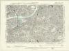
London XI.NW - OS Six-Inch Map
1 : 10560 Topographic maps Ordnance Survey Ordnance Survey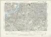
Surrey III.SW - OS Six-Inch Map
1 : 10560 Topographic maps Ordnance Survey Ordnance Survey
Charles Booth's descriptive map of London poverty 1889
Charles Booth
PLAN SHEWING THE PROPOSED LINE of the LONDON AND GREENWICH RAILWAY
1 : 7200 The title of this plan appears at bottom left, with an explanatory note and scale bar at bottom centre. An illustration of the general construction of the railway features at bottom right. The Greenwich line reached Bermondsey in 1836. A year later, it reached London Bridege, which became the first railway terminus in the capital. Wyld, James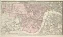
PLAN OF WESTMINSTER. No III
The area shaded red represents the extent of Westminster as defined in the Letters Patent of 3 August 1604. Basire, J.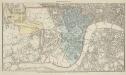
PLAN OF WESTMINSTER. No II
This map is highlighted to give a retrospective view of the extent of Westminster. Represented in blue is the territory of Westminster according to the Decretal of AD1222 , while the red outline shows the present boundary. The green and yellow outlines indicate manor boundaries. Basire, J.
PLAN OF WESTMINSTER. No 1 [A Plan of the City of Westminster, showing all the Parishes, as well as the Ancient Boundary of Westminster, in the year 951.]
An orange coloured area shows the extent of Westminster according to King Edgar's Charter of AD951. The contemporary boundary of Westminster is shown in red. Basire, J.
Insurance Plan of London South West District Vol. K: Key Plan
1 : 10560 This "key plan" indicates coverage of the Goad 1897 series of fire insurance maps of London that were originally produced to aid insurance companies in assessing fire risks. The building footprints, their use (commercial, residential, educational, etc.), the number of floors and the height of the building, as well as construction materials (and thus risk of burning) and special fire hazards (chemicals, kilns, ovens) were documented in order to estimate premiums. Names of individual businesses, property lines, and addresses were also often recorded. Together these maps provide a rich historical shapshot of the commercial activity and urban landscape of towns and cities at the time. The British Library holds a comprehensive collection of fire insurance plans produced by the London-based firm Charles E. Goad Ltd. dating back to 1885. These plans were made for most important towns and cities of the British Isles at the scales of 1:480 (1 inch to 40 feet), as well as many foreign towns at 1:600 (1 inch to 50 feet). Chas E Goad Limited Chas E Goad Limited
London SE.
1 : 15840 Stanford, Edward
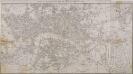
An exact survey of the city's of London Westminster , VII
1 Blatt : 53 x 71 cm John Rocque
London
Grosser Hand-Atlas über alle Theile der Erde in 170 Karten Meyer, J. Verlag des Bibliographischen Instituts
London Sheet O - OS Six-Inch Map
1 : 10560 Topographic maps Ordnance Survey Ordnance Survey
London Sheet O - OS Six-Inch Map
1 : 10560 Topographic maps Ordnance Survey Ordnance Survey
Middlesex XXII - OS Six-Inch Map
1 : 10560 Topographic maps Ordnance Survey Ordnance Survey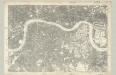
Surrey III - OS Six-Inch Map
1 : 10560 Topographic maps Ordnance Survey Ordnance Survey
The London guide, or, a pocket plan of the cities of London & Westminster & borough of Southwak : with the new buildings &c. to the year 1767
Ellis, J. (John), fl. 1750-1800 Printed for Carington Bowles
Londini Angliae regni metropolis delineatio accuratissima / autore F. de Witt
1 : 13000 Wit, Frederik de Amsterdam : F. de Witt
Illustrated map of London, or, Stranger's guide to the public buildings, theatres, music halls, & and all places of interest
Bartlett, G. Warren George H. Young
A colored plan, on vellum, of Southwark, and the country on the Surrey side of the Thames from Vauxhall to Deptford, with proposed roads from Westminster Bridge
MAP of LONDON and its ENVIRONS 203
The title of this map appears along the top, with scale bar and imprint below the plan. It shows Regents Park and the proposed new bridges at Vauxhall and Waterloo, with the East and West India Docks in the Isle of Dogs added on a separate sheet. Sherwood, Neely & Jones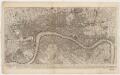
To Martin Folkes esq.r, president of the Royal Society : this plan of the cities of London and Westminster and borough of Southwark, with the contiguous buildings is humbly inscribed
1 : 15000 Rocque, John, d. 1762 John Pine ; John Tinney, print and map sellar
MAP of LONDON and its ENVIRONS 209
This later edition of Sherwood, Neely and Jones's 1813 original. The title appears along the top, with the publisher’s imprint and scale bar below the plan. The map shows Regents Park and the proposed new bridges at Vauxhall and Waterloo, with the Isle of Dogs and the East and West India Docks on an added sheet. Sherwood, Neely & Jones
LONDON AND WESTMINSTER with the Borough of SOUTHWARK Being an INDEX to the Large Plan in forty sheets 219
This folding map of London was originally published as the index to Harwood's famous map of Regency London. The map features the title, imprint and scale bar at the top right and is divided into squares, with letters and numbers along the borders for reference. Faden, William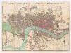
The stranger's guide to London and Westminster exhibiting all the various alterations and improvements, complete to the present time
Mogg, Edward Edward Mogg