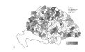
Maps of Carpathian Mountains
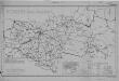
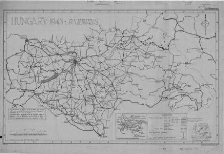
Hungary Railways (1944)
Hungary 1943 : Railways, MDR Misc 8021. Includes detail in territories annexed by Hungary from Czechoslovakia, Roumania and Yugoslavia. Great Britain. Army. Royal Engineers. Field Survey Company, 512th. [Cairo] : [Survey Directorate, Middle East]
Charte von den Kaiserlich Oesterreichischen Ungarischen Ländern
1 : 1200000 entworfen u. gezeichnet von F. W. Streit Weimar : Verlag des Geograph. Instituts
Allgemeine Charte vom Königreiche Ungarn
1 : 1500000 Chorvatsko Liechtenstern, Joseph Marx von Berken von Ottendorff, Johann Kunst und Industrie Comptoirs
Allgemeine Charte vom Königreiche Ungarn
1 : 1500000 Chorvatsko Liechtenstern, Joseph Marx von Berken von Ottendorff, Johann im Verlage des Kunst und Industrie Comptoirs
Plan der Bergstadt Terestian
Mollova mapová sbírka Geyer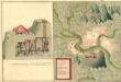
Plan des Gold und Silber Berg Adamos
Mollova mapová sbírka Geyer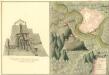
Plan der Bergstat Bogan
Mollova mapová sbírka Geyer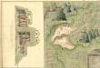
Plan der Bergstadt Abrugbania
Mollova mapová sbírka Geyer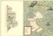
Plaan des Haupt Bergwerg Maidanpeg
Mollova mapová sbírka Geyer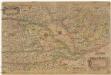
Nova et recens emendata totius regni Ungariae una cum adiacentibus et finitimis regionibus delineatio
1 : 1250000 Uhersko Keere, Pieter van den Corn. Nicol. P. Keere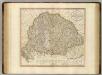
Hungary, Transylvania, Croatia.
1 : 1500000 Cary, John, ca. 1754-1835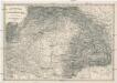
Uibersichts Karte des Kriegsschauplatzes von Ungarn und Siebenbürgen
1 : 1500000 Evropa střední a východní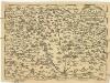
Regni Hvngariae
1 : 4000000 Uhersko
Ungarn mit seinen Nebenländern und Galizien
1 : 1600000 Dalmácie (Chorvatsko)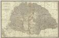
Magyar országnak
1 : 1000000 Maďarsko Engelmann Karacs Ferentz
Die konservativen Wahlbezirke
Ungarn Wahlbezirk, Wahlverhalten
Strassen-Karte des Koenigreiches Ungarn
1 : 430000 Uhersko A. Floder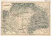
Uibersichts Karte des Kriegsschauplatzes von Ungarn und Siebenbürgen
1 : 1470000 Maďarsko
Die kaiserl. oesterreichischen ungarischen Erbstaaten
1 : 2276000 Maďarsko Weiland, Karl Ferdinand Jungmann, Carl im Verlage des Geograph. Instituts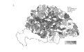
Die Bezirke der Tendenz "B" vor 1875
Ungarn Wahlbezirk, Wahlverhalten
Novissima regni Hungariae potamographica et telluris productorum tabula
1 : 991000 Maďarsko Junker, Christoph Joh. Matth. Korabinsky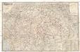
Magyarország és Horvát-Szlavonország
1 : 900000 Evropa východní Eggenberger-féle könyvkereskedés
Königreich Hungarn
1 : 1321000 Bukovina (Rumunsko a Ukrajina) Mollo, Tranquillo T. Mollo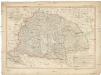
Königreich Hungarn
1 : 1321000 Bukovina (Rumunsko a Ukrajina) Mollo, Tranquillo T. Mollo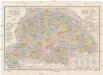
Orts- und Strassenkarte des Königreiches Ungarn
1 : 1296000 Chorvatsko Steinhauser, Anton Artaria
Hongrie. Coal Resources of the World.
1 : 1724100 de Pann, Charles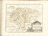
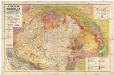
A Magyar birodalom és a szomszédos országok határos területeinek földtani térképe
1 : 900000 Maďarsko Lóczy, Lajos Papp, Károly Magyar földrajzi társaság
Karta teatra vojny v Vengrīi
Ungarn