Maps of Mizdah

Maps of Mizdah

$title$

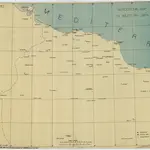
Western Libya, Aerodrome Map

Aerodrome map of Western Libya, DR 326. Great Britain. Army. Royal Engineers. Field Survey Company, 512th. [Cairo] : [Survey Directorate, Middle East]
$title$

Partie, Tunis et Tripoli. Afrique 3.

1 : 1641836 Vandermaelen, Philippe, 1795-1869
$title$

Een gedeelte van de kust van Barbaria tusschen C. Capudia en C. Mesurata int grood

Libya Gerard van Keulen
$title$

Neue Charte der Canarien Inseln

Kanárské ostrovy Linschoten, Jan Huygen van Bory de Saint-Vincent, Jean-Baptist Genevieve Marcellin
$title$

Isles de Madere, de Porto Santo, et celles des Salvages

Madeira (Madeirské souostroví) Bonne, Rigobert André
$title$

Insularum Aliquot Maris Mediterranei Descriptio. [Zerbi] [Karte], in: Theatrum orbis terrarum, S. 335.

1 Karte aus Atlas Ortelius, Abraham Vrients, Jan Baptista
$title$

Insularum Aliquot Maris Mediterranei Descriptio. [Zerbi] [Karte], in: Theatrum orbis terrarum, S. 240.

1 Karte aus Atlas Ortelius, Abraham
$title$

Insularum Aliquot Maris Mediterranei Descriptio. [Zerbi] [Karte], in: Theatrum orbis terrarum, S. 91.

1 Karte aus Atlas Ortelius, Abraham
$title$

Charte von der Insel Teneriffa

Tenerife (Kanárské ostrovy) Homann, Johann Christoph Bory de Saint-Vincent, Jean-Baptist Genevieve Marcellin
$title$

Tripoli

1 : 25000 Tripolis (Libye) Istituto geografico militare
$title$

De haven en stad Tripoli geleegen agter in de Middellandsche Zee, aen de cust van Barbarijen

Libya Gerard van Keulen
$title$

Plan de Ghadamés

1 : 10000
$title$

Port ou rade, de haven van Tripoli

Libya Gerard van Keulen
$title$

De haven of baij van Tripoli in Barbarijen geleegen agter in de Middellandse Zee

Libya Gerard van Keulen
$title$

[Střední Maroko]

Maroko Zeithammer, Antonín Otakar Badía y Leblich, Domingo
$title$

Africa 1:2.000.000, Tunisie

Tripolitania, Libya (also Tunisia)
$title$

Feuille 45 (C VII), uit: Carte géologique internationale de l'Europe : la carte, votée au congrès géologique international de Bologne en 1881, est exécutée conformément aux décisions d'une commission internationale, avec le concours des gouvernements, sous le dir. de M.M. Beyrich et Hauchecorne

Annotatie: Blad 48 gamme des couleurs; blad 49: bladwijzer en titelblad Heinrich Ernst Beyrich 1815-1896; Wi. Hauchecorne Berlin : Reimer / (Berlin: Institut lithographique)
$title$

Aegypten.

1 : 3000000 Radefeld, Carl Christian Franz, 1788-1874
$title$

[XXIII], uit: Geognostische Karte des Oesterreichischen Kaiserstaates mit einem grossen Theile Deutschland's u. Italien / hauptsachlich nach ... Haidinger's geognostischer Karte dieses Staates bearb. von Josef Scheda

1 : 3000000 titelvariant: General-Karte von Europa in 25 Blättern; Annotatie: Bijlage bij: General-Karte von Europa in 25 Blättern. - 1:2.592.000. - 1845-1847 Scheda, Joseph Wien : K.K. Militär. Geografisch. Institut
$title$

Afrika

$title$

Tunis, Tripoli.

1 : 2000000 Society for the Diffusion of Useful Knowledge (Great Britain)
$title$

Carte De La Mer Mediterranee. VI.

Roux, Joseph
$title$

Stato di Tunisi.

1 : 2000000 Marzolla, Benedetto
$title$

Tripoli.

1 : 2000000 Society for the Diffusion of Useful Knowledge (Great Britain)
$title$

Partie du Fezzan. Afrique 9.

1 : 1641836 Vandermaelen, Philippe, 1795-1869
$title$

Tunis.

1 : 2000000 Radefeld, Carl Christian Franz, 1788-1874
$title$

Neueste Karte von Tunis

Grosser Hand-Atlas über alle Theile der Erde in 170 Karten Meyer, J. Verlag des Bibliographischen Instituts
$title$

Tunis u. westl. Theil von Tripoli

1 : 2000000 Libye C. Flemming
$title$

Marocco, Algier und Tunis

Maroko Radefeld Kleinknecht
$title$

Carte de la Régence de Tripoli et des principales routes commerciales de l'interieur de l'Afrique : d'après les observations de Mr. Prax, les renseignements recueillis par ce voyageur et les études faites par Mr. Renou

1 : 2000000 dressée par MM. Prax et Renou d'après les observations de Mr. Prax, les renseignements recueillis par ce voyageur, et les études faites par Mr. Renou gravée sur pierre par F. Delamare Paris : Lemercier
© MapTiler © OpenStreetMap contributors
How does it work?
These instructions will show you how to find historical maps online.
Getting started
Type the place name in the search box to find the exact location. You can further adjust the search by zooming in and out.
Zoom
Zoom in and out with the buttons or use your mouse or touchpad natively.
Exact Area tool
Click here and draw a rectangle over the map to precisely define the search area.
Set filters
Narrow your search with advanced settings, such as Years (from/to), Fulltext, Publisher, etc.
Results
See the results of your search on the right side. You can scroll down to find more maps of this location.
?

Download OldMapsOnline Mobile