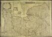
Maps of Meuvaines

France 1:25,000, Creully
France 1:25,000 , Series GSGS 4347. Great Britain. War Office. [S.l.] : [s.n.]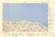
France 1:50,000 , Series GSGS 4250, Creully
France 1:50,000 , Series GSGS 4250. Great Britain. War Office. General Staff. Geographical Section. [London] : Ordnance Survey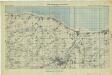
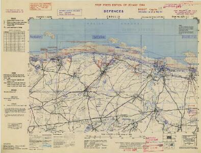
Arromanches - Carourg (Special), 21A Gp No 2
Arromanches - Carourg (Special), 21A Gp No 2. [S.l.] : [21st Army Group, United Kingdom]
France 1:25,000, Thaon
France 1:25,000 , Series GSGS 4347. Great Britain. War Office. [S.l.] : [s.n.]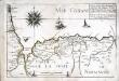
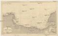
Capitaineries garde costes de Grais Port S.te Honorine Grand Camp Carentan et de la Hougue
1 Karte : 22 x 33 cm de Fer
[Bayeux - Caen]
1 Blatt : 60 x 92 cm s.n.
France 1:100,000, Caen-Falaise
France 1:50,000 , Series GSGS 4250. Great Britain. War Office. General Staff. Geographical Section. [London] : Ordnance Survey
Carte topographique du diocese de Bayeux, 2
1 Blatt : Jaillot
Calvados
Normandie (Francie) Levasseur, V. Aumont-Thiéville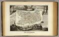
Dept. Du Calvados.
1 : 465000 Levasseur, Victor.
Département du Calvados
1 Karte : Kupferdruck ; 48 x 48 cm Houdan au bureau de l'atlas national rue de la Harpe n.o 26, et au dépôt du dit atlas rue de la Monnoye n.o 5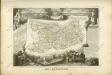
Der Kanal
1 : 150000 Francie Reichs-Marine-Amt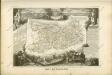

Département du Calvados
1 Karte : Kupferdruck ; 32 x 40 cm Capitaine s.n.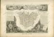

France 1:250,000, Caen
Sheet 8 of the 40-sheet map series, France 1:250 000, Series GSGS 2738. Great Britain. General Staff. Geographical Section. [London] : [GSGS, War Office]
9) V.N.O. ''Le Havre'', uit: Carte géologique de France
1 : 500000 Annotatie: Voor aanwezige bladen zie bladoverzicht [S.l : s.n.]
Carte de la province de Normandie, 1
1 Blatt : Esnauts et Rapilly
Le gouvernement general de Normandie, 1
1 Blatt : chez l'auteur Jaillot
delineation of the strata of England and Wales, with part of Scotland
1 : 320000 Blatt 14 Smith, William Cary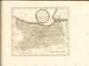

Northwestern Normandy : natural regions
1 : 550000 Provisional ed. Relief shown by shading. "Map no. 2369, 8 July 1943." "Restricted." "Reliability code: 00--2B--2." United States. Office of Strategic Services. Research and Analysis Branch [Washington, D.C.] : R & A, OSS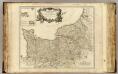
Normandie.
1 : 550000 Robert de Vaugondy, Gilles, 1688-1766
De Fransche Kanaalkust : (Cherbourg-Le Tréport)
1 : 1000000 Den Haag : Kompas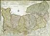
Carte de Normandie
1 Karte : Kupferdruck ; 47 x 65 cm L'Isle; Buache; Dezauche chez Dezauche graveur successeur et possesseur du fond géographique des S.rs Delisle et Buache et chargés de l'entrepo't général des cartes de la marine rue des Noyers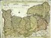
Carte de Normandie
1 Karte auf 2 Blättern : Kupferdruck ; 47 x 64 cm L'Isle; Condet chez J. Cóvens et C. Mortier
Carte de Normandie
1 Karte : Kupferdruck ; 47 x 65 cm L'Isle chez l'auteur sur le quay de l'Horloge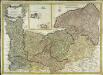
Carte de la province de Normandie
1 Karte : Kupferdruck ; 48 x 68 cm Duperrier chez l'auteur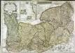
Le Duché et gouvernement de Normandie
1 Karte : Kupferdruck ; 48 x 68 cm Crépy; Crépy chez Crepy