Maps of Thessaloniki
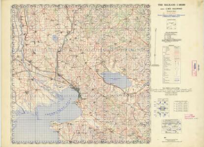
Balkans 1:100,000, Salonike
This is one sheet (C3672) of the topographical map series - Balkans 1:100,000 , Series GSGS 4087 - in 38 sheets, covering northern and central mainland Greece. The sheetlines are based on Mediterranean Grid. Originally, it was designated as "Not to be published". Great Britain. War Office. General Staff. Geographical Section. [London] : War Office
Solun
1 : 200000 Soluň (Řecko) Kartografska radionica
Karta na čast' ot' južna Makedonija
1 : 210000 Makedonie
[Macedonien]
1 Karte : Kupferdruck ; 18 x 13 cm [Trattner]
Carte des écoles et églises du vilayet de Salonique (1908)
Griechenland Selanik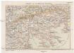
Saloniki und die Halbinsel Chalkidike
1 : 1250000 Chalkidiki (Řecko) Freytag & Berndt
Carte normale aeronautique internationale
1 : 200000 Geografike yperesia strarou
Westliches Mazedonien
1 : 600000 Makedonien (Landschaft)
Oestliches Mazedonien
1 : 600000 Makedonien (Landschaft)
Vodena
1 : 200000 Kartografska radionica
Saloniki, Seres, Xanthi, Kastro, Pharsalos
1 : 750000 Fársala (Řecko) Budik, A. K. u. k. Militärgeographisches Institut
Salonik, Seres, Xanthi, Kastro, Phersala
1 : 750000 Soluň (Řecko) K. k. militär-geographisches Institut
Übersichtskarte von Mittel - Europa

[Mazedonien]
Makedonien
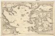
Schema k dějstvījam Senjavina i Grejga v Archipelagě v 1807 godu
Türkei Seeschlacht Senjavin, Dmitrij Nikolaevič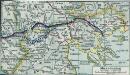
Mazedonien
1 : 3000000 Makedonien (Landschaft) Weltkrieg <1914-1918>
[Bălgarska zemja v Makedonija]
Makedonien Ethnische Gruppe Bulgaren
[Mazedonien]
Makedonien
Izvod ot etnografskata karta na Ležana
Makedonien Ethnische Gruppe
Izvod ot etnografskata karta na Mekenzi i Erbi
Makedonien Ethnische Gruppe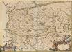
Macedonia Alexandri M. Patria Illustris. [Karte], in: Novus atlas absolutissimus, Bd. 10, S. 67.
1 Karte aus Atlas Janssonius Offizin
Thessaliae accurata Descriptio [Karte], in: Novus atlas absolutissimus, Bd. 10, S. 89.
1 Karte aus Atlas Janssonius Offizin
H.8. Skoplje, uit: [Übersichtskarte von Europa 1:750.000]
1 : 750000 Wien : K.u.K. Militärgeographisches Institut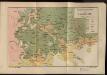
Etnografska karta na Makedonija
Makedonien Ethnische Gruppe
Carte ethnographique de la Macédoine, Point de vue bulgare
Makedonien Ethnische Gruppe Th. Weinreb del.
Carte ethnographique de la Macédoine, Point de vue serbe
Makedonien Ethnische Gruppe Th. Weinreb del.
Národopisná mapka Macedonie
Makedonie Král z Dobré Vody, Vojtěch Kančov, Vasil
Carte de la Macédoine d'une partie de l'Albanie, de l'Epire et de la Thessalie
1 : 800000 Albánie Lapie, Pierre Kaeppelin Société geologique de France
Der von der IMRO geplante Mazedonische Staat
Makedonien Innere Makedonische Revolutionäre Organisation