Project
Community
News
My maps
Gecatalogiseerde kaart
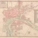
A colored plan of Montauban; drawn about 1700
Volledige titel:
A colored plan of Montauban; drawn about 1700
Fysieke grootte:
20 x 30 cm
Geschiedenis