Maps of Luzon

Maps of Luzon

$title$

A collection of charts prepared from various sources by Alexander Dalrymple, Philipinas, 1788
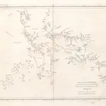
[A collection of charts prepared from various sources by Alexander Dalrymple and showing the coasts of West and South Africa, the Indian Ocean, Malay Archipelago, China, the Moluccas and New Holland] London : Alexander Dalrymple.
$title$

Partie, Iles Philippines. Oceanique no. 4.

1 : 1641836 Vandermaelen, Philippe, 1795-1869
$title$

Luzon, Philippine Islands.

1 : 2408000 Rand McNally and Company
$title$

No. 24. Norte de Paragua.

1 : 147000 U.S. Coast and Geodetic Survey
$title$

No. 8. Luzon.

1 : 723000 U.S. Coast and Geodetic Survey
$title$

[Islas filipinas - Mindoro]

Atlas de Filipinas Algué, P. José Government Printing Office
$title$

[Islas filipinas - Luzon]

Atlas de Filipinas Algué, P. José Government Printing Office
$title$

[Islas filipinas - Norte de Paragua]

Atlas de Filipinas Algué, P. José Government Printing Office
$title$

No. 15. Mindoro.

1 : 807000 U.S. Coast and Geodetic Survey
$title$

A collection of charts prepared from various sources by Alexander Dalrymple, Luzon, 1788

[A collection of charts prepared from various sources by Alexander Dalrymple and showing the coasts of West and South Africa, the Indian Ocean, Malay Archipelago, China, the Moluccas and New Holland] London : Alexander Dalrymple.
$title$

No. 11. Luzon.

1 : 670000 U.S. Coast and Geodetic Survey
$title$

No. 10. Luzon.

1 : 670000 U.S. Coast and Geodetic Survey
$title$

[Islas filipinas - Negros]

Atlas de Filipinas Algué, P. José Government Printing Office
$title$

[Islas filipinas - Luzon]

Atlas de Filipinas Algué, P. José Government Printing Office
$title$

[Islas filipinas - Luzon]

Atlas de Filipinas Algué, P. José Government Printing Office
$title$

[Islas filipinas - Leyte]

Atlas de Filipinas Algué, P. José Government Printing Office
$title$

[Islas filipinas - Cebú]

Atlas de Filipinas Algué, P. José Government Printing Office
$title$

[Islas filipinas - Panay]

Atlas de Filipinas Algué, P. José Government Printing Office
$title$

No. 9. Luzon.

1 : 535000 U.S. Coast and Geodetic Survey
$title$

No. 20. Panay.

1 : 640000 U.S. Coast and Geodetic Survey
$title$

No. 21. Negros.

1 : 665000 U.S. Coast and Geodetic Survey
$title$

No. 22. Cebu.

1 : 642000 U.S. Coast and Geodetic Survey
$title$

No. 19. Leyte.

1 : 660000 U.S. Coast and Geodetic Survey
$title$

[Islas filipinas - Luzon]

Atlas de Filipinas Algué, P. José Government Printing Office
$title$

No. 17. Masbate y Ticao.

1 : 498000 U.S. Coast and Geodetic Survey
$title$

[Islas filipinas - Masbate y Ticao]

Atlas de Filipinas Algué, P. José Government Printing Office
$title$

[Islas filipinas - Infantay Polillo]

Atlas de Filipinas Algué, P. José Government Printing Office
$title$

No. 12. Infanta y Polillo.

1 : 390000 U.S. Coast and Geodetic Survey
$title$

[Islas filipinas - Bohol]

Atlas de Filipinas Algué, P. José Government Printing Office
$title$

[Islas filipinas - Romblón, Tablas y Sibuyán]

Atlas de Filipinas Algué, P. José Government Printing Office
© MapTiler © OpenStreetMap contributors
How does it work?
These instructions will show you how to find historical maps online.
Getting started
Type the place name in the search box to find the exact location. You can further adjust the search by zooming in and out.
Zoom
Zoom in and out with the buttons or use your mouse or touchpad natively.
Exact Area tool
Click here and draw a rectangle over the map to precisely define the search area.
Set filters
Narrow your search with advanced settings, such as Years (from/to), Fulltext, Publisher, etc.
Results
See the results of your search on the right side. You can scroll down to find more maps of this location.
?

Download OldMapsOnline Mobile