Maps of Ogo Mountains

Maps of Ogo Mountains

$title$

1 : 125,000 Somaliland Protectorate. Geological Survey. D.C.S. 1076, El Dur Elan
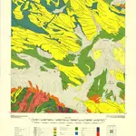
1 : 125,000 Somaliland Protectorate. Geological Survey. D.C.S. 1076. [Surbiton] : Directorate of Colonial Surveys
$title$

Somaliland 1:250 000, Las Dureh

Somaliland 1:250 000 , Series GSGS 3927. Series in seventeen sheets covers former British Somaliland only. Sheetlines based on grid. Sheets numbered consecutively; 1 to 17. Great Britain. War Office. General Staff. Geographical Section. [S.l.] : War Office.
$title$

Soil map (Somalia)

[A collection of maps illustrating an economic survey and reconnaissance report on British Somaliland, G.P. numbers 2577 - 2593]. Great Britain. Army. East Africa Force. [S.l.] : 157 (E.A. & S.R.) Base Svy. Coy., E.A.E.
$title$

Carta dimostrativa della Etiopia (Sheet 6)

Carta dimostrativa della Etiopia, in 6 fogli e 2 aggiunte, alla scala di 1 : 100,000. Compilata dal Capitano ... Ethiopia de Chaurand, etc. [Rome]
$title$

British Somaliland [showing routes] (1926)

British Somaliland [showing routes], GSGS 2991(b). Great Britain. General Staff. Geographical Section. [London] : [GSGS, War Office]
$title$

British Somaliland, GSGS 2991 (1922)

British Somaliland, GSGS 2991. Great Britain. General Staff. Geographical Section. [London] : [GSGS, War Office]
$title$

Plant ecology (Somalia)

[A collection of maps illustrating an economic survey and reconnaissance report on British Somaliland, G.P. numbers 2577 - 2593]. Great Britain. Army. East Africa Force. [S.l.] : 157 (E.A. & S.R.) Base Svy. Coy., E.A.E.
$title$

Adel. Afrique 33.

1 : 1641836 Vandermaelen, Philippe, 1795-1869
$title$

British Somaliland and Sokotra

in British Somaliland and Sokotra. [With a map.] iv, 40 p. ; 8 -- . Great Britain. Foreign Office. Historical Section.
$title$

Itinerari di due viaggi al Madagascar eseguiti dall'inge. E. Cortese nel 1887

1 : 1000000 Società geografica italiana
$title$

Cestovatele Viléma Němce přehledná mapa Císařství habešského s poznámkami zoografickými a místopisnými

1 : 2070000 Etiopie Němec, Vilém Československá grafická unie
$title$

Upper Nubia and Abyssinia.

1 : 2854868 Johnston, W. & A.K.
$title$

Upper Nubia and Habesh or Abyssina.

1 : 5000000 Rand McNally and Company
$title$

Ethiopia. Pergamon World Atlas.

1 : 5000000 Polish Army Topography Service
$title$

AEthiopisches Hochland Alpenland Habesch und Vorstuffe von Darfur und Sennaar

Dárfúr (Súdán) Arrowsmith, John
$title$

Nubia, Abyssinia.

1 : 3860000 Arrowsmith, John
$title$

Abyssinië in vogelvlucht gezien = Abyssinie vue a vol d'oiseau / Seghers

titelvariant: Abyssinie vue a vol d'oiseau; Annotatie: Gegevens verzameld over de periode/Data collected over the period: 1935; With photographs of current world leaders; Fragment: foto's van wereldleiders ontbreken; Annotatie geografische gegevens: Bijkaart: Van Gibraltar tot Abessinië = De Gibraltar a l'Abessinie W. Seghers Antwerpen [etc.] : [Patria, etc.]
$title$

Nubien, Habesch, Kordofan, Darfur.

1 : 6300000 Radefeld, Carl Christian Franz, 1788-1874
$title$

Programma di massima della triangolazione geodetica di I° ordine dell' altopiano etiopico

1 : 3000000 Eritrea Istituto geografico militare
$title$

Abessinien

1 : 5000000 Etiopie G. Freytag & Berndt
$title$

Abyssinien oder (Habesch) Nubien - Burnu

1 : 55650000 Etiopie Jättnig, Karl Gleditsch
$title$

Nubia, Abyssinia.

1 : 5100000 Hall, S. (Sidney)
$title$

[Kaart], uit: Colonie dell'Africa Orientale Italiana

1 : 4000000 Annotatie: Ondertitel op omslag: Eritrea - Somalia Italiana - Etiopia - Somalia Francese e Britannica; Annotatie geografische gegevens: Inzetkrt.: [Omgevingskaart]. - 1:50.000.000 Milano : Vallardi
$title$

La Nubia ed Abissinia

$title$

Ostafrika – Vých. Afrika

$title$

Nubie, Abissinie.

1 : 7000000 Bonne, Rigobert, 1727-1794
$title$

Abessinien

1 : 5000000 Afrika východní Josef Ulbricht
$title$

Abyssinia, Nubia &c.

1 : 4000000 Pinkerton, John, 1758-1826
$title$

116-17. Eritrea, Etiopia, Somalia.

1 : 5000000 Touring club italiano
$title$

Spezial-Karte von Afrika

1 : 4000000 Blatt 6 Habenicht, Hermann Perthes
© MapTiler © OpenStreetMap contributors
How does it work?
These instructions will show you how to find historical maps online.
Getting started
Type the place name in the search box to find the exact location. You can further adjust the search by zooming in and out.
Zoom
Zoom in and out with the buttons or use your mouse or touchpad natively.
Exact Area tool
Click here and draw a rectangle over the map to precisely define the search area.
Set filters
Narrow your search with advanced settings, such as Years (from/to), Fulltext, Publisher, etc.
Results
See the results of your search on the right side. You can scroll down to find more maps of this location.
?

Download OldMapsOnline Mobile