Maps of Islington

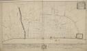
Plan of the Six Alms-Houses on Snow-Hill of the Benefaction of Edmond Hammond ESQ
1 : 72 This plan depicts the almshouses belonging to the Haberdasher's Company, one of the City of London's livery companies. These were massive trade guilds, many of which had existed since medieval times. The date in pencil at the base of the plan ("June 10th 1805") is in the same hand as the measurements of the covered passage running from the bottom of the sheet. Cooper, J.
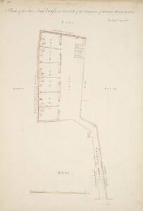
Drawn Plan of the Property of St. Bartholomew's Hospital] 9
This is an 18th-Century copy of Ralph Treswell's plan of the property of St. Bartholomew's Hospital. A painter by trade, Treswell was also a mapmaker and one of the first surveyors of the modern era. The plan features orientation points marked on margins. The tenements in St. Bartholomew's Estate, St. Sepulchre's Churchyard, the ditch running from Smithfield Bars to the Common Shore and Smithfield are shown pictorially.
Insurance Plan of City of London Vol. II: sheet 39-1
1 : 480 This detailed 1886 plan of London is one of a series of twenty sheets in an atlas originally produced to aid insurance companies in assessing fire risks. The building footprints, their use (commercial, residential, educational, etc.), the number of floors and the height of the building, as well as construction materials (and thus risk of burning) and special fire hazards (chemicals, kilns, ovens) were documented in order to estimate premiums. Names of individual businesses, property lines, and addresses were also often recorded. Together these maps provide a rich historical shapshot of the commercial activity and urban landscape of towns and cities at the time. The British Library holds a comprehensive collection of fire insurance plans produced by the London-based firm Charles E. Goad Ltd. dating back to 1885. These plans were made for most important towns and cities of the British Isles at the scales of 1:480 (1 inch to 40 feet), as well as many foreign towns at 1:600 (1 inch to 50 feet). Chas E Goad Limited Chas E Goad Limited
Plan of the improvements at Snowhill
1 : 1200 Snowhill is a steep hill extending from Central Markets to Holborn Viaduct. The plan shows improvements at Snowhill which predate the building of the viaduct in 1869. Woodthorpe, V.
Insurance Plan of City of London Vol. II: sheet 42
1 : 480 This detailed 1886 plan of London is one of a series of twenty sheets in an atlas originally produced to aid insurance companies in assessing fire risks. The building footprints, their use (commercial, residential, educational, etc.), the number of floors and the height of the building, as well as construction materials (and thus risk of burning) and special fire hazards (chemicals, kilns, ovens) were documented in order to estimate premiums. Names of individual businesses, property lines, and addresses were also often recorded. Together these maps provide a rich historical shapshot of the commercial activity and urban landscape of towns and cities at the time. The British Library holds a comprehensive collection of fire insurance plans produced by the London-based firm Charles E. Goad Ltd. dating back to 1885. These plans were made for most important towns and cities of the British Isles at the scales of 1:480 (1 inch to 40 feet), as well as many foreign towns at 1:600 (1 inch to 50 feet). Chas E Goad Limited Chas E Goad Limited
PLAN OF THE CITYS INTENDED IMPROVEMENT AT SNOW HILL
1 : 4800 This plan shows the widening and continuation of the road at Snow Hill. The properties within the route of expansion are numbered and lettered, indicating that they are to be purchased to allow for the development. Metcalf, R.
Proposed Plan for improving the Approaches to the Metropolitan Meat Market, Smithfield, and Railway Stations; and for reducing the Acclivities of Holborn Hill, Skinner street, etc
London VII.55 - OS London Town Plan
1 : 1056 Topographic maps Ordnance Survey Ordnance Survey
FARINGTON within and BAYNARD CASTLE with its Divisions into Parishes taken from the last Survey with Corrections. 23A
1 : 2400 This plan was published in Strype's first annotated edition of Stow's 'Survey of England'. The plan's title features in cartouche at top left, with compass star and scale bar near bottom left. The keys to streets, yards, halls, courts and private properties appear in tables down both sides of the plate. St. Paul's Cathedral and other prominent buildings are shown pictorially. Farringdon Ward was divided into Farringon Within and Farringdon Without in 1394 because "the governance thereof is too laborious and grievous for one person to occupy and duly govern the same". Blome, Richard
BAYNARDS CASTLE AND FARINGDON WARD WITHIN with their Divisions into Parishes according to a new SURVEY.
1 : 3600 This plan was published in William Maitland's 'History of London from its Foundation to the Present Time'. Its title features in cartouche at lower left, with the arms of Sir Robert Ladbrook, Alderman of Baynord Castle, and William Bridgen, Alderman of Farringdon Within, at bottom left. The compass star appears at bottom centre. An illustrated view of St Bennet's Church is at top left, with St Martin's Church at top right and St. Andrew's church at bottom right. Maitland's ward plans were largely derived from Strype's plans, with the illustrations copied from West Tow's 1736 'Prospect Views of Ancient Churches'. Farringdon Ward was divided into Farringon Within and Farringdon Without in 1394 because "the governance thereof is too laborious and grievous for one person to occupy and duly govern the same." Cole, B.
FARRINGDON WARD without WITH ITS Divisions into Parishes taken from the last Survey with Corrections and Amendm.ts 24A
1 : 3600 This plan was published in Strype's first annotated edition of Stow's 'Survey of England'. The plan's title features in banner at the top of the plate, with a compass star at middle left. The key to streets, yards, halls, courts and private properties appears in a table at lower right, with the wards prominent buildings shown pictorially. Farringdon ward was divided into Farringon Within and Farringdon Without in 1394 because "the governance thereof is too laborious and grievous for one person to occupy and duly govern the same". Blome, Richard
FARRINGDON WARD without WITH ITS Divisions into Parishes taken from the last Survey with Corrections and Amendm.ts 26
1 : 3600 This plan was published in William Maitland's 'History of London from its Foundation to the Present Time'. The plan's title features in cartouche at top left, with the heraldic arms of dedicatee Richard Beckford, the ward Alderman, at top centre. A view of Temple Bar appears at top right, with view of Bridewell North Gate next to the compass star at bottom right. Maitland's ward plans were largely derived from Strype's, with the illustrations copied from West Tow's 1736 'Prospect Views of Ancient Churches'. Farringdon Ward was divided into Farringon Within and Farringdon Without in 1394 because "the governance thereof is too laborious and grievous for one person to occupy and duly govern the same". Cole, B.
Insurance Plan of City of London Vol. II: Key Plan
1 : 480 This "key plan" indicates coverage of the Goad 1886 series of fire insurance maps of London that were originally produced to aid insurance companies in assessing fire risks. The building footprints, their use (commercial, residential, educational, etc.), the number of floors and the height of the building, as well as construction materials (and thus risk of burning) and special fire hazards (chemicals, kilns, ovens) were documented in order to estimate premiums. Names of individual businesses, property lines, and addresses were also often recorded. Together these maps provide a rich historical shapshot of the commercial activity and urban landscape of towns and cities at the time. The British Library holds a comprehensive collection of fire insurance plans produced by the London-based firm Charles E. Goad Ltd. dating back to 1885. These plans were made for most important towns and cities of the British Isles at the scales of 1:480 (1 inch to 40 feet), as well as many foreign towns at 1:600 (1 inch to 50 feet). Chas E Goad Limited Chas E Goad Limited
Insurance Plan of City of London Vol. I: Key Plan
1 : 480 This "key plan" indicates coverage of the Goad 1886 series of fire insurance maps of London that were originally produced to aid insurance companies in assessing fire risks. The building footprints, their use (commercial, residential, educational, etc.), the number of floors and the height of the building, as well as construction materials (and thus risk of burning) and special fire hazards (chemicals, kilns, ovens) were documented in order to estimate premiums. Names of individual businesses, property lines, and addresses were also often recorded. Together these maps provide a rich historical shapshot of the commercial activity and urban landscape of towns and cities at the time. The British Library holds a comprehensive collection of fire insurance plans produced by the London-based firm Charles E. Goad Ltd. dating back to 1885. These plans were made for most important towns and cities of the British Isles at the scales of 1:480 (1 inch to 40 feet), as well as many foreign towns at 1:600 (1 inch to 50 feet). Chas E Goad Limited Chas E Goad Limited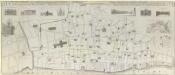
AN EXACT SURVEIGH OF THE STREETS, LANES AND CHURCHES, COMPREHEND.D PLATS, 10 Decem.r A.o Dom.i 1666
1 : 1836 This plan was reduced and engraved by Vertue in 1723 for the Society of Antiquaries. It is a derivative of Leake's 1667 map depicting London after the great fire of the previous year. The title of the map appears at the top, with scale bar at bottom right, a dedication to the Society of Antiquaries at middle left, and the key to lines and symbol in a banner at middle right. Below the title are illustrated prospects of buildings near Temple Gate in Fleet Street, Baynards Castle, St. Paul's Cathedral (from the south and west), Cheapside, Guildhall and the Royal Exchange. A plan of the City of London and Westminster is inset at upper right with a reference table. Vertue, George
London (1915- Numbered sheets) V.10 (includes: City Of Westminster; Finsbury; Holborn; Inner Temple; Lambeth St Mary; London; Southwark) - 25 Inch Map
1 : 2500 Topographic maps Ordnance Survey Ordnance Survey
Insurance Plan of London Vol. 1: Key Plan
1 : 3600 This "key plan" indicates coverage of the Goad 1904 series of fire insurance maps of London that were originally produced to aid insurance companies in assessing fire risks. The building footprints, their use (commercial, residential, educational, etc.), the number of floors and the height of the building, as well as construction materials (and thus risk of burning) and special fire hazards (chemicals, kilns, ovens) were documented in order to estimate premiums. Names of individual businesses, property lines, and addresses were also often recorded. Together these maps provide a rich historical shapshot of the commercial activity and urban landscape of towns and cities at the time. The British Library holds a comprehensive collection of fire insurance plans produced by the London-based firm Charles E. Goad Ltd. dating back to 1885. These plans were made for most important towns and cities of the British Isles at the scales of 1:480 (1 inch to 40 feet), as well as many foreign towns at 1:600 (1 inch to 50 feet). Chas E Goad Limited Chas E Goad Limited
Collins' Illustrated Atlas of London with 7000 references, in 36 plates of the principal routes between St. Paul's and the suburbs, from a survey made expressly for this work, by R. Jarman

WYLD'S PLAN OF THE CITY OF LONDON
This map of the City of London is based on Horwood's map of 1792-9. The map is enclosed in a border and features title inset in the top border, scale bar and imprint in the bottom border and table with reference to City wards at top right. Ward boundaries are highlighted in colour. Wyld, James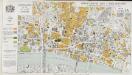
Report of the Improvements and Town Planning Committee to the Right Honourable the Lord Mayor, Aldermen and Commons of the City of London, in Common Council assembled on the preliminary draft proposals for post-war reconstruction in the City of London.
Corporation of London
GENERAL PLAN OF THAT PART OF THE CITY OF LONDON THAT WAS DESTROYED BY THE GREAT FIRE OF 1666; SHOWING THE PRESENT STATE THEREOF
1 : 2431 This retrospective map compares pre-fire London with the city of the 1830s. The title and publisher's imprint appear at top left, with a reference table at bottom right, scale bar at bottom centre, and woodcut view of the Temple at top right. The map shows churches, halls and public buildings destroyed in the fire in grey,with contemporary buildings in pink. Wishaw, Francis
Greater London Plan 1944. By Patrick Abercrombie
Abercrombie, Patrick His Majesty's Stationery Office
PLAN of the CITY ROAD
1 : 4800 Survey of the City Road, London, from the Angel Inn in Islington to Finsbury Square with title and imprint at top left, compass in the centre, scale bar at bottom right and note on paving of Finsbury Square at lower right. Wickings, W.
PLAN OF THE CITY OF LONDON DIVIDED INTO WARDS
This plan was published in Allen's 'History of London' of 1828. Its title and a list of the city wards feature below the plan, with ward boundaries indicated by a dotted line. City wards were created in the Norman era with aldermen elected for life for the purpose of government. Ward 'beadles' were employed fulltime with responsibility for the "preservation of peace, supervision of trading, sanitation and local upkeep". Allen, Thomas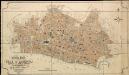
General Plan of the City of London
Haywood, William London
Sr. Cristopher Wren's Plan for Rebuilding the City after the dreadfull Conflagration in 1666
1 : 31680 This is an eighteenth-century copy of Sir Christopher Wren's plan for rebuilding London after the great fire destroyed seven-eighths of the city. This reduced plan seems to have been published a number of times. This latest edition has a textual explanation beneath the map. When Wren made his plan for rebuilding he was an Oxford astronomer with comparatively little architectural experience, but he was among the first to present a reconstruction plan after the catastrophe. On this plan the narrow streets which had helped spread the fire are replaced by monumental avenues. The influence of the classical buildings and formal street plans which Wren had studied in Paris are a clear influence. Wren also proposed constructing a Thameside quay from Bridle to the Tower, replacing the ramshackle wooden wharfside buildings with warehouses. A vignette of 'Thamesis' (a putative river god), a female personification of the city, and London burning in the background have been added to the border. Wren's plan was never used. Perhaps due to his eagerness to produce a plan quickly, he was inaccurate in making his ground plan and did not consider contours adequately. Neither king nor parliament were ever to take it seriously, despite title's the assertion that it was 'unhappily defeated by faction.' Wren, Christopher
Insurance Plan of London: sheet 6
This detailed 1889 plan of London is one of a series of six sheets in an atlas originally produced to aid insurance companies in assessing fire risks. The building footprints, their use (commercial, residential, educational, etc.), the number of floors and the height of the building, as well as construction materials (and thus risk of burning) and special fire hazards (chemicals, kilns, ovens) were documented in order to estimate premiums. Names of individual businesses, property lines, and addresses were also often recorded. Together these maps provide a rich historical shapshot of the commercial activity and urban landscape of towns and cities at the time. The British Library holds a comprehensive collection of fire insurance plans produced by the London-based firm Charles E. Goad Ltd. dating back to 1885. These plans were made for most important towns and cities of the British Isles at the scales of 1:480 (1 inch to 40 feet), as well as many foreign towns at 1:600 (1 inch to 50 feet). Chas E Goad Limited Chas E Goad Limited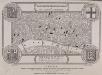
LABYRINTHUS LONDINENSIS or THE EQUESTRIAN PERPLEXED
The author of this small plan of London invites his readers to find their way around the city, from the Strand to St. Paul's, avoiding the many roads closed for repair. The plan's title appears at the top, with the royal Arms at the top left, the city arms at the top right, the arms of Bridge House at the bottom right and the arms of Westminster at the bottom left. A note explains the rules of the puzzle in the panel below the plan. Ingrey, Charles
LARGE AND ACCURATE MAP OF THE CITY OF LONDON. Ichnographically describing all the Streets, Lanes, Alleys, Courts, Yards, Churches, Halls and Houses, &Amp;c
1 : 1200 Large map of London printed in 20 sheets featuring title along the top, city arms and dedication to the Lord Mayor, the Aldermen and Sheriffs of the city in cartouche at top left and arms of Sheldon, Lord Mayor at top right and with compass star and dividers at bottom centre. This is the first accurate and detailed map of London, with all the buildings represented in plan rather than as bird's eye views. Ogilby, John and Morgan, William