Maps of Wandsworth

Maps of Wandsworth

$title$

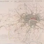
JURISDICTION OF THE METROPOLITAN POLICE

This map illustrates plans for the reform of the jurisdiction of Metropolitan Police. Based on Dawson's map of 1832, the map’s title appear along the top, with compass star at top right, explanatory note at bottom left, and a scale bar at bottom right. District boundaries are highlighted in colour, with the old limits of London, Westminster and Southwark shaded. Formed in 1829, the Metropolitan Police had its jurisdiction extended in 1839to Greater London - an area taken to mean all parishes partly within twelve miles of Charing Cross or wholly within fifteen miles of Charing Cross. In the same year, the City of London formed its own police force. Dawson, Lieut. Robert K.
$title$

A New and Accurate Survey of the Country about the Cities of LONDON, and WESTMINSTER and the Borough of Southwark for 15 miles in Length & 12 in Depth

In the second half of the18th century, the introduction of turnpike roads and the increased coach-traffic in and out of London contributed to the popularity of the maps of the countryside around the capital. The title of this plan appears in cartouche at bottom centre, with a scale bar near bottom left and its border divided in degrees of latitude and longitude. Bennost
$title$

[Recto], uit: Map of general routes / Fred J.H. Elston

1 : 12500 Elston, Fred J. H. London : General Omnibus Co.
$title$

A PLAN of LONDON on the Same Scale as that of PARIS: In Order to ascertain the Difference of the extent of these two Rivals

The title of this plan appears in English and French along the top of the plate, along with the scale bars. The publisher’s imprint and dedication to John, Duke of Montague, feature below the plan. Allegorical figures are depicted at bottom centre holding the Duke's coat of arms. The border of the map is divided in degrees of longitude from the old meridian at St Paul's. Rocque, John
$title$

A plan of London

1 Karte : Kupferdruck ; 44 x 62 cm Rocque; Parr John Rocque
$title$

An Exact Survey of the Citys of London, Westminster, ye Borough of Southwark, and the Country near Ten Miles round

This map was first published by Rocque in 1746, and several editions appeared before his death in 1762. His widow Mary Ann carried on the business for a few years, until, in the late 1760s, she transferred the plates of the map to the publishers Carrington Bowles and Robert Sayer, under whose imprints this edition appeared in 1769. Printed in 16 sheets, the map is set within a decorative border. Its title features in English, Latin and French along the top, with emblematic figures below the City arms at top centre, and the compass star at top left. The map is dedicated to Lord Burlington at bottom centre. Scales are given at the foot of the map in versts, leagues, toises, yards and miles. A key to symbols distinguishing orchards, arable land, formal parkland and gardens, pasture, and woodland is included at bottom right. The "New Road" (Marylebone Road), Blackfriars Bridge and the roads across St George's Fields are also shown. Rocque, John
$title$

INDEX TO THE PLAN OF LONDON MADE FOR The Metropolitan Commissioners of Sewers

This map's title and imprint feature at top left, with an explanatory note at bottom right and scale bar at bottom centre. The map is divided into rectangles, forming the index to two "London and its Environs" Ordnance Survey maps. The cholera outbreaks of the 1830s and 40s forced the government to improve London drainage and sewage disposal. The Commission of Sewers was established to combine seven of the eight existing sewage companies into one, unifying their drainage systems. Metropolitan Commission of Sewers
$title$

Stanford's new two inch map of London and its environs

1 : 31680 Londýn (Anglie) Edward Stanford
$title$

LONDON AND ITS ENVIRONS 241

This is a later edition of the map of London and the suburbs first issued by Davies in 1840. The map features title in top border, scale bar at bottom centre and key to symbols below the map. A note below the map states that the map contains "the boundaries of the Metropolitan Boroughs, the different railroads and stations, the new cemeteries and roads, docks, canals and all the modern improvements. The map is chiefly drawn from the Ordnance Survey, the railroads and the other improvements from the official copies and the Borough of Marylebone from the survey published by Mr Britton. The whole corrected from personal observations and measurements." Davies, Benjamin Rees
$title$

LONDON AND ITS ENVIRONS 248

This is a later edition of the map of London and the suburbs first issued by Davies in 1840. The map features title in top border, scale bar at bottom centre and key to symbols below the map. A note below the map states that the map contains "the boundaries of the Metropolitan Boroughs, the different railroads and stations, the new cemeteries and roads, docks, canals and all the modern improvements. The map is chiefly drawn from the Ordnance Survey, the railroads and the other improvements from the official copies and the Borough of Marylebone from the survey published by Mr Britton. The whole corrected from personal observations and measurements. “Borough and county boundaries are highlighted in colour, with principal roads represented in yellow. Davies, Benjamin, Rees
$title$

[Kaart], uit: Bartholomew's road surface map of London & neighbourhood

1 : 30000 Edinburgh : Bartholomew
$title$

Map of London [showing] work of the Metropolitan Public Gardens Association, November, 1882, to December, 1900. Scale of miles, 1 1/2[ = 2 1/4 inches]

$title$

[Recto], uit: Route map and guide : [London]

1 : 50000 London : London General Omnibus Co.
$title$

[Recto], uit: L.C.C. trams

1 : 50000 titelvariant: The tramways pocket map & timetable; Annotatie: Omslagtitel: The tramways pocket map & timetable London County Council [London : London County Council]
$title$

LONDON AND ITS ENVIRONS LEVELS TAKEN BY ORDER OF THE COMMISSIONERS OF SEWERS

The cholera outbreaks of the 1830s and 1840s forced the government to make drastic improvements to the methods of drainage and sewage disposal in London. A Metropolitan Commission of Sewers was charged with the central task of unifying the existing piecemeal drainage system and forming a plan for a completely new one. A new map showing the levels of the land to be drained was needed for this. In March 1848, officers of the Royal Engineers began to prepare stations for triangulation. Observation posts were set up on one of the towers of Westminster Abbey and over the cross of St Paul's. This map is the result of the survey, showing the relative altitude of the land, a necessary preamble to planning drainage systems, as sewage can only be washed away downhill. Wyld, James
$title$

Plan of a Proposed TURNPIKE ROAD From St. JOHN'S CHAPEL, ST. MARYLEBONE into the Great North Road Near the 8 Mile Stone at Finchley

1 : 31680 Plan of the proposed turnpike road from Regent's Park to Finchley, today's Finchley Road. The plan features title at top right, scale bars at lower right and sections of the road in elevation at the foot of the plate, with the new road represented by a double dotted line coloured red. Down the left of the plate a table gives distances between stations along the road and shows the savings in milage generated by the new road. Phillips, Henry
$title$

METROPOLITAN BOROUGHS

This map of London was produced for the 1832 Reform Bill that established the metropolitan boroughs. The map's title features along the top; with a compass star at top right, an explanatory note at bottom right. At bottom left is a list of the 'liberties' of the city - the name given to areas exempt from the jurisdiction of the country sheriff, being subject to a separate commission of the peace (in this case royal and governmental authorities). The new boroughs are highlighted in colour, with the shaded area representing the old boundaries of London, Westminster and Southwark. Dawson, Lieut. Robert K.
$title$

The Lancet Map of Medical London

$title$

The METROPOLITAN BOROUGHS As Defined by the reform Bill

This map was produced after the Reform Bill of 1831/32 that created the metropolitan boroughs of London. The title appears at bottom right, with scale bar at bottom left, London arms of at top left, and arms of Westminster at top right. Also at bottom left is a list of 'liberties' - the name given to areas exempt from the jurisdiction of the country sheriff, being subject to a separate commission of the peace (in this case royal and governmental authorities).
$title$

A Map of London showing the proportion of the inhabitants of each registration sub-district in 1881, born in other parts of the United Kingdom

$title$

Kaart van Londen enz. en van het naby gelegen land ruim een uur gaans rondom dezelve stad : getrokken uit de groote gemeeten kaart van de Hr. John Rocque

1 : 63500 Amstersdam : Isaak Tirion
$title$

Map of the County of Middlesex in which parishes are bounded with red to be distinguished from the others

The title is missing from this copy of the map. The gives a list of parishes within the Bill of Mortality in scroll at top right with parish boundaries outlined in colour. Land use and reliefs are expressed by symbols, with the built-up area within the City of London represented by stippling. Rocque, John
$title$

The fourth sheet of an actual survey of the county of Middlesex in which the parishes within the bills of mortality are bounded with red to be distinguished from the others

1 Blatt : 53 x 70 cm John Rocque
$title$

England and Wales, Cities, Ports & Harbours.

1 : 63360 Fullarton, A. & Co.
$title$

London : guide to the International Exhibition, 1862

1 : 15840 Dower, John, fl. 1838-1846? Illustrated London News
$title$

LONDON Drawn and engraved expressly for the POST OFFICE DIRECTORY

Map of London published by Benjamin Rees Davies for the Post Office Directory with title and scale bar in table at top right. The London post codes W, N, N.E., E, S.E., S and S.W. are indicated. Davies, Benjamin Rees
$title$

CRUCHLEY'S New Plan of LONDON and its ENVIRONS

This map is the 11th edition of Cruchley's 'New Plan'. It was altered on each publication, recording the many developments than spanned this period, particularly railway expansion. In this edition the Waterloo and Bricklayers Arms stations are shown, as are Battersea and Victoria Parks. Prior to the establishment of his own business, Cruchley worked for the Arrowsmiths map-publishing firm. Consequently the words “from Arrowsmiths" appear in his imprint on many of his early maps. George Frederick Cruchley
$title$

Stanford’s Map of London, shewing the Areas granted to the Electric Light Supply Companies

Edward STANFORD
$title$

KAART van LONDEN enz en van het NABY GELEGEN LAND ruim een Uur gaans. rondsom dezelve Stad; getrokken uit de groote gemeeten Kaart van de Hr. JOHN ROCQUE, Te AMSTERDAM by ISAAK TIRION 1754

In the second half of the18th century, the introduction of turnpike roads and the increased coach-traffic in and out of London contributed to the popularity of the maps of the countryside around the capital. This map of the area ten miles round the City of London was published in Amsterdam by Isaak Tirion. Based on John Rocque's survey of 1744, the map’s title, imprint and key appears in a table at top left. The scale bars are in a panel below the plan. Built-up areas are stippled in the City and hatched elsewhere. Tirion, Isaak
$title$

London : drawn and engraved expressly for the post office directory

1 : 253440 Kelly's Directories Ltd Kelly & Co. Ltd., Post Office Directory Office
© MapTiler © OpenStreetMap contributors
How does it work?
These instructions will show you how to find historical maps online.
Getting started
Type the place name in the search box to find the exact location. You can further adjust the search by zooming in and out.
Zoom
Zoom in and out with the buttons or use your mouse or touchpad natively.
Exact Area tool
Click here and draw a rectangle over the map to precisely define the search area.
Set filters
Narrow your search with advanced settings, such as Years (from/to), Fulltext, Publisher, etc.
Results
See the results of your search on the right side. You can scroll down to find more maps of this location.
?

Download OldMapsOnline Mobile