Maps of Westminster

Maps of Westminster

$title$

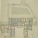
Whitehall, showing the Admiralty

1 : 192 Stretching from the edge of St James's Park to Buckingham Court and Spring Garden Mews, this map shows the Admiralty buildings at Whitehall. Ordnance Storehouses are noted along the edge of the park. The drawing features plans of the individual buildings, including details such as staircases, piers and water closets. Chawner, Thomas
$title$

Insurance Plan of London Vol. VIII: sheet 180

1 : 480 This detailed 1888 plan of London is one of a series of twenty-six sheets in an atlas originally produced to aid insurance companies in assessing fire risks. The building footprints, their use (commercial, residential, educational, etc.), the number of floors and the height of the building, as well as construction materials (and thus risk of burning) and special fire hazards (chemicals, kilns, ovens) were documented in order to estimate premiums. Names of individual businesses, property lines, and addresses were also often recorded. Together these maps provide a rich historical shapshot of the commercial activity and urban landscape of towns and cities at the time. The British Library holds a comprehensive collection of fire insurance plans produced by the London-based firm Charles E. Goad Ltd. dating back to 1885. These plans were made for most important towns and cities of the British Isles at the scales of 1:480 (1 inch to 40 feet), as well as many foreign towns at 1:600 (1 inch to 50 feet). Chas E Goad Limited Chas E Goad Limited
$title$

Plan of Spring Gardens, with Improvements and Additions.] 1

1 : 456 Plan of the proposed improvements to the Spring gardens in St James's. The gardens were known for the Great Room, used throughout the 18th century as an exhibition room, museum and concert hall. Chawner, Thomas
$title$

Insurance Plan of London Vol. VIII: sheet 181

1 : 480 This detailed 1888 plan of London is one of a series of twenty-six sheets in an atlas originally produced to aid insurance companies in assessing fire risks. The building footprints, their use (commercial, residential, educational, etc.), the number of floors and the height of the building, as well as construction materials (and thus risk of burning) and special fire hazards (chemicals, kilns, ovens) were documented in order to estimate premiums. Names of individual businesses, property lines, and addresses were also often recorded. Together these maps provide a rich historical shapshot of the commercial activity and urban landscape of towns and cities at the time. The British Library holds a comprehensive collection of fire insurance plans produced by the London-based firm Charles E. Goad Ltd. dating back to 1885. These plans were made for most important towns and cities of the British Isles at the scales of 1:480 (1 inch to 40 feet), as well as many foreign towns at 1:600 (1 inch to 50 feet). Chas E Goad Limited Chas E Goad Limited
$title$

A drawn Plan of the Palace at Whitehall, taken about 1680

$title$

A reduced copy of FISHER'S GROUND PLAN of the ROYAL PALACE of WHITEHALL, taken in the Reign of CHARLES 2d 1680.

This plan of the Royal Palace was published in the early 19th century, but is actually a copy of a plan dating from 1680. A black star shows where King Charles I was beheaded in the January of 1649, after he was convicted of treason by Parliament. Smith, John Thomas
$title$

PLAN OF THE CHARING CROSS & STRAND IMPROVEMENTS 1832

Trafalgar Square is indicated in this plan of Charing Cross as King William Square. The National Gallery of Painting and Sculpture is also indicated on the plan. Founded in 1824, the National Gallery was initially housed in a building in Pall Mall until a more suitable one was built on the north side of Trafalgar Square in 1832-38 to a design by William Wilkins. Wyld, James
$title$

London VII.73 - OS London Town Plan

1 : 1056 Topographic maps Ordnance Survey Ordnance Survey
$title$

Schetch for the Situation of a Palace at Whitehall the better to Settle that of a Bridge and of a Road to it

Plan of a proposed new palace at Whitehall with key down the left side of the plate.
$title$

The Plan of ye City of Westminster [showing five locations proposed for the placing of a new bridge]

1 : 3600 Due to the growth of the area in the 18th century, a bridge at Westminster became necessary.This plan shows suggested locations for the building of a bridge. The five locations proposed are: "A", the Horse Ferry on Millbank; "B", College Street or the Slaughter House; "C", the wool stable opposite New Place Yard; "D", Stephen's Alley; "E", Whitehall. There are evident concerns about the Whitehall location being too near the 'elbow' of the river. Cole, B.
$title$

A MAPP of the Parish of St MARTINS in the FIELDS, taken from ye last survey, with Additions By Blome, Richard.

1 : 3600 This plan of the parish of St Martins in the Fields shows the Banqueting House at Whitehall, the New Exchange on the Strand and Northumberland House.Near the top of the plate, the southern part of today's Leicester Square is indicated with the name of Leicester Fields. The equestrian statue of Charles I is depicted at Charing Cross. A pecked line marks the boundaries with the neighbouring parishes of St James and St Giles. Blome, Richard
$title$

le Palais et Park de St. James. St James Palace and Park

St James's Palace was built by Henry VIII on the site of St James's Hospital, Westminster. It became the principal royal residence in London, after the destruction by fire of Whitehall Palace in 1698. This bird's-eye view shows in detail the palace and grounds, the elevation of the building and the layout of the ornamental gardens. The Admiralty Office is shown on the boundaries of the palace grounds. Kip, J.
$title$

Sketch of the Procession Usually Observed in the Coronation of our KINGS & QUEENS together with a PLAN pointing out Several new Paths and their Parts Adjacent

A sketch of individuals and their order in the coronation procession is featured at the top of the page.60 years as king, George III's was the second longest reign in British history. He was third Hanoverian monarch, but the first to be born in England and use English as his first language. His reign was curtailed by periodic bouts of mental instability,which many contemporary commentators ascribed to the strain of the American conflict,but was more likely caused by the hereditary physical disorder called porphyria. He was a cultured monarch who donated to the nation a royal collection of books as the nucleus of a national library, now held in the King's Tower;in the British Library.
$title$

The PARISH of ST. JAMES'S, Westminster, taken from the last Survey with Corrections 3

1 : 11076 This plan was taken from Strype's first annotated edition of Stow's "Survey of England". The plan's title features in cartouche at the top of the plate, with keys to streets, yards, inns, halls and other landmarks in tables at top left and bottom right.The scale bar is also at bottom right. Additions made by Strype that did not feature in earlier editions of the plan include the housing developments in Soho and neighbouring St Martin's (replacing open fields and an extended table of reference). Blome, Richard
$title$

The PARISH of ST. JAMES'S, Westminster, taken from the last Survey with Corrections 2

1 : 11076 This plan is taken from the first edition of Stow's "Survey of England".The plan's title features in a banner at the top centre, with a key to streets, yards, halls, courts and private properties at the top left.Land use and natural features described by symbols and three-dimensional illustrations.St James's Square was laid out in 1662 when Henry Jermyn, Earl of St Albans, obtained a grant of land on the outskirts of London.In 1674, Christopher Wren was appointed architect of the parish church. Blome, Richard
$title$

Insurance Plan of London Vol. VIII: Key Plan

1 : 480 This "key plan" indicates coverage of the Goad 1888 series of fire insurance maps of London that were originally produced to aid insurance companies in assessing fire risks. The building footprints, their use (commercial, residential, educational, etc.), the number of floors and the height of the building, as well as construction materials (and thus risk of burning) and special fire hazards (chemicals, kilns, ovens) were documented in order to estimate premiums. Names of individual businesses, property lines, and addresses were also often recorded. Together these maps provide a rich historical shapshot of the commercial activity and urban landscape of towns and cities at the time. The British Library holds a comprehensive collection of fire insurance plans produced by the London-based firm Charles E. Goad Ltd. dating back to 1885. These plans were made for most important towns and cities of the British Isles at the scales of 1:480 (1 inch to 40 feet), as well as many foreign towns at 1:600 (1 inch to 50 feet). Chas E Goad Limited Chas E Goad Limited
$title$

London (1915- Numbered sheets) V.13 (includes: City Of Westminster) - 25 Inch Map

1 : 2500 Topographic maps Ordnance Survey Ordnance Survey
$title$

London (Edition of 1894-96) LXXV (includes: City Of Westminster) - 25 Inch Map

1 : 2500 Topographic maps Ordnance Survey Ordnance Survey
$title$

London (First Editions c1850s) XLIII (includes: City Of Westminster) - 25 Inch Map

1 : 2500 Topographic maps Ordnance Survey Ordnance Survey
$title$

A SURVEY OF THE CONDUITS &c. to WHITEHALL, St.JAMES &c.

1 : 3600 This is a 19th century copy of an original 1718 plan held by the Society of Antiquaries. t details the conduits supplying water to St. James's and Whitehall from Hyde Park. Long
$title$

Plan, presented to the House of Commons, of a street proposed from Charing Cross to Portland Place, leading to the Crown Estate in Mary-le-Bone Park.

Basire, James
$title$

PLAN, presented to the House of Commons, of a STREET proposed from Charing Cross to Portland Place, leading to the Crown Estate in Mary-le-Bone Park

1 : 3684 This original design for Regent Street was commissioned by the House of Commons.The title appears along the top, with a descriptive note below the plan and a scale bar at the bottom centre. Crown Property is highlighted in blue.Starting at Carlton House, Regent Street ran through crownland at Piccadilly (where a circus was built) before turning north-west along Swallow Street, in Soho, finally joining Portland Place north of Oxford Street. Basire, James
$title$

Drawn plan of the Goring Estate] 3

This is a copy by Crace of a plam of the Goring Estate as it was in 1640. The drawing shows the site in Mulberry Garden Fields where Buckingham Palace was built. Crace, Frederick
$title$

PLAN OF A Street Proposed FROM CHARING CROSS TO PORTLAND PLACE.

1 : 6000 This is Nash's original design for Regent Street.The title appears at top right, with compass star and scale bar at the bottom left. The course of the street highlighted in yellow, with Crown property is highlighted in blue.Starting at Carlton House, Regent Street ran through crownland at Piccadilly (where a circus was built) before turning north-west along Swallow Street, in Soho, finally joining Portland Place north of Oxford Street. Thompson
$title$

Views of London in 1616 and 1890

1 : 1
$title$

WESTMINSTER

This plan-view of Westminster was published in Norden's 'Speculum Britanniae' in 1593. The title appears at top right below the royal arms, with a compass rose at the foot of the plate. Under different jurisdiction than the City of London, Westminster had developed during the middle ages into a centre of royal administration. Along the Strand are the former residences of the Bishops deposed at the Reformation. By the late 16th Century, these properties were in the hands of the Queen's courtiers, statesmen and other people of influence. Norden, John
$title$

A Copy of Part of a Map of London from Newcourt

This is a copy of part of the Faithorne map. It is an example of a bird's-eye (or 'plan') view. Crace often had copies made of maps if he was unable to procure an original.
$title$

Plan of the Road through Westminster and Tutthill Fields & from St. James's Park Gate by Buckingham House & from Hyde Park Corner to a Bridge that is desired to be made over the Thames 1768 27

This engraved plan shows the road through Tutthill Fields in Westminster leading to the new bridge at Vauxhall.The plan's title features in banner at top left, with compass star at bottom right.The proposed new road stippled and highlighted in colour.
$title$

A PLAN OF HIS MAJESTY'S BAYLIWICK OF ST. JAMES IN THE COUNTY OF MIDDLESEX

1 : 2400 This drawn survey of the West of London extends from Knightsbridge to Temple Bar and from Marylebone Gardens to Buckingham Palace. Buildings are indicated in red, open spaces and park land in green and watercourses in blue. Symbols are used to distinguish land use. Gough, William
$title$

Vrbium Londini et West-Monasterii nec non suburbii Southwark accurata ichnographia, 1

1 Blatt : 52 x 64 cm Homännische Erben
© MapTiler © OpenStreetMap contributors
How does it work?
These instructions will show you how to find historical maps online.
Getting started
Type the place name in the search box to find the exact location. You can further adjust the search by zooming in and out.
Zoom
Zoom in and out with the buttons or use your mouse or touchpad natively.
Exact Area tool
Click here and draw a rectangle over the map to precisely define the search area.
Set filters
Narrow your search with advanced settings, such as Years (from/to), Fulltext, Publisher, etc.
Results
See the results of your search on the right side. You can scroll down to find more maps of this location.
?

Download OldMapsOnline Mobile