Maps of Islington

Maps of Islington

$title$

The Newest and Exactest MAPP of the most Famous Citties LONDON and WESTMINSTER, with their Suburbs; and the manner of their Streets:
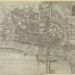
The arms of the Commonwealth and of the City appear on the upper-left cornermap, facing the personifications of Justice and Prudence on the upper right. A number key is provided so users can find "the nearest way from one place to another." 'Pecadilly Hall' appears in place of modern Piccadilly. This was a derisive name for the country house built around1612 by Robert Baker, a tailor with a shop on the Strand. Baker made his fortune by selling "picadils" (a stiff collar popular at Court). By the 18th Century, Piccadilly was the name of the whole street. Porter, T.
$title$

A NEW MAP OF THE CITYES OF LONDON, WESTMINSTER AND THE BURROUGH OF SOUTHWARK TOGETHER WITH THE SUBURBS AS THEY ARE NOW STANDDING Anno Dom.1707.

This title of this map of London appears along the top, with the city arms at top left and the publisher’s name in cartouche at top right. The map appeared in Volume I of 'A New View of London', by Edward Hutton. Chiswell, Richard et al.
$title$

London

1 : 50000 Londýn (Anglie) Hollar, Václav Blome, Richard Ric. Blome
$title$

LONDEN, WESTMUNSTER U: SOUDWARK

The title of this German map of London, Westminster and Southwark, appears between two ribbons at the top. A compass rose appears in the river, with prominent buildings shown pictorially instead of in plan and numbered for reference. Stridbeck, Johannes
$title$

A New Map of the Cities of London and Westminster and Ye Borough of Southwarke with the Suburbs

Large map of London with prospect view of the City from Bankside in a strip above the main plan. Entitled "Prospect of London as it was flourishing before the destruction by fire", the view is based on Hollar's celebrated view of London from Bankside of 1647 and shows London from Worcester House (just west of the Savoy) on the west to Wapping and St Catherine's Docks to the east. The view shows London before the fire being composed almost exclusively of Gothic buildings, Inigo Jones’s Banqueting Hall at Whitehall and the classical restoration of St. Paul’s cathedral being the only examples of Renaissance architecture. The map, with title in cartouche, reference tables at top right and top left and scale bar at bottom centre, is a very minute bird's eye view of the cities of London and Westminster, the borough of Southwark and the suburbs showing London after the fire growing in area faster than ever before. Stepney Church, for example, marks a new point of growth east of the city. Hollar, Wenceslaus
$title$

Bowles's reduced new pocket plan of the cities of London

1 : 15700 Londýn (Anglie) Bowles, Carington Carington Bowles
$title$

A PLAN of the CITIES of LONDON AND WESTMINSTER and BOROUGH of SOUTHWARK 1771

The reference key of this map extends along the right margin and bottom of the map, with the title is in a cartouche. This map shows proposed lines of approach towards Blackfriars Bridge, later abandoned. Andrews, J.
$title$

The LONDON GUIDE, or A POCKET PLAN of the CITIES OF LONDON & WESTMINSTER and BOROUGH of SOUTHWARK with the BEW BUILDINGS, &C to the present year

This map of Georgian London was published in John Entick's 1766'A New and Accurate History and Survey of London, Westminster and Southwark.' The title of the map appears in a panel below the plan along with the rates of hackney coaches and water ferries. It extends eastward to include Limehouse, then one of the main centres for shipbuilding in the capital. Bowles, Carington
$title$

A New and Complete Plan of LONDON, WESTMINSTER & BOROUGH OF SOUTHWARK containing the Improvements IN, and ROUND the METROPOLIS

Roads and open spaces are depicted in different colours and margins divided into miles and furlongs. The map’s title and a list of districts in Westminster are at the top left, with a key to public offices and Westminster parishes at the bottom left. The fares of hackney coaches and water ferries are at the bottom right, along with a list of Surrey parishes. At middle right, there is a list of parishes within the 'Bill of Mortality' - the name given to parishes who sent regular death notices to the central London government. A fine mezzotint engraver and regular exhibitor at the Society of Artists in the 1770s, Robert Laurie acquired Sayer’s stock in 1794 and (with James Whittle) founded the map publishing house Laurie & Whittle. Laurie, Robert and Whittle, James
$title$

A NEW POCKET PLAN OF THE CITIES OF LONDON & WESTMINSTER WITH THE BOROUGH OF SOUTHWARK: Comprehending the New Buildings and other Alterations to the Year 1790

This is the third edition of William Faden's 1787 map, which was printed 11 times over a period of 25 years. Faden called himself "Geographer to the King”, and was very interested the work of the Ordnance Survey. In 1800 he published 'An account of the operations carried on for accomplishing a trigonometrical survey of England and Wales'. Faden's skill as a cartographer was so well-noted that his map of 'The Country Twenty-Five Miles round London' was re-engraved for the French War Department in preparation for an invasion of England. This map includes a list of Surrey Parishes within the Bills of Mortality, an area of 109 parishes in and near London from which a weekly report of deaths was collated. Westminster is divided into 12 districts, each indicated by coloured boundaries. William Faden
$title$

Vrbium Londini et West-Monasterii, nec non suburbii Southwark

1 : 6600 Londýn (Anglie) edita curis Homannianorum Heredum
$title$

Urbium Londini et West-Monasterii nec non suburbii Southwark accurata ichnographia : in qua viae publicae omnes et singulae, plateae majores et minores, vici, angiporti, porticulae etc. una cum accessionibus aedificiorum, quibus urbs usque ad a. 1736, novissime locupletata est, reprasentantur : ad norman prototypi Londinensis edita curris Hommannianorum Heredum C.P.S.C.M

1 : 5280 Homann Erben (Firm) Homaennischen Erben
$title$

A NEW PLAN of the CITY AND LIBERTY of WESTMINSTER

The engraver-turned-cartographer Thomas Jeffrey began commissioning original surveys for a series of English county maps in the early 1760s. This is the combination of two separate maps: a map of Westminster, with a list of districts and parishes in the County of Middlesex; and an adjoining map of London featuring list of parishes in the County of Surrey and key to colours. The map is a later edition of Jeffrey's map of 1766, with the imprint, dedication and City arms omitted, updated to include the New Road, the first London bypass, and the roads across St. George's Fields. Jeffrey, Thomas
$title$

Map of London

This untitled map is a later edition one first published by Phillips in the 1802'Picture of London'. The map is divided into mile squares with letters along the border for reference, and shows the new London Docks. The proposed street layout across the fields in Shoreditch, between Mile End Road and Bethnal Green Road, is indicated by a double dotted line. Phillips, Richard
$title$

A NEW POCKET PLAN OF THE CITIES OF LONDON & WESTMINSTER WITH THE BOROUGH OF SOUTHWARK

This folding map of London is the eighth edition of a map first published by Faden in 1787. It features title at top left, table of parishes next to the title, and scale bar at bottom right. At bottom centre is a list of Surrey parishes within the Bill of Mortality - the name given to the areas from which the London government received regular death notices. The border of the map is divided in miles and furlongs. At the beginning of the 19th Century, the administration of London was split among a multitude of authorities, vestries, special commissions and private enterprises. The nine districts in London are distinguished on the map by areas of different colour, with key to colours and explanation of the relevant civil and military authorities in handwritten notes down both sides of the map. Faden, William
$title$

A New and Exact PLAN of the CITIES of LONDON and WESTMINSTER and BOROUGH of SOUTHWARK, with the Additional Buildings to the Year 1756

This map of London was engraved by Seale for publication in John Strype's 1754 edition of Stow's 'Survey of London and Westminster and the Borough of Southwark'. The plan's title features along the top, with compass rose near top left and scale bar below the plan. It illustrates St. Paul's Cathedral and other prominent buildings pictorially. Seale, Richard William
$title$

LONDON WESTMINSTER AND SOUTHWARK

The title of this small map runs along the top, with the imprint and scale bar below the plan. The map shows Waterloo Bridge, or Strand Bridge, with the proposed southern approach indicated by a dotted line. Designed by John Rennie, Waterloo Bridge was constructed by a commercial company hoping to profit from toll-paying traffic. The bridge cost 1m and was never profitable. The bridge was demolished and replaced controversially in 1936. Luffman, John
$title$

This Actual Survey Of London Westminster Southwark Is Humbly Dedicated To Ye Ld. Mayor & Court of Aldermen

Morden, Robert; Lea, Philip Covens et Mortier
$title$

Plan von London und Westminster mit der Borough von Southwark

Londýn (Anglie)
$title$

PLAN von LONDON und WESTMINSTER mit der BOROUGH von SOUTHWARK

Londýn (Anglie)
$title$

London, Westminster and Southwark

1 : 10138 This untitled map of Stuart London features royal arms at top left, city arms at top right, with a scale bar and dividers shown beneath a female figure with a globe at lower left. A key to Southwark's churches is provided at lower right. This map is derivative of Wenceslaus Hollar posthumously published plan of 1685 and features vignettes of prominent buildings along the top, together with portraits of King William and Queen Mary. At the foot of the plate, views of the seven city gates and the Tower of London accompany equestrian statues of Charles I and Charles II.
$title$

A NEW PLAN OF LONDON AND WESTMINSTER WITH THE BOROUGH OF SOUTHWARK 218

Map of London with the title in a panel at top left, imprint below the plan, key to colours at bottom centre, a scale bar at bottom right and with a list of parishes in tables near bottom left and bottom right. The map is divided into furlong squares printed in red ink and features numbers along the borders for reference. The son of a map publisher, James Wyld attended military college before entering the map trade. He became one of the best-known map publishers of the middle of the 19th Century and during the railway-building mania of those years, his maps of railway developments were often put before parliament. Wyld, James
$title$

A New Map of the Cities of London and Westminster and Ye Borough of Southwarke with their Suburbs

This is a later edition of Hollar's map of London of 1675 without the prospect view of the City entitled "Prospect of London as it was flourishing before the destruction by fire" that featured in the first edition. The map, with title in cartouche, reference tables and scale bar, is a very minute bird’s eye view of the cities of London and Westminster, with the Borough of Southwark and suburbs showing London after the fire growing in area faster than ever before, with former satellite villages fast becoming mere localities in the urban sprawl. Stepney church, for example, marks a new point of growth east of the city. Hollar, Wenceslaus
$title$

A New and Exact Plan of Ye City of London and suburbs thereof, 1731 93

This is the third edition of Overton's map of London and the suburbs first issued in 1720. The map features title in cartouche at top left, lists of Hackney coaches and watermen's rates at bottom left and centre, City arms at bottom right and compass in river. The area within the boundaries of the City of London is stippled, with ward boundaries highlighted in colour. The map is divided in squares with letters along the margins for reference. Overton, Henry
$title$

AN ENTIRE NEW PLAN OF THE CITIES OF LONDON AND WESTMINSTER WITH THE BOROUGH OF SOUTHWARK 205

The title and imprint of this folding map of London appear in a table at the top left, facing an advertisement for Mogg's "Survey of the Roads" at the top right. A compass star and scale bar feature at the bottom right. The river, open spaces and city boundaries are distinguished by colour use. A derivative of Cary’s plan of 1790, twenty editions of this map were published between 1803 and 1828. Mogg, Edward
$title$

Plan von London und Westminster mit der Borough von Southwark

$title$

AN EXACT DELINEATION OF THE CITIES OF LONDON AND WESTMINSTER AND THE SUBURBS Thereof, Together Wth. Ye Burrough of SOUTHWARK

This is a copy of the 1658 Faithorne map made in 1857. It depicts London as it stood during the last two years of the Commonwealth, before the great fire. Dense clusters of houses appear very close together, separated only by narrow streets - an indication of the city's vulnerability to fire. Newcourt, Richard
$title$

A Pocket MAP of LONDON, WESTMINSTER and SOUTHWARK With ye New Buildings to ye Year 1759

This pocket map of London is reminiscent of Henry Overton's map of 1731.The title and scale bar appear at top left, fares of hackney coaches feature at top and middle right, and fares of water ferries at bottom centre. A note on distances, churches and public buildings is included at bottom right with the city boundaries outlined in colour. Robert Whity, who issued this map in 1759, added a sheet to include the development north of Oxford Street in the estate of Henry Cavendish, Duke of Newcastle, where Cavendish Square was at the centre of a new residential district being built by Edward Harley, the duke’s son-in-law. Whity, Robert
$title$

A New Mapp of the CITTY OF LONDON much Inlarged since the great Fire in 1666

This title of this map of Stuart London appears along the top, with the City arms depicted at top left, and a reference panel at top right. A scale bar with dividers features at bottom left, with the key to individual churches in Southwark in a banner at bottom right. Like many other contemporary plans of London, this one is derivative of Hollar's posthumously published map of1685. Overton, John
$title$

BOWLES'S NEW POCKET PLAN OF THE CITIES OF LONDON & WESTMINSTER; WITH THE BOROUGH OF SOUTHWARK: Comprehending the New Buildings and other Alterations to the Year 1780

This map was printed for Caringtom Bowles who traded from a St. Paul's churchyard. The Bowles family were not cartographers but published and sold maps. This is the fourth edition of a map originally issued in 1773.The title is at top left, next to a list of parishes, with a key to Great Offices of State and Westminster parishes down the left of the plate. The border of the map is marked off in miles and furlongs. There is no discernible difference between this edition and the previous ones. Bowles, Carington
© MapTiler © OpenStreetMap contributors
How does it work?
These instructions will show you how to find historical maps online.
Getting started
Type the place name in the search box to find the exact location. You can further adjust the search by zooming in and out.
Zoom
Zoom in and out with the buttons or use your mouse or touchpad natively.
Exact Area tool
Click here and draw a rectangle over the map to precisely define the search area.
Set filters
Narrow your search with advanced settings, such as Years (from/to), Fulltext, Publisher, etc.
Results
See the results of your search on the right side. You can scroll down to find more maps of this location.
?

Download OldMapsOnline Mobile