Maps of Virginia
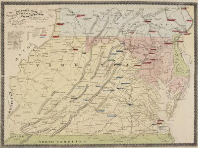
Pocket Map, showing the probable Theatre of the War. Compiled by G.A. Aschbach
Pocket Map, showing the probable Theatre of the War. Compiled by G.A. Aschbach. Published in Philadelphia, Pocket Map Showing the Probable Theatre of the War, complied by G.A. Aschbach, details the states of Virginia, Maryland and Pennsylvania. Published in 1860, before any major fighting had occurred, this map highlights areas that would see the bulk of fighting in the conflict. The map shows the balance on military power on either side by pointing out camps and forts. The Union held military bases are underlined in red, while Confederate holdings are in blue. The map also shows railway lines running across the states.
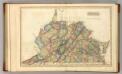
Virginia.
1 : 2500000 Tanner, Henry S.
Virginia.
1 : 1650000 DeSilver, Robert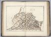
Virginia.
1 : 1630000 Carey, Mathew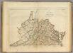
Map of Virginia.
1 : 1600000 Carey, Mathew
Map of Virginia and Maryland, constructed from the latest authorities / J.H. Young sc.
from Parts J. H. Young,
Virginia, Maryland and Delaware.
from Parts s.n.: [Philadelphia?],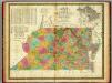
Map of Virginia and Maryland.
1 : 1450000 Mitchell, Samuel Augustus
Map of Virginia and Maryland, constructed from the latest authorities.
from Parts Published by Anthony Finley, at the corner of Chestnut and Fourth Streets?: [Philadelphia?],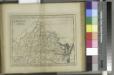
Virginia / W. Barker sculp.; Carey's American pocket atlas; containing nineteen maps... with a brief description of each state.
from Carey's American pocket atlas; containing nineteen maps... with a brief description of each state. Carey, Mathew; Sweitzer, Henry,
A map of Virginia: formed from actual surveys and the latest as well as the most accurate observations / by James Madison; drawn by Wm. Davis; with extensive additions and corrections to the year 1818.
from Charts and maps James Madison; William Davis,
A map of Virginia: formed from actual surveys and the latest as well as the most accurate observations / by James Madison; drawn by Wm. Davis; with extensive additions and corrections to the year 1818.
from Charts and maps James Madison; William Davis,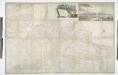
A map of Virginia: formed from actual surveys, and the latest as well as most accurate observations / by James Madison, D.D., president of Wm. & Mary College.; drawn by Wm. Davis; engraved by Fred. Bossler, Richmd.
from Charts and maps James Madison; William Davis; Fred. Bossler,
Virginia, Maryland & Delware.
1 : 3200000 Black, Adam & Charles
Virginia. West Virginia.
1 : 2000000 Colton, G.W.
Virginia, Maryland, Washington D.C.
1 : 1518000 Finley, Anthony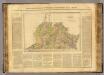
Virginie.
1 : 1650000 Buchon, J. A. C.; Carey, H. C.; Lea, I.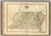
Virginia, Maryland, Delware.
1 : 1120000 Tanner, Henry S.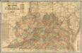
Lloyd's official map of the State of Virginia.
1 : 650000 Lloyd, J. T.
Map of the state of Virginia / constructed in conformity to law from the late surveys authorized by the Legislature and other original and authentic documents, by Herman Böye ; engraved by H.S. Tanner ; title, writn. & engrd. by Jos. Perkins.
from Virginia
Virginia and West Virginia.
1 : 2000000 Colton, G.W.
Virginia
1 : 1900000 Annotatie: Gerestaureerd en op Japans papier geplakt New York, [N.Y.] : J.H. Colton & Co.
Virginia.
1 : 2000000 Colton, G.W.
State of Virginia.
1 : 1647360 Winterbotham, W.
Virginia.
1 : 2040000 Tanner, Henry S.
Virginia.
1 : 1930000 Mitchell, Samuel Augustus
Virginia.
1 : 1930000 Mitchell, Samuel Augustus
Virginia.
1 : 2550000 Finley, Anthony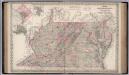
Delaware, Maryland, Virginia.
1 : 1267000 Colton, G.W.