Maps of Outer Hebrides

Maps of Outer Hebrides

$title$

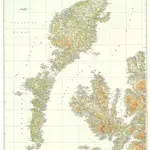
Scotland[Motoring Map of]

London : "Geographia
$title$

Tabula Leogi et Haraiæ, ac Skiæ vel Skianæ insularum

1 Karte : Kupferdruck ; 43 x 51 cm Valck; Schenk ex officina Gerardi Valk et Petri Schenk
$title$

A new chart of the West coast of Scotland from the Mull of Galloway to Dunan Point in Sky.

Huddart, Joseph, 1740/1-1816 Laurie, Robert Whittle, James
$title$

Carte particuliere de la cote occidentale d'Escosse, depuis le Cape Wrath jusqu'a la Pointe d'Ardnamurchan.

Depot Generale de la Marine, Paris
$title$

A new chart of the West coast of Scotland from the point of Ardnamurchan to Cape Wrath.

Huddart, Joseph, 1740/1-1816 Laurie, Robert Whittle, James
$title$

A Map of the North West part of the Western Islands / by H. Moll.

Moll, Herman, d. 1732
$title$

A general map of Scotland and islands thereto belonging, 1

2 Blätter : 90 x 76 cm s.n.
$title$

Scotland / J. Ainslie, 1

1 Blatt : 64 x 58 cm Ainslie, Faden
$title$

Leogus et Haraia insulae ex Aebudarum numero, quae quamquam isthmo cohaereant, pro diversis habentur. Lewis and Harray of the numbre of the Western Yles, which two although they ioyne be a necke of la

Blaeu, Joan, 1596-1673
$title$

Leogvs et Haraia

1 Karte : Kupferdruck ; 38 x 51 cm Blaeu Joan Blaeu
$title$

Island of Skye

1 : 126720 Ordnance Survey Office
$title$

Uist & Barra, Sheet 18 - Bartholomew's "Half Inch to the Mile Maps" of Scotland

1 : 126720 Topographic maps John Bartholomew & Son, Ltd John Bartholomew & Son, Ltd
$title$

North & South Uist, Sheet 18 - Bartholomew's "Half Inch to the Mile Maps" of Scotland

1 : 126720 Topographic maps Bartholomew, John George John Bartholomew & Co
$title$

Harris & The Lewis, Sheet 23 - Bartholomew's "Half Inch to the Mile Maps" of Scotland

1 : 126720 Topographic maps John Bartholomew & Son, Ltd John Bartholomew & Son, Ltd
$title$

Outer Hebrides, Sheet 23 - Bartholomew's "Half Inch to the Mile Maps" of Scotland

1 : 126720 Topographic maps Bartholomew, John George John Bartholomew & Co
$title$

LEOGVS et HARAIA, | insulæ ex Æbudarum numero, | quæ, quamquam isthmo cohæreant, | pro diversis habentur. | LEWIS and HARRAY | of the numbre of the Westerne Yles, which two although | they ioyne be a necke of land ar accounted dyvers Ylands.

[Amsterdam : Joan Blaeu]
$title$

Skye Island &c.

1 : 139000 Johnson, William, fl. 1806-1840
$title$

Skye Island, &c.

Thomson, John, 1777- ca. 1840 Johnson, William, fl. 1806-1840
$title$

VISTVS INSVLA, | vulgo VIIST, | cum aliis minoribus | EX ÆBVDARVM NVMERO | ei ad meridiem adjacentibus.

Auct. Timotheo Pont. [Amsterdam : Joan Blaeu]
$title$

Ardnamurchan to Summer Isles, including the Inner Channel and part of the Minch.

Great Britain. Hydrographic Office
$title$

Western Isles S.

1 : 106000 Thomson, John
$title$

Skia vel Skiana

1 Karte : Kupferdruck ; 40 x 51 cm Blaeu; Pont Joan Blaeu
$title$

Skia vel Skiana, [vulgo], The Yle of Skie / Auct. Timotheo Pont.

Pont, Timothy, 1560?-1614? Blaeu, Joan, 1596-1673
$title$

The Lewis or north part of Long Island.

Mackenzie, Murdoch (Senior), 1712-1797
$title$

Isle of Skye, Sheet 19 - Bartholomew's "Half Inch to the Mile Maps" of Scotland

1 : 126720 Topographic maps John Bartholomew & Son, Ltd John Bartholomew & Son, Ltd
$title$

Isle of Skye, Sheet 19 - Bartholomew's "Half Inch to the Mile Maps" of Scotland

1 : 126720 Topographic maps Bartholomew, John George John Bartholomew & Co
$title$

The channel between Sky I and the Lewis.

Mackenzie, Murdoch (Senior), 1712-1797
$title$

The north part of Sky island and the adjacent main of Scotland.

Mackenzie, Murdoch (Senior), 1712-1797
$title$

SKIA vel SKIANA | The Yle of SKIE

Auct. Timotheo Pont. [Amsterdam : Joan Blaeu]
$title$

Western Isles N.

1 : 107000 Thomson, John
© MapTiler © OpenStreetMap contributors
How does it work?
These instructions will show you how to find historical maps online.
Getting started
Type the place name in the search box to find the exact location. You can further adjust the search by zooming in and out.
Zoom
Zoom in and out with the buttons or use your mouse or touchpad natively.
Exact Area tool
Click here and draw a rectangle over the map to precisely define the search area.
Set filters
Narrow your search with advanced settings, such as Years (from/to), Fulltext, Publisher, etc.
Results
See the results of your search on the right side. You can scroll down to find more maps of this location.
?

Download OldMapsOnline Mobile