Maps of Halton

Birkenhead
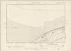
The formal title at the top left of this drawing states that Robert Dawson supervised the surveyor. One of the best surveyors and draughtsmen, Dawson was employed on the Ordnance Survey for over forty years, also working as an instructor. The scale of the drawing is noted and the area of the land is recorded as 64.0185 square miles. A triangulation diagram appears on the reverse of this drawing. This was an essential tool enabling draughtsmen to plot the exact location of topographical features. Hill sketching has not been included on this plan. Giles, John C.
Liverpool (Outline) - OS One-Inch Revised New Series
1 : 63360 Topographic maps Ordnance Survey Ordnance Survey
Liverpool (Hills) - OS One-Inch Revised New Series
1 : 63360 Topographic maps Ordnance Survey Ordnance Survey
Map of the borough of Liverpool : with Parliamentary boundaries, ecclesiastical divisions and a part of the Cheshire coast
Hilliar, H engraved and published by H. Hilliar
SJ28 - OS 1:25,000 Provisional Series Map
1 : 25000 Topographic maps Ordnance Survey Ordnance Survey
Philip's plan of the town and port of Liverpool with Birkenhead and the adjoining Cheshire coast
1 : 15500 Bartholomew, John Bartholomew
Plan of the Mersey docks and harbour estate with part of the city of Liverpool
1 : 10750 s.n.
Philip's Plan of the town and port of Liverpool
1 : 15100 Liverpool (Anglie) Bartholomew, John George Philip & Son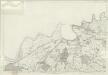
Cheshire XIII - OS Six-Inch Map
1 : 10560 Topographic maps Ordnance Survey Ordnance Survey
Cheshire XXII - OS Six-Inch Map
1 : 10560 Topographic maps Ordnance Survey Ordnance Survey
Flintshire VIa - OS Six-Inch Map
1 : 10560 Topographic maps Ordnance Survey Ordnance Survey
Bacon's plan of Liverpool : divided into 1/4 mile squares
1 : 10560 G.W. Bacon & Co G.W. Bacon & Co.
SJ38 - OS 1:25,000 Provisional Series Map
1 : 25000 Topographic maps Ordnance Survey Ordnance Survey
Cheshire VII - OS Six-Inch Map
1 : 10560 Topographic maps Ordnance Survey Ordnance Survey
Cheshire VII & XIII - OS Six-Inch Map
1 : 10560 Topographic maps Ordnance Survey Ordnance Survey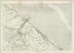
Flintshire VI - OS Six-Inch Map
1 : 10560 Topographic maps Ordnance Survey Ordnance Survey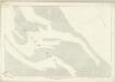
Flintshire III (inset IIA & IIIA) - OS Six-Inch Map
1 : 10560 Topographic maps Ordnance Survey Ordnance Survey
SJ27 - OS 1:25,000 Provisional Series Map
1 : 25000 Topographic maps Ordnance Survey Ordnance Survey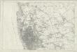
Lancashire CVI - OS Six-Inch Map
1 : 10560 Topographic maps Ordnance Survey Ordnance Survey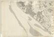
Lancashire CXIII - OS Six-Inch Map
1 : 10560 Topographic maps Ordnance Survey Ordnance Survey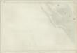
Lancashire CXVII - OS Six-Inch Map
1 : 10560 Topographic maps Ordnance Survey Ordnance Survey
Cheshire XXI - OS Six-Inch Map
1 : 10560 Topographic maps Ordnance Survey Ordnance Survey
Cheshire XII - OS Six-Inch Map
1 : 10560 Topographic maps Ordnance Survey Ordnance Survey
Cheshire XXX - OS Six-Inch Map
1 : 10560 Topographic maps Ordnance Survey Ordnance Survey
Cheshire VI - OS Six-Inch Map
1 : 10560 Topographic maps Ordnance Survey Ordnance Survey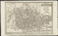
Plan of Liverpool
1 : 9000 Neele sc. Strand [London] : Tho.s Kaye
Cheshire VI.SE - OS Six-Inch Map
1 : 10560 Topographic maps Ordnance Survey Ordnance Survey
Cheshire VI.SE - OS Six-Inch Map
1 : 10560 Topographic maps Ordnance Survey Ordnance Survey
Cheshire VI.SE - OS Six-Inch Map
1 : 10560 Topographic maps Ordnance Survey Ordnance Survey