Maps of Eastling

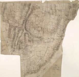
Doddington, Kent(002OSD00000027AU00431000)
1 : 10560 This field sketch of the chalk hills of the North Downs in Kent extends from Doddington and Newnham, at the bottom of the map, to Norton, at the top. Several irregularly cut sheets have been joined together and laid down on coarse paper. The surveyor's calculations for for the area covered by the map survive in black ink along the margins. The 'fair' drawings OSD 110 and OSD 110/111/113 also relate to this area.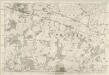
Kent XXXIII - OS Six-Inch Map
1 : 10560 Topographic maps Ordnance Survey Ordnance Survey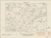
Kent XXXIII.SE - OS Six-Inch Map
1 : 10560 Topographic maps Ordnance Survey Ordnance Survey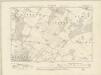
Kent XXXIII.SE - OS Six-Inch Map
1 : 10560 Topographic maps Ordnance Survey Ordnance Survey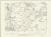
Kent XXXIII.SE - OS Six-Inch Map
1 : 10560 Topographic maps Ordnance Survey Ordnance Survey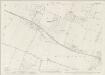
Kent XXXIII.8 (includes: Buckland; Luddenham; Norton; Teynham) - 25 Inch Map
1 : 2500 Topographic maps Ordnance Survey Ordnance Survey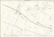
Kent XXXIII.8 (includes: Buckland; Luddenham; Norton; Teynham) - 25 Inch Map
1 : 2500 Topographic maps Ordnance Survey Ordnance Survey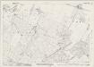
Kent XXXIII.12 (includes: Buckland; Norton; Ospringe; Stone) - 25 Inch Map
1 : 2500 Topographic maps Ordnance Survey Ordnance Survey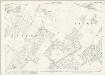
Kent XXXIII.12 (includes: Buckland; Norton; Ospringe; Stone) - 25 Inch Map
1 : 2500 Topographic maps Ordnance Survey Ordnance Survey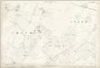
Kent XXXIII.12 (includes: Buckland; Norton; Ospringe; Stone) - 25 Inch Map
1 : 2500 Topographic maps Ordnance Survey Ordnance Survey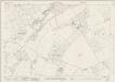
Kent XXXIII.16 (includes: Norton; Ospringe) - 25 Inch Map
1 : 2500 Topographic maps Ordnance Survey Ordnance Survey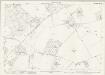
Kent XXXIII.16 (includes: Norton; Ospringe) - 25 Inch Map
1 : 2500 Topographic maps Ordnance Survey Ordnance Survey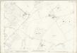
Kent XXXIII.16 (includes: Norton; Ospringe) - 25 Inch Map
1 : 2500 Topographic maps Ordnance Survey Ordnance Survey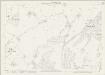
Kent XLIV.4 (includes: Eastling; Ospringe; Throwley) - 25 Inch Map
1 : 2500 Topographic maps Ordnance Survey Ordnance Survey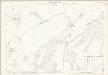
Kent XLIV.4 (includes: Eastling; Ospringe; Throwley) - 25 Inch Map
1 : 2500 Topographic maps Ordnance Survey Ordnance Survey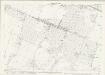
Kent XXXIII.7 (includes: Lynsted; Teynham) - 25 Inch Map
1 : 2500 Topographic maps Ordnance Survey Ordnance Survey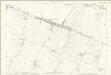
Kent XXXIII.7 (includes: Lynsted; Teynham) - 25 Inch Map
1 : 2500 Topographic maps Ordnance Survey Ordnance Survey
Kent XXXIII.11 (includes: Lynsted) - 25 Inch Map
1 : 2500 Topographic maps Ordnance Survey Ordnance Survey
Kent XXXIII.11 (includes: Lynsted) - 25 Inch Map
1 : 2500 Topographic maps Ordnance Survey Ordnance Survey
Kent XXXIII.11 (includes: Lynsted) - 25 Inch Map
1 : 2500 Topographic maps Ordnance Survey Ordnance Survey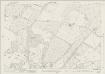
Kent XXXIII.15 (includes: Doddington; Lynsted; Newnham; Norton) - 25 Inch Map
1 : 2500 Topographic maps Ordnance Survey Ordnance Survey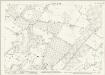
Kent XXXIII.15 (includes: Doddington; Lynsted; Newnham; Norton) - 25 Inch Map
1 : 2500 Topographic maps Ordnance Survey Ordnance Survey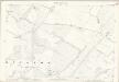
Kent XXXIII.15 (includes: Doddington; Lynsted; Newnham; Norton) - 25 Inch Map
1 : 2500 Topographic maps Ordnance Survey Ordnance Survey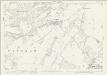
Kent XLIV.3 (includes: Doddington; Eastling; Newnham) - 25 Inch Map
1 : 2500 Topographic maps Ordnance Survey Ordnance Survey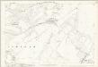
Kent XLIV.3 (includes: Doddington; Eastling; Newnham) - 25 Inch Map
1 : 2500 Topographic maps Ordnance Survey Ordnance Survey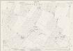
Kent XXXIII.6 (includes: Bapchild; Rodmersham; Tonge) - 25 Inch Map
1 : 2500 Topographic maps Ordnance Survey Ordnance Survey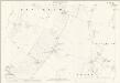
Kent XXXIII.6 (includes: Bapchild; Rodmersham; Tonge) - 25 Inch Map
1 : 2500 Topographic maps Ordnance Survey Ordnance Survey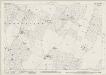
Kent XXXIII.10 (includes: Lynsted; Rodmersham; Tonge) - 25 Inch Map
1 : 2500 Topographic maps Ordnance Survey Ordnance Survey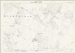
Kent XXXIII.10 (includes: Lynsted; Rodmersham; Tonge) - 25 Inch Map
1 : 2500 Topographic maps Ordnance Survey Ordnance Survey