Project
Community
News
My maps
Gecatalogiseerde kaart
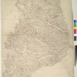
Towcester
Volledige titel:
Towcester
Fysieke grootte:
20 x 30 cm
Geschiedenis