Maps of Filkins and Broughton Poggs
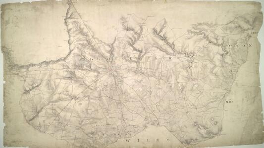
Cirencester(002OSD000000020U00118000)
1 : 31680 This drawing covers the counties of Gloucestershire, Oxfordshire and Wiltshire, with their boundaries indicated by pecked lines. The Roman road to Bath is tinted yellow to highlight it as a major communication route. A dotted line leading from Sapperton indicates the Sapperton Tunnel, which was opened in 1789. Linked to the Thames and Severn Canal, it was, at that time, the longest tunnel in England. The Sapperton Tunnel enabled boats carry coal cheaply to Cirencester from mines in the north and west. Several trigonometrical points are marked by dots within circles. These were points from which the surveyor took angular measurements to determine the relative locations of prominent features of the landscape. Metcalf, Edward B.
Cirencester (Outline) - OS One-Inch Revised New Series
1 : 63360 Topographic maps Ordnance Survey Ordnance Survey
Cirencester (Hills) - OS One-Inch Revised New Series
1 : 63360 Topographic maps Ordnance Survey Ordnance Survey
Swindon (Hills) - OS One-Inch Revised New Series
1 : 63360 Topographic maps Ordnance Survey Ordnance Survey
Swindon (Outline) - OS One-Inch Revised New Series
1 : 63360 Topographic maps Ordnance Survey Ordnance Survey
SP10 - OS 1:25,000 Provisional Series Map
1 : 25000 Topographic maps Ordnance Survey Ordnance Survey
SU19 - OS 1:25,000 Provisional Series Map
1 : 25000 Topographic maps Ordnance Survey Ordnance Survey
SO90 - OS 1:25,000 Provisional Series Map
1 : 25000 Topographic maps Ordnance Survey Ordnance Survey
SP00 - OS 1:25,000 Provisional Series Map
1 : 25000 Topographic maps Ordnance Survey Ordnance Survey
ST99 - OS 1:25,000 Provisional Series Map
1 : 25000 Topographic maps Ordnance Survey Ordnance Survey
SU09 - OS 1:25,000 Provisional Series Map
1 : 25000 Topographic maps Ordnance Survey Ordnance Survey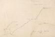
Cirencester(002OSD000000020U00117000)
1 : 31680 This unfinished drawing shows a small section of road, with milestones labelled "M.S". Dots within circles represent trigonometrical stations, from which the surveyor took angular readings to determine the locations of topographical features. Reflecting the military emphasis of the survey, the finished drawings show the road system in great detail, an important consideration for a military campaign.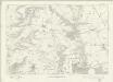
Gloucestershire XLII - OS Six-Inch Map
1 : 10560 Topographic maps Ordnance Survey Ordnance Survey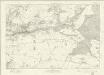
Gloucestershire L - OS Six-Inch Map
1 : 10560 Topographic maps Ordnance Survey Ordnance Survey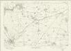
Gloucestershire LVIII - OS Six-Inch Map
1 : 10560 Topographic maps Ordnance Survey Ordnance Survey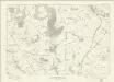
Gloucestershire XLIII - OS Six-Inch Map
1 : 10560 Topographic maps Ordnance Survey Ordnance Survey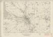
Gloucestershire LI - OS Six-Inch Map
1 : 10560 Topographic maps Ordnance Survey Ordnance Survey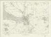
Gloucestershire LI - OS Six-Inch Map
1 : 10560 Topographic maps Ordnance Survey Ordnance Survey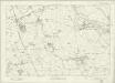
Gloucestershire LIX - OS Six-Inch Map
1 : 10560 Topographic maps Ordnance Survey Ordnance Survey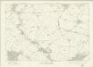
Gloucestershire XLIV - OS Six-Inch Map
1 : 10560 Topographic maps Ordnance Survey Ordnance Survey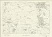
Gloucestershire LII - OS Six-Inch Map
1 : 10560 Topographic maps Ordnance Survey Ordnance Survey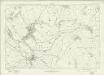
Gloucestershire LX - OS Six-Inch Map
1 : 10560 Topographic maps Ordnance Survey Ordnance Survey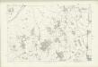
Gloucestershire LX - OS Six-Inch Map
1 : 10560 Topographic maps Ordnance Survey Ordnance Survey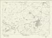
Gloucestershire XLV - OS Six-Inch Map
1 : 10560 Topographic maps Ordnance Survey Ordnance Survey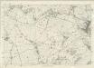
Oxfordshire XXX - OS Six-Inch Map
1 : 10560 Topographic maps Ordnance Survey Ordnance Survey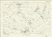
Gloucestershire LIII - OS Six-Inch Map
1 : 10560 Topographic maps Ordnance Survey Ordnance Survey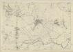
Oxfordshire XXXVI - OS Six-Inch Map
1 : 10560 Topographic maps Ordnance Survey Ordnance Survey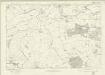
Berkshire VII - OS Six-Inch Map
1 : 10560 Topographic maps Ordnance Survey Ordnance Survey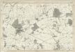
Berkshire VII - OS Six-Inch Map
1 : 10560 Topographic maps Ordnance Survey Ordnance Survey
Gloucestershire XLII.NW - OS Six-Inch Map
1 : 10560 Topographic maps Ordnance Survey Ordnance Survey