Maps of Alkham
Dover (Kent)
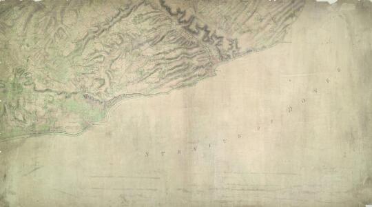
The cliffs of Dover are shown almost pictorially on this plan, with dark striations indicating steepness. Relief is shown elsewhere by shading and interlining ('hachuring'). Field boundaries are observed. The sandy coast is represented by a speckled pattern and grassland by a green wash. Dover Castle is seen in plan, with dark hachure lines depicting the steep underlying rocks. The castle, known as the 'Key to England', was a site of unique strategic importance, affording the shortest crossing point of the English Channel to continental Europe. Its defences were improved during the Napoleonic conflicts. Special tunnels were even bored beneath the keep for emergency entrance and exit. This drawing was surveyed while the war was at its most ferocious, yet no batteries are recorded.
A topographical-map, of the county of Kent, 20
1 Blatt : 54 x 71 cm A. Dury, W. Herbert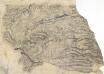
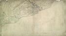
Folkstone (Kent)
Drawing of an area to the east of Folstone in Kent, showing Hawkinge and West Hougham. Dense brushwork interlining ('hachuring') is used in this plan to indicate the contours of the land. Wavy lines indicate woodland. Compared to the later surveys, this drawing is very crude, suggesting it is a preliminary sketch taken in the field.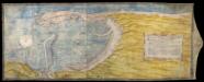
Plan of Dover Harbour
This is an anonymous plan of proposals for Dover harbour dating from 1552. It is titled 'ffor dovour pere. Thys platt exhibited vnto the kinges maiesties (?) most honorable pryvey counsell the xxiith daye of the monthe of november anno regis Edwardi Sexti sexto: de domini 1552. It is drawn and finished to a high standard, suggesting that it is a show plan intended for presentation. The map extends from Dover Castle to Folkestone. The surrounding area is shown schematically in yellow but is largely obscured by a large, pictorial cartouche containing an explanation of the proposals derived from a separate written statement. Dover Harbour is seen from an imaginary viewpoint to the north-east. The view of the town is considerable foreshortened. The sea is shown at high tide. South-West is at the top and there is a compass rose with North, South, East and West marked schematically with a crescent moon, sun, fleur-de-lys and star. The plan illustrates a variation on the proposals of 1541, shown in a map by Richard Cavendish, for the enclosure of Dover Harbour behind two immense piers stretching south from the old town and north, in this case, from Crane Head with further jetties envisaged to the south of the King's Pier and Archcliff ('Heckclyfe'). Outlines of the continuation of the pier from Crane Head are visible under the blue of the sea suggesting that there were intentions to continue on the shore side behind the pier from the North, but this idea seems to have been abandoned in the process of drawing the plan. The stylistic treatment of the depiction of the sea, the compass star, the land and the buildings, suggests that the draughtsman of this map is the same individual who created an anonymous Dover plan, convincingly dated about 1532 and is likely to have been by a painter rather than an engineer or surveyor. In contrast, this plan represents features of the harbour in a less artistic, more cartographic style. The proposed piers are shown in plan and not, as on the 1532 plan, as if completed. These developments in presentation may be a result of the presence of Sir Richard Lee, a regular visitor to Dover and probable draughtsman of a 1538 view of Dover and of a plan of Orwell Haven where the same presentation methods are employed.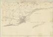
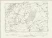
Kent LXXV (inset LXXVI) - OS Six-Inch Map
1 : 10560 Topographic maps Ordnance Survey Ordnance Survey
Kent LXVIII - OS Six-Inch Map
1 : 10560 Topographic maps Ordnance Survey Ordnance Survey
Kent LXVII - OS Six-Inch Map
1 : 10560 Topographic maps Ordnance Survey Ordnance Survey
TR23 - OS 1:25,000 Provisional Series Map
1 : 25000 Topographic maps Ordnance Survey Ordnance Survey
TR24 - OS 1:25,000 Provisional Series Map
1 : 25000 Topographic maps Ordnance Survey Ordnance Survey
TR34 & Parts of TR33 - OS 1:25,000 Provisional Series Map
1 : 25000 Topographic maps Ordnance Survey Ordnance Survey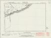
Kent LXVIII.SE - OS Six-Inch Map
1 : 10560 Topographic maps Ordnance Survey Ordnance Survey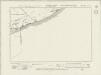
Kent LXVIII.SE - OS Six-Inch Map
1 : 10560 Topographic maps Ordnance Survey Ordnance Survey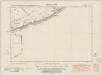
Kent LXVIII.SE - OS Six-Inch Map
1 : 10560 Topographic maps Ordnance Survey Ordnance Survey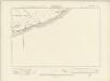
Kent LXVIII.SE - OS Six-Inch Map
1 : 10560 Topographic maps Ordnance Survey Ordnance Survey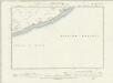
Kent LXVIII.SE - OS Six-Inch Map
1 : 10560 Topographic maps Ordnance Survey Ordnance Survey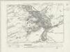
Kent LXVIII.SW - OS Six-Inch Map
1 : 10560 Topographic maps Ordnance Survey Ordnance Survey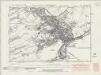
Kent LXVIII.SW - OS Six-Inch Map
1 : 10560 Topographic maps Ordnance Survey Ordnance Survey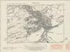
Kent LXVIII.SW - OS Six-Inch Map
1 : 10560 Topographic maps Ordnance Survey Ordnance Survey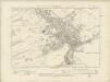
Kent LXVIII.SW - OS Six-Inch Map
1 : 10560 Topographic maps Ordnance Survey Ordnance Survey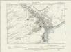
Kent LXVIII.SW - OS Six-Inch Map
1 : 10560 Topographic maps Ordnance Survey Ordnance Survey
Kent LXXVI.NW - OS Six-Inch Map
1 : 10560 Topographic maps Ordnance Survey Ordnance Survey
Kent LXXVI.NW - OS Six-Inch Map
1 : 10560 Topographic maps Ordnance Survey Ordnance Survey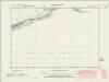
Kent LXXVI.NW - OS Six-Inch Map
1 : 10560 Topographic maps Ordnance Survey Ordnance Survey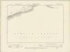
Kent LXXVI.NW - OS Six-Inch Map
1 : 10560 Topographic maps Ordnance Survey Ordnance Survey
Kent LXXVI.NW - OS Six-Inch Map
1 : 10560 Topographic maps Ordnance Survey Ordnance Survey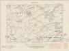
Kent LXVII.SE - OS Six-Inch Map
1 : 10560 Topographic maps Ordnance Survey Ordnance Survey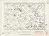
Kent LXVII.SE - OS Six-Inch Map
1 : 10560 Topographic maps Ordnance Survey Ordnance Survey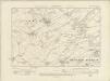
Kent LXVII.SE - OS Six-Inch Map
1 : 10560 Topographic maps Ordnance Survey Ordnance Survey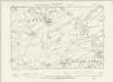
Kent LXVII.SE - OS Six-Inch Map
1 : 10560 Topographic maps Ordnance Survey Ordnance Survey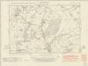
Kent LXVII.SW - OS Six-Inch Map
1 : 10560 Topographic maps Ordnance Survey Ordnance Survey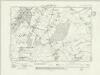
Kent LXVII.SW - OS Six-Inch Map
1 : 10560 Topographic maps Ordnance Survey Ordnance Survey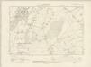
Kent LXVII.SW - OS Six-Inch Map
1 : 10560 Topographic maps Ordnance Survey Ordnance Survey
Kent LXVII.SW - OS Six-Inch Map
1 : 10560 Topographic maps Ordnance Survey Ordnance Survey