Maps of North Hertfordshire
Baldock
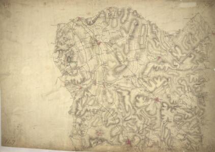
1 : 31680 The prehistoric Icknield Way runs from just left of Hitchin at the bottom of this plan to Royston at the top right. Earthworks and Roman roads are described, as is the New Inn near Caldecote. Inns provided important stopping points for food, accommodation, and a change of horse. The River Cam which rises near Ashwell depicted in blue. Hyett, William
The county of Bedford, 6
1 Blatt : 53 x 72 cm s.n.
Hitchin (Hills) - OS One-Inch Revised New Series
1 : 63360 Topographic maps Ordnance Survey Ordnance Survey
Hitchin (Outline) - OS One-Inch Revised New Series
1 : 63360 Topographic maps Ordnance Survey Ordnance Survey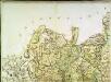
A topographical map of Hartford-Shire, 2
1 Blatt : 53 x 72 cm A. Dury
Biggleswade (Outline) - OS One-Inch Revised New Series
1 : 63360 Topographic maps Ordnance Survey Ordnance Survey
Biggleswade (Hills) - OS One-Inch Revised New Series
1 : 63360 Topographic maps Ordnance Survey Ordnance Survey
A topographical map of Hartford-Shire, 3
1 Blatt : 53 x 72 cm A. Dury
TL24 - OS 1:25,000 Provisional Series Map
1 : 25000 Topographic maps Ordnance Survey Ordnance Survey
TL23 - OS 1:25,000 Provisional Series Map
1 : 25000 Topographic maps Ordnance Survey Ordnance Survey
TL14 - OS 1:25,000 Provisional Series Map
1 : 25000 Topographic maps Ordnance Survey Ordnance Survey
TL13 - OS 1:25,000 Provisional Series Map
1 : 25000 Topographic maps Ordnance Survey Ordnance Survey
Hertfordshire VI - OS Six-Inch Map
1 : 10560 Topographic maps Ordnance Survey Ordnance Survey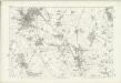
Hertfordshire XI - OS Six-Inch Map
1 : 10560 Topographic maps Ordnance Survey Ordnance Survey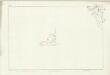
Hertfordshire IV (inset I & II) - OS Six-Inch Map
1 : 10560 Topographic maps Ordnance Survey Ordnance Survey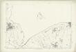
Hertfordshire III - OS Six-Inch Map
1 : 10560 Topographic maps Ordnance Survey Ordnance Survey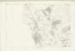
Hertfordshire VII - OS Six-Inch Map
1 : 10560 Topographic maps Ordnance Survey Ordnance Survey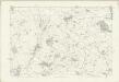
Hertfordshire XII - OS Six-Inch Map
1 : 10560 Topographic maps Ordnance Survey Ordnance Survey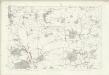
Hertfordshire VIII - OS Six-Inch Map
1 : 10560 Topographic maps Ordnance Survey Ordnance Survey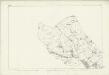
Hertfordshire XIII - OS Six-Inch Map
1 : 10560 Topographic maps Ordnance Survey Ordnance Survey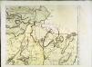
The county of Bedford, 4
1 Blatt : 53 x 72 cm s.n.
TL33 - OS 1:25,000 Provisional Series Map
1 : 25000 Topographic maps Ordnance Survey Ordnance Survey
TL34 - OS 1:25,000 Provisional Series Map
1 : 25000 Topographic maps Ordnance Survey Ordnance Survey
TL12 - OS 1:25,000 Provisional Series Map
1 : 25000 Topographic maps Ordnance Survey Ordnance Survey
TL22 - OS 1:25,000 Provisional Series Map
1 : 25000 Topographic maps Ordnance Survey Ordnance Survey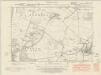
Cambridgeshire LI.NE - OS Six-Inch Map
1 : 10560 Topographic maps Ordnance Survey Ordnance Survey
Cambridgeshire LI.NE - OS Six-Inch Map
1 : 10560 Topographic maps Ordnance Survey Ordnance Survey
Cambridgeshire LI.NE - OS Six-Inch Map
1 : 10560 Topographic maps Ordnance Survey Ordnance Survey
Cambridgeshire LII.NW - OS Six-Inch Map
1 : 10560 Topographic maps Ordnance Survey Ordnance Survey
Cambridgeshire LII.NW - OS Six-Inch Map
1 : 10560 Topographic maps Ordnance Survey Ordnance Survey