Maps of Sevenoaks
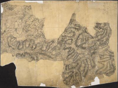
Penshurst Park, Kent
1 : 21120 Drawing of the area around Penshurst Park, to the west of Tonbridge in Kent. Although this field sketch appears loosely drawn, it includes carefully observed details such as the layout of avenues of trees in Penshurst Park itself.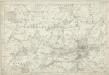
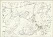
Kent LX - OS Six-Inch Map
1 : 10560 Topographic maps Ordnance Survey Ordnance Survey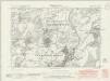
Kent LX.NE - OS Six-Inch Map
1 : 10560 Topographic maps Ordnance Survey Ordnance Survey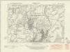
Kent LX.NE - OS Six-Inch Map
1 : 10560 Topographic maps Ordnance Survey Ordnance Survey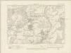
Kent LX.NE - OS Six-Inch Map
1 : 10560 Topographic maps Ordnance Survey Ordnance Survey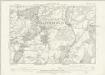
Kent LX.NE - OS Six-Inch Map
1 : 10560 Topographic maps Ordnance Survey Ordnance Survey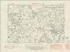
Kent LX.NW - OS Six-Inch Map
1 : 10560 Topographic maps Ordnance Survey Ordnance Survey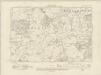
Kent LX.NW - OS Six-Inch Map
1 : 10560 Topographic maps Ordnance Survey Ordnance Survey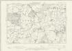
Kent LX.NW - OS Six-Inch Map
1 : 10560 Topographic maps Ordnance Survey Ordnance Survey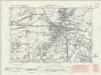
Kent L.SE - OS Six-Inch Map
1 : 10560 Topographic maps Ordnance Survey Ordnance Survey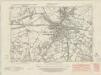
Kent L.SE - OS Six-Inch Map
1 : 10560 Topographic maps Ordnance Survey Ordnance Survey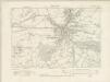
Kent L.SE - OS Six-Inch Map
1 : 10560 Topographic maps Ordnance Survey Ordnance Survey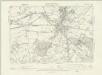
Kent L.SE - OS Six-Inch Map
1 : 10560 Topographic maps Ordnance Survey Ordnance Survey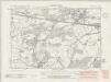
Kent L.SW - OS Six-Inch Map
1 : 10560 Topographic maps Ordnance Survey Ordnance Survey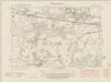
Kent L.SW - OS Six-Inch Map
1 : 10560 Topographic maps Ordnance Survey Ordnance Survey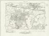
Kent L.SW - OS Six-Inch Map
1 : 10560 Topographic maps Ordnance Survey Ordnance Survey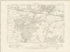
Kent L.SW - OS Six-Inch Map
1 : 10560 Topographic maps Ordnance Survey Ordnance Survey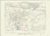
Kent L.SW - OS Six-Inch Map
1 : 10560 Topographic maps Ordnance Survey Ordnance Survey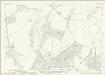
Kent L.14 (includes: Bidborough; Leigh) - 25 Inch Map
1 : 2500 Topographic maps Ordnance Survey Ordnance Survey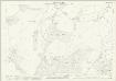
Kent L.14 (includes: Bidborough; Leigh) - 25 Inch Map
1 : 2500 Topographic maps Ordnance Survey Ordnance Survey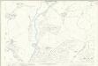
Kent L.14 (includes: Bidborough; Leigh) - 25 Inch Map
1 : 2500 Topographic maps Ordnance Survey Ordnance Survey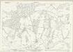
Kent LX.2 (includes: Bidborough; Penshurst) - 25 Inch Map
1 : 2500 Topographic maps Ordnance Survey Ordnance Survey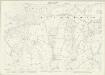
Kent LX.2 (includes: Bidborough; Penshurst) - 25 Inch Map
1 : 2500 Topographic maps Ordnance Survey Ordnance Survey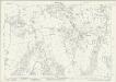
Kent LX.6 (includes: Bidborough; Penshurst; Speldhurst) - 25 Inch Map
1 : 2500 Topographic maps Ordnance Survey Ordnance Survey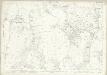
Kent LX.6 (includes: Bidborough; Penshurst; Speldhurst) - 25 Inch Map
1 : 2500 Topographic maps Ordnance Survey Ordnance Survey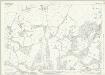
Kent L.15 (includes: Bidborough; Southborough; Tonbridge) - 25 Inch Map
1 : 2500 Topographic maps Ordnance Survey Ordnance Survey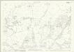
Kent L.15 (includes: Bidborough; Southborough; Tonbridge) - 25 Inch Map
1 : 2500 Topographic maps Ordnance Survey Ordnance Survey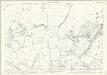
Kent L.15 (includes: Bidborough; Southborough; Tonbridge) - 25 Inch Map
1 : 2500 Topographic maps Ordnance Survey Ordnance Survey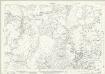
Kent LX.3 (includes: Bidborough; Southborough) - 25 Inch Map
1 : 2500 Topographic maps Ordnance Survey Ordnance Survey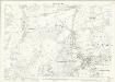
Kent LX.3 (includes: Bidborough; Southborough) - 25 Inch Map
1 : 2500 Topographic maps Ordnance Survey Ordnance Survey