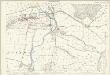
Maps of Exeter

Ottery St. Mary
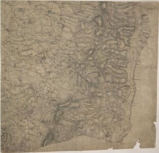
Woodbury Common dominates this drawing. The uncultivated land of the common is represented by sets of dashes representing grass. Woodbury Castle is indicated by concentric irregular shapes, mirroring the shape of the prehistoric earthworks. This drawing is drawn to a scale of 3 inches to 1 mile, larger than most of the other drawings, which are 2 inches to 1 mile. The larger scale reflects the need for greater detail in areas of the south coast that were particularly vulnerable to invasion. Budgen, Thomas
SY09 - OS 1:25,000 Provisional Series Map
1 : 25000 Topographic maps Ordnance Survey Ordnance Survey
Devonshire LXXXI.NE - OS Six-Inch Map
1 : 10560 Topographic maps Ordnance Survey Ordnance Survey
Devonshire LXXXI.NE - OS Six-Inch Map
1 : 10560 Topographic maps Ordnance Survey Ordnance Survey
Devonshire LXXXI.NE - OS Six-Inch Map
1 : 10560 Topographic maps Ordnance Survey Ordnance Survey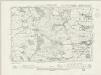
Devonshire LXXXI.SE - OS Six-Inch Map
1 : 10560 Topographic maps Ordnance Survey Ordnance Survey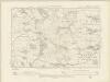
Devonshire LXXXI.SE - OS Six-Inch Map
1 : 10560 Topographic maps Ordnance Survey Ordnance Survey
Devonshire LXXXI.SE - OS Six-Inch Map
1 : 10560 Topographic maps Ordnance Survey Ordnance Survey
Devonshire XCIII.NE - OS Six-Inch Map
1 : 10560 Topographic maps Ordnance Survey Ordnance Survey
Devonshire XCIII.NE - OS Six-Inch Map
1 : 10560 Topographic maps Ordnance Survey Ordnance Survey
Devonshire LXXXI.NW - OS Six-Inch Map
1 : 10560 Topographic maps Ordnance Survey Ordnance Survey
Devonshire LXXXI.NW - OS Six-Inch Map
1 : 10560 Topographic maps Ordnance Survey Ordnance Survey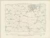
Devonshire LXXXI.SW - OS Six-Inch Map
1 : 10560 Topographic maps Ordnance Survey Ordnance Survey
Devonshire LXXXI.SW - OS Six-Inch Map
1 : 10560 Topographic maps Ordnance Survey Ordnance Survey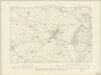
Devonshire XCIII.NW - OS Six-Inch Map
1 : 10560 Topographic maps Ordnance Survey Ordnance Survey
Devonshire XCIII.NW - OS Six-Inch Map
1 : 10560 Topographic maps Ordnance Survey Ordnance Survey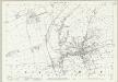
Devon LXX.13 (includes: Ottery St Mary) - 25 Inch Map
1 : 2500 Topographic maps Ordnance Survey Ordnance Survey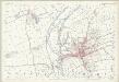
Devon LXX.13 (includes: Ottery St Mary) - 25 Inch Map
1 : 2500 Topographic maps Ordnance Survey Ordnance Survey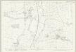
Devon LXXXII.1 (includes: Ottery St Mary) - 25 Inch Map
1 : 2500 Topographic maps Ordnance Survey Ordnance Survey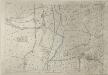
Devon LXXXII.1 (includes: Ottery St Mary) - 25 Inch Map
1 : 2500 Topographic maps Ordnance Survey Ordnance Survey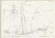
Devon LXXXII.5 (includes: Ottery St Mary) - 25 Inch Map
1 : 2500 Topographic maps Ordnance Survey Ordnance Survey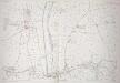
Devon LXXXII.5 (includes: Ottery St Mary) - 25 Inch Map
1 : 2500 Topographic maps Ordnance Survey Ordnance Survey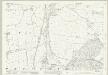
Devon LXXXII.9 (includes: Newton Popleford and Harpford; Ottery St Mary; Sidmouth) - 25 Inch Map
1 : 2500 Topographic maps Ordnance Survey Ordnance Survey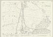
Devon LXXXII.9 (includes: Newton Popleford and Harpford; Ottery St Mary; Sidmouth) - 25 Inch Map
1 : 2500 Topographic maps Ordnance Survey Ordnance Survey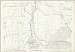
Devon LXXXII.9 (includes: Newton Popleford and Harpford; Ottery St Mary; Sidmouth) - 25 Inch Map
1 : 2500 Topographic maps Ordnance Survey Ordnance Survey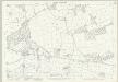
Devon LXIX.16 (includes: Ottery St Mary; Rockbeare; Talaton; Whimple) - 25 Inch Map
1 : 2500 Topographic maps Ordnance Survey Ordnance Survey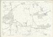
Devon LXIX.16 (includes: Ottery St Mary; Rockbeare; Talaton; Whimple) - 25 Inch Map
1 : 2500 Topographic maps Ordnance Survey Ordnance Survey
Devon LXXXII.13 (includes: Colaton Raleigh; Newton Popleford and Harpford; Otterton; Sidmouth) - 25 Inch Map
1 : 2500 Topographic maps Ordnance Survey Ordnance Survey
Devon LXXXII.13 (includes: Colaton Raleigh; Newton Popleford and Harpford; Otterton; Sidmouth) - 25 Inch Map
1 : 2500 Topographic maps Ordnance Survey Ordnance Survey