Maps of King's Lynn and West Norfolk
River Ouse
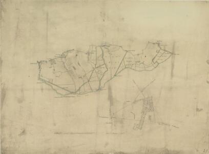
1 : 31680 .This plan is dominated by arable land divided by straight, water-filled dykes., This was a new landscape in the English fenlands., It was only in the preceding century that the Dutch engineer Vermuyden had designed the elaborate system of drains and river diversions that made possible the conversion of pasture to arable land in this region., On the top left of the manuscript, a crossed-out inscription in red ink, 'Ex AWR', reveals that the drawing was examined by Royal Military Surveyor and,Draughtsman,Alexander W Robe.
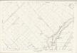
Norfolk LXIX.5 (includes: Denver; Downham Market; Downham West) - 25 Inch Map
1 : 2500 Topographic maps Ordnance Survey Ordnance Survey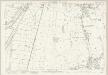
Norfolk LXIX.5 (includes: Denver; Downham Market; Downham West) - 25 Inch Map
1 : 2500 Topographic maps Ordnance Survey Ordnance Survey
Norfolk LXIX.9 (includes: Denver; Fordham) - 25 Inch Map
1 : 2500 Topographic maps Ordnance Survey Ordnance Survey
Norfolk LXIX.9 (includes: Denver; Fordham) - 25 Inch Map
1 : 2500 Topographic maps Ordnance Survey Ordnance Survey
Norfolk LXIX.13 (includes: Denver; Fordham; Hilgay) - 25 Inch Map
1 : 2500 Topographic maps Ordnance Survey Ordnance Survey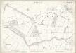
Norfolk LXIX.13 (includes: Denver; Fordham; Hilgay) - 25 Inch Map
1 : 2500 Topographic maps Ordnance Survey Ordnance Survey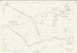
Norfolk LXIX.13 (includes: Denver; Fordham; Hilgay) - 25 Inch Map
1 : 2500 Topographic maps Ordnance Survey Ordnance Survey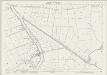
Norfolk LXXXI.1 (includes: Fordham; Hilgay) - 25 Inch Map
1 : 2500 Topographic maps Ordnance Survey Ordnance Survey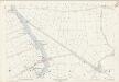
Norfolk LXXXI.1 (includes: Fordham; Hilgay) - 25 Inch Map
1 : 2500 Topographic maps Ordnance Survey Ordnance Survey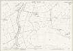
Norfolk LXXXI.5 (includes: Hilgay; Southery) - 25 Inch Map
1 : 2500 Topographic maps Ordnance Survey Ordnance Survey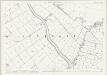
Norfolk LXXXI.9 (includes: Hilgay; Methwold; Southery) - 25 Inch Map
1 : 2500 Topographic maps Ordnance Survey Ordnance Survey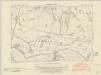
Norfolk LXIX.SW - OS Six-Inch Map
1 : 10560 Topographic maps Ordnance Survey Ordnance Survey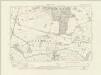
Norfolk LXIX.SW - OS Six-Inch Map
1 : 10560 Topographic maps Ordnance Survey Ordnance Survey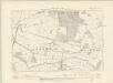
Norfolk LXIX.SW - OS Six-Inch Map
1 : 10560 Topographic maps Ordnance Survey Ordnance Survey
Norfolk LXIX.SW - OS Six-Inch Map
1 : 10560 Topographic maps Ordnance Survey Ordnance Survey
Norfolk LXXXI.NW - OS Six-Inch Map
1 : 10560 Topographic maps Ordnance Survey Ordnance Survey
Norfolk LXXXI.NW - OS Six-Inch Map
1 : 10560 Topographic maps Ordnance Survey Ordnance Survey
Norfolk LXXXI.NW - OS Six-Inch Map
1 : 10560 Topographic maps Ordnance Survey Ordnance Survey
Norfolk LXXX.12 (includes: Hilgay; Southery) - 25 Inch Map
1 : 2500 Topographic maps Ordnance Survey Ordnance Survey
Norfolk LXXX.12 (includes: Hilgay; Southery) - 25 Inch Map
1 : 2500 Topographic maps Ordnance Survey Ordnance Survey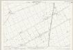
Norfolk LXXX.8 (includes: Hilgay) - 25 Inch Map
1 : 2500 Topographic maps Ordnance Survey Ordnance Survey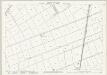
Norfolk LXXX.4 (includes: Denver; Fordham; Hilgay) - 25 Inch Map
1 : 2500 Topographic maps Ordnance Survey Ordnance Survey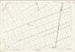
Norfolk LXXX.4 (includes: Denver; Fordham; Hilgay) - 25 Inch Map
1 : 2500 Topographic maps Ordnance Survey Ordnance Survey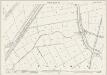
Norfolk LXVIII.16 (includes: Denver; Fordham; Hilgay; Nordelph; Welney) - 25 Inch Map
1 : 2500 Topographic maps Ordnance Survey Ordnance Survey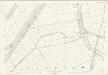
Norfolk LXVIII.16 (includes: Denver; Fordham; Hilgay; Nordelph; Welney) - 25 Inch Map
1 : 2500 Topographic maps Ordnance Survey Ordnance Survey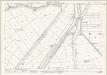
Norfolk LXVIII.12 (includes: Denver; Downham West; Nordelph) - 25 Inch Map
1 : 2500 Topographic maps Ordnance Survey Ordnance Survey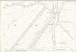
Norfolk LXVIII.12 (includes: Denver; Downham West; Nordelph) - 25 Inch Map
1 : 2500 Topographic maps Ordnance Survey Ordnance Survey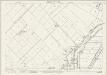
Norfolk LXVIII.8 (includes: Denver; Downham West; Nordelph; Stow Bardolph) - 25 Inch Map
1 : 2500 Topographic maps Ordnance Survey Ordnance Survey