Maps of Barford St. John and St. Michael
Barford St. John
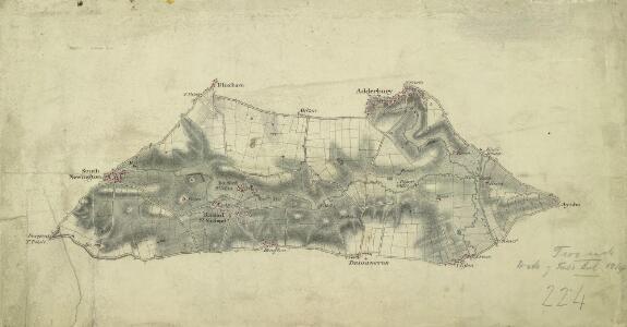
1 : 31680 .Turnpike roads, shown in yellow, form the boundaries of this part of Oxfordshire around Barford St. John. Mills are depicted along the River Swere, one of which is identified as a paper mill. Just outside Deddington, on the road leading north to Adderbury, is the Pest House, which still stands. On the right of the drawing is the Oxford Canal, completed in 1790 to ferry coal from the north to Oxford. Stanley, William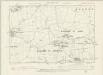
Oxfordshire IX.SE - OS Six-Inch Map
1 : 10560 Topographic maps Ordnance Survey Ordnance Survey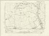
Northamptonshire LXII.SW - OS Six-Inch Map
1 : 10560 Topographic maps Ordnance Survey Ordnance Survey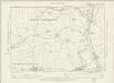
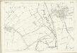
Oxfordshire X.SW - OS Six-Inch Map
1 : 10560 Topographic maps Ordnance Survey Ordnance Survey
Northamptonshire LXII.SW - OS Six-Inch Map
1 : 10560 Topographic maps Ordnance Survey Ordnance Survey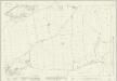
Oxfordshire IX.11 (includes: Barford St John and St Michael; Bloxham; Milcombe; South Newington) - 25 Inch Map
1 : 2500 Topographic maps Ordnance Survey Ordnance Survey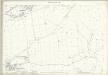
Oxfordshire IX.11 (includes: Barford St John and St Michael; Bloxham; Milcombe; South Newington) - 25 Inch Map
1 : 2500 Topographic maps Ordnance Survey Ordnance Survey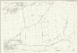
Oxfordshire IX.11 (includes: Barford St John and St Michael; Bloxham; Milcombe; South Newington) - 25 Inch Map
1 : 2500 Topographic maps Ordnance Survey Ordnance Survey
Oxfordshire IX.15 (includes: Barford St John and St Michael; Deddington; South Newington) - 25 Inch Map
1 : 2500 Topographic maps Ordnance Survey Ordnance Survey
Oxfordshire IX.15 (includes: Barford St John and St Michael; Deddington; South Newington) - 25 Inch Map
1 : 2500 Topographic maps Ordnance Survey Ordnance Survey
Oxfordshire IX.12 (includes: Barford St John and St Michael; Bloxham; Milton) - 25 Inch Map
1 : 2500 Topographic maps Ordnance Survey Ordnance Survey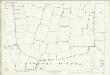
Oxfordshire IX.12 (includes: Barford St John and St Michael; Bloxham; Milton) - 25 Inch Map
1 : 2500 Topographic maps Ordnance Survey Ordnance Survey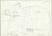
Oxfordshire IX.16 (includes: Barford St John and St Michael; Deddington) - 25 Inch Map
1 : 2500 Topographic maps Ordnance Survey Ordnance Survey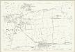
Oxfordshire IX.16 (includes: Barford St John and St Michael; Deddington) - 25 Inch Map
1 : 2500 Topographic maps Ordnance Survey Ordnance Survey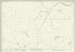
Oxfordshire X.9 (includes: Barford St John and St Michael; Deddington; East Adderbury; Milton; West Adderbury) - 25 Inch Map
1 : 2500 Topographic maps Ordnance Survey Ordnance Survey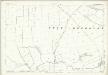
Oxfordshire X.9 (includes: Barford St John and St Michael; Deddington; East Adderbury; Milton; West Adderbury) - 25 Inch Map
1 : 2500 Topographic maps Ordnance Survey Ordnance Survey
Oxfordshire X.13 (includes: Barford St John and St Michael; Deddington; West Adderbury) - 25 Inch Map
1 : 2500 Topographic maps Ordnance Survey Ordnance Survey
Oxfordshire X.13 (includes: Barford St John and St Michael; Deddington; West Adderbury) - 25 Inch Map
1 : 2500 Topographic maps Ordnance Survey Ordnance Survey
Northamptonshire LXII.10 (includes: Aynho; Deddington; East Adderbury; Kings Sutton; West Adderbury) - 25 Inch Map
1 : 2500 Topographic maps Ordnance Survey Ordnance Survey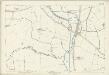
Northamptonshire LXII.10 (includes: Aynho; Deddington; East Adderbury; Kings Sutton; West Adderbury) - 25 Inch Map
1 : 2500 Topographic maps Ordnance Survey Ordnance Survey
Northamptonshire LXII.14 (includes: Aynho; Deddington; Souldern) - 25 Inch Map
1 : 2500 Topographic maps Ordnance Survey Ordnance Survey
Northamptonshire LXII.14 (includes: Aynho; Deddington; Souldern) - 25 Inch Map
1 : 2500 Topographic maps Ordnance Survey Ordnance Survey
Oxfordshire IX.7 (includes: Bloxham; Milcombe; Tadmarton) - 25 Inch Map
1 : 2500 Topographic maps Ordnance Survey Ordnance Survey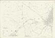
Oxfordshire IX.7 (includes: Bloxham; Milcombe; Tadmarton) - 25 Inch Map
1 : 2500 Topographic maps Ordnance Survey Ordnance Survey
Oxfordshire IX.8 (includes: Bloxham; Milton) - 25 Inch Map
1 : 2500 Topographic maps Ordnance Survey Ordnance Survey
Oxfordshire IX.8 (includes: Bloxham; Milton) - 25 Inch Map
1 : 2500 Topographic maps Ordnance Survey Ordnance Survey
Oxfordshire X.5 (includes: Bloxham; East Adderbury; Milton; West Adderbury) - 25 Inch Map
1 : 2500 Topographic maps Ordnance Survey Ordnance Survey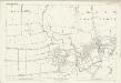
Oxfordshire X.5 (includes: Bloxham; East Adderbury; Milton; West Adderbury) - 25 Inch Map
1 : 2500 Topographic maps Ordnance Survey Ordnance Survey
Northamptonshire LXII.6 (includes: East Adderbury; Kings Sutton) - 25 Inch Map
1 : 2500 Topographic maps Ordnance Survey Ordnance Survey
Northamptonshire LXII.6 (includes: East Adderbury; Kings Sutton) - 25 Inch Map
1 : 2500 Topographic maps Ordnance Survey Ordnance Survey