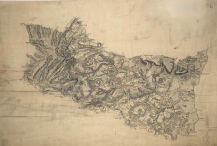
Maps of Haslemere
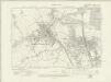
Chiddingfold
1 : 31680 .A turnpike road, coloured ochre yellow, forms a boundary from Hascombe at the top right of the map to 'Aldfold' at the bottom. Common land and dense woodland dominate the region to the left around Hindhead Valley and the Devil's Punchbowl.Commonland is indicated by open dotting. Woods and trees could provide hindrance or cover for the movement of a regiment, so these are recorded in painstaking detail. Individual trees are depicted with a small vertical stem and a shadow at the base. There are also more general representations of groups of treetops. Budgen, Thomas
Haslemere (Outline) - OS One-Inch Revised New Series
1 : 63360 Topographic maps Ordnance Survey Ordnance Survey
Haslemere (Hills) - OS One-Inch Revised New Series
1 : 63360 Topographic maps Ordnance Survey Ordnance Survey
SU93 - OS 1:25,000 Provisional Series Map
1 : 25000 Topographic maps Ordnance Survey Ordnance Survey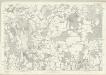
Sussex XI - OS Six-Inch Map
1 : 10560 Topographic maps Ordnance Survey Ordnance Survey
Hampshire & Isle of Wight XLV - OS Six-Inch Map
1 : 10560 Topographic maps Ordnance Survey Ordnance Survey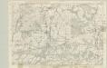
Surrey XXXVIII - OS Six-Inch Map
1 : 10560 Topographic maps Ordnance Survey Ordnance Survey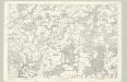
Surrey XLV - OS Six-Inch Map
1 : 10560 Topographic maps Ordnance Survey Ordnance Survey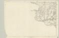
Surrey XLIV - OS Six-Inch Map
1 : 10560 Topographic maps Ordnance Survey Ordnance Survey
Surrey XLIV & XLV Parts - OS Six-Inch Map
1 : 10560 Topographic maps Ordnance Survey Ordnance Survey
Surrey XXXVII - OS Six-Inch Map
1 : 10560 Topographic maps Ordnance Survey Ordnance Survey
SU83 - OS 1:25,000 Provisional Series Map
1 : 25000 Topographic maps Ordnance Survey Ordnance Survey
Sussex X - OS Six-Inch Map
1 : 10560 Topographic maps Ordnance Survey Ordnance Survey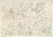
Sussex II - OS Six-Inch Map
1 : 10560 Topographic maps Ordnance Survey Ordnance Survey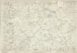
Sussex I - OS Six-Inch Map
1 : 10560 Topographic maps Ordnance Survey Ordnance Survey
TQ03 - OS 1:25,000 Provisional Series Map
1 : 25000 Topographic maps Ordnance Survey Ordnance Survey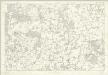
Sussex XII - OS Six-Inch Map
1 : 10560 Topographic maps Ordnance Survey Ordnance Survey
Sussex X.NE - OS Six-Inch Map
1 : 10560 Topographic maps Ordnance Survey Ordnance Survey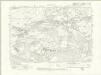
Sussex X.NE - OS Six-Inch Map
1 : 10560 Topographic maps Ordnance Survey Ordnance Survey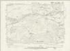
Sussex X.NE - OS Six-Inch Map
1 : 10560 Topographic maps Ordnance Survey Ordnance Survey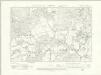
Sussex X.SE - OS Six-Inch Map
1 : 10560 Topographic maps Ordnance Survey Ordnance Survey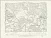
Sussex X.SE - OS Six-Inch Map
1 : 10560 Topographic maps Ordnance Survey Ordnance Survey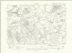
Sussex XI.NW - OS Six-Inch Map
1 : 10560 Topographic maps Ordnance Survey Ordnance Survey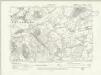
Sussex XI.NW - OS Six-Inch Map
1 : 10560 Topographic maps Ordnance Survey Ordnance Survey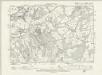
Sussex XI.NW - OS Six-Inch Map
1 : 10560 Topographic maps Ordnance Survey Ordnance Survey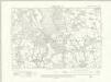
Sussex XI.SW - OS Six-Inch Map
1 : 10560 Topographic maps Ordnance Survey Ordnance Survey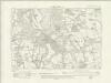
Sussex XI.SW - OS Six-Inch Map
1 : 10560 Topographic maps Ordnance Survey Ordnance Survey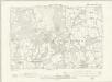
Sussex XI.SW - OS Six-Inch Map
1 : 10560 Topographic maps Ordnance Survey Ordnance Survey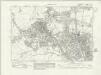
Hampshire & Isle of Wight XLV.NE - OS Six-Inch Map
1 : 10560 Topographic maps Ordnance Survey Ordnance Survey