Maps of Ilsington

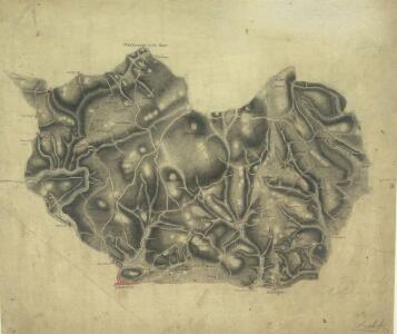
Ashburton(002OSD000000001U00017000)
Draughtsmen would sometimes rotate the area they were mapping to fit in to the available paper. Hence, this map is not orientated with north at the top. Earthworks around Ashburton and Ashburton Down, near the bottom of the drawing, are depicted by short, open, circular strokes ('hachures') in black. Around Holne Chase, to the left of the picture, feathered arrows describe the flow of the River Dart beyond two points of confluence. Dawson, Robert
Devonshire C.SW - OS Six-Inch Map
1 : 10560 Topographic maps Ordnance Survey Ordnance Survey
Devonshire C.SW - OS Six-Inch Map
1 : 10560 Topographic maps Ordnance Survey Ordnance Survey
Devonshire CVIII.NW - OS Six-Inch Map
1 : 10560 Topographic maps Ordnance Survey Ordnance Survey
Devonshire CVIII.NW - OS Six-Inch Map
1 : 10560 Topographic maps Ordnance Survey Ordnance Survey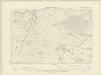
Devonshire C.SE - OS Six-Inch Map
1 : 10560 Topographic maps Ordnance Survey Ordnance Survey
Devonshire C.SE - OS Six-Inch Map
1 : 10560 Topographic maps Ordnance Survey Ordnance Survey
Devonshire CVIII.SW - OS Six-Inch Map
1 : 10560 Topographic maps Ordnance Survey Ordnance Survey
Devonshire CVIII.SW - OS Six-Inch Map
1 : 10560 Topographic maps Ordnance Survey Ordnance Survey
Devonshire CVIII.NE - OS Six-Inch Map
1 : 10560 Topographic maps Ordnance Survey Ordnance Survey
Devonshire CVIII.NE - OS Six-Inch Map
1 : 10560 Topographic maps Ordnance Survey Ordnance Survey
Devonshire CVIII.SE - OS Six-Inch Map
1 : 10560 Topographic maps Ordnance Survey Ordnance Survey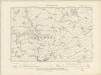
Devonshire CVIII.SE - OS Six-Inch Map
1 : 10560 Topographic maps Ordnance Survey Ordnance Survey
Devonshire CVIII.SE - OS Six-Inch Map
1 : 10560 Topographic maps Ordnance Survey Ordnance Survey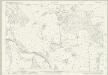
Devon CI.5 (includes: Bovey Tracey; Hennock; Lustleigh) - 25 Inch Map
1 : 2500 Topographic maps Ordnance Survey Ordnance Survey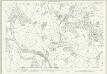
Devon CI.5 (includes: Bovey Tracey; Hennock; Lustleigh) - 25 Inch Map
1 : 2500 Topographic maps Ordnance Survey Ordnance Survey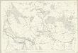
Devon CI.5 (includes: Bovey Tracey; Hennock; Lustleigh) - 25 Inch Map
1 : 2500 Topographic maps Ordnance Survey Ordnance Survey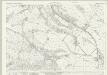
Devon CI.9 (includes: Bovey Tracey) - 25 Inch Map
1 : 2500 Topographic maps Ordnance Survey Ordnance Survey
Devon CI.9 (includes: Bovey Tracey) - 25 Inch Map
1 : 2500 Topographic maps Ordnance Survey Ordnance Survey
Devon CI.9 (includes: Bovey Tracey) - 25 Inch Map
1 : 2500 Topographic maps Ordnance Survey Ordnance Survey
Devon C.5 (includes: Manaton; North Bovey; Widecombe in the Moor) - 25 Inch Map
1 : 2500 Topographic maps Ordnance Survey Ordnance Survey
Devon C.5 (includes: Manaton; North Bovey; Widecombe in the Moor) - 25 Inch Map
1 : 2500 Topographic maps Ordnance Survey Ordnance Survey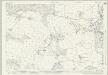
Devon CI.13 (includes: Bovey Tracey; Ilsington) - 25 Inch Map
1 : 2500 Topographic maps Ordnance Survey Ordnance Survey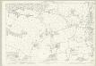
Devon CI.13 (includes: Bovey Tracey; Ilsington) - 25 Inch Map
1 : 2500 Topographic maps Ordnance Survey Ordnance Survey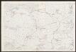
Devon CI.13 (includes: Bovey Tracey; Ilsington) - 25 Inch Map
1 : 2500 Topographic maps Ordnance Survey Ordnance Survey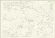
Devon CI.13 (includes: Bovey Tracey; Ilsington) - 25 Inch Map
1 : 2500 Topographic maps Ordnance Survey Ordnance Survey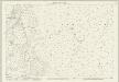
Devon C.9 (includes: Manaton; Widecombe in the Moor) - 25 Inch Map
1 : 2500 Topographic maps Ordnance Survey Ordnance Survey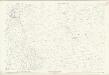
Devon C.9 (includes: Manaton; Widecombe in the Moor) - 25 Inch Map
1 : 2500 Topographic maps Ordnance Survey Ordnance Survey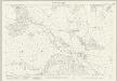
Devon CIX.1 (includes: Ilsington) - 25 Inch Map
1 : 2500 Topographic maps Ordnance Survey Ordnance Survey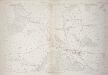
Devon CIX.1 (includes: Ilsington) - 25 Inch Map
1 : 2500 Topographic maps Ordnance Survey Ordnance Survey