Maps of Shropshire
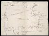
Foresta de Morfe, [Shropshire?]
This is a map of the "Forresta de Morfe", Shropshire(?). It is a simple pen and ink drawing whose intention seems to be to record the extent to which the neighbouring villages lie on forest land, presumably so that any further encroachment and claim to forest land can be refuted. It is annotated with "All the villages herein named be commoners in the said forest". A path through the forest is marked, houses are indicated with a generic symbol and churches are distinguished. Cardinal points are indicated. Maps such as this one of a small locality, drawn to illustrate a particular situation with regards to land boundaries and ownership is an invention of the later 16th century and illustrates how map use was developing to fulfil a practical function, contrasting with the symbolic and religious function of maps in the previous centuries. William Cecil, Lord Burghley
Shropshire LIX.NW - OS Six-Inch Map
1 : 10560 Topographic maps Ordnance Survey Ordnance Survey
Shropshire LIX.NW - OS Six-Inch Map
1 : 10560 Topographic maps Ordnance Survey Ordnance Survey
Shropshire LIX.NW - OS Six-Inch Map
1 : 10560 Topographic maps Ordnance Survey Ordnance Survey
Shropshire LIX.SW - OS Six-Inch Map
1 : 10560 Topographic maps Ordnance Survey Ordnance Survey
Shropshire LIX.SW - OS Six-Inch Map
1 : 10560 Topographic maps Ordnance Survey Ordnance Survey
Shropshire LIX.SW - OS Six-Inch Map
1 : 10560 Topographic maps Ordnance Survey Ordnance Survey
Shropshire LIX.2 (includes: Claverley; Worfield) - 25 Inch Map
1 : 2500 Topographic maps Ordnance Survey Ordnance Survey
Shropshire LIX.2 (includes: Claverley; Worfield) - 25 Inch Map
1 : 2500 Topographic maps Ordnance Survey Ordnance Survey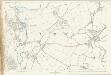
Shropshire LIX.2 (includes: Claverley; Worfield) - 25 Inch Map
1 : 2500 Topographic maps Ordnance Survey Ordnance Survey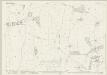
Shropshire LIX.6 (includes: Claverley; Worfield) - 25 Inch Map
1 : 2500 Topographic maps Ordnance Survey Ordnance Survey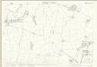
Shropshire LIX.6 (includes: Claverley; Worfield) - 25 Inch Map
1 : 2500 Topographic maps Ordnance Survey Ordnance Survey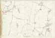
Shropshire LIX.6 (includes: Claverley; Worfield) - 25 Inch Map
1 : 2500 Topographic maps Ordnance Survey Ordnance Survey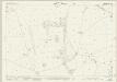
Shropshire LIX.10 (includes: Claverley; Worfield) - 25 Inch Map
1 : 2500 Topographic maps Ordnance Survey Ordnance Survey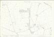
Shropshire LIX.10 (includes: Claverley; Worfield) - 25 Inch Map
1 : 2500 Topographic maps Ordnance Survey Ordnance Survey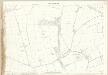
Shropshire LIX.10 (includes: Claverley; Worfield) - 25 Inch Map
1 : 2500 Topographic maps Ordnance Survey Ordnance Survey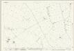
Shropshire LIX.14 (includes: Claverley; Quatt Malvern; Worfield) - 25 Inch Map
1 : 2500 Topographic maps Ordnance Survey Ordnance Survey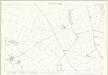
Shropshire LIX.14 (includes: Claverley; Quatt Malvern; Worfield) - 25 Inch Map
1 : 2500 Topographic maps Ordnance Survey Ordnance Survey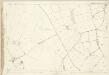
Shropshire LIX.14 (includes: Claverley; Quatt Malvern; Worfield) - 25 Inch Map
1 : 2500 Topographic maps Ordnance Survey Ordnance Survey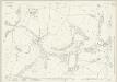
Shropshire LIX.1 (includes: Worfield) - 25 Inch Map
1 : 2500 Topographic maps Ordnance Survey Ordnance Survey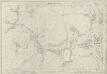
Shropshire LIX.1 (includes: Worfield) - 25 Inch Map
1 : 2500 Topographic maps Ordnance Survey Ordnance Survey
Shropshire LIX.1 (includes: Worfield) - 25 Inch Map
1 : 2500 Topographic maps Ordnance Survey Ordnance Survey
Shropshire LIX.5 (includes: Worfield) - 25 Inch Map
1 : 2500 Topographic maps Ordnance Survey Ordnance Survey
Shropshire LIX.5 (includes: Worfield) - 25 Inch Map
1 : 2500 Topographic maps Ordnance Survey Ordnance Survey
Shropshire LIX.5 (includes: Worfield) - 25 Inch Map
1 : 2500 Topographic maps Ordnance Survey Ordnance Survey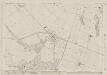
Shropshire LIX.9 (includes: Bridgnorth St Mary Magdalen; Quatford; Worfield) - 25 Inch Map
1 : 2500 Topographic maps Ordnance Survey Ordnance Survey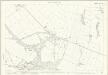
Shropshire LIX.9 (includes: Bridgnorth St Mary Magdalen; Quatford; Worfield) - 25 Inch Map
1 : 2500 Topographic maps Ordnance Survey Ordnance Survey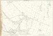
Shropshire LIX.9 (includes: Bridgnorth St Mary Magdalen; Quatford; Worfield) - 25 Inch Map
1 : 2500 Topographic maps Ordnance Survey Ordnance Survey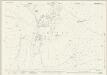
Shropshire LIX.13 (includes: Bridgnorth St Mary Magdalen; Eardington; Quatford; Quatt Malvern; Worfield) - 25 Inch Map
1 : 2500 Topographic maps Ordnance Survey Ordnance Survey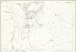
Shropshire LIX.13 (includes: Bridgnorth St Mary Magdalen; Eardington; Quatford; Quatt Malvern; Worfield) - 25 Inch Map
1 : 2500 Topographic maps Ordnance Survey Ordnance Survey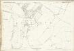
![Foresta de Morfe, [Shropshire?]](https://images-2.georeferencer.com/images/iiif/609266388557/full/,300/0/native.jpg)

