Maps of Dorset

Maps of Dorset

$title$

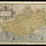
DORCESTRIAE Comitatus

This is a map of Dorset by Christopher Saxton, datingfrom 1575. It forms part of an atlas that belonged to William Cecil Lord Burghley, Elizabeth I’s Secretary of State. Burghley used this atlas to illustrate domestic matters. This map is actually a proof copy of one which forms part of Christopher Saxton’s Atlas of England and Wales. This atlas was first published as a whole in 1579. It consists of 35 coloured maps depicting the counties of England and Wales. The atlas is of great significance to British cartography as it set a standard of cartographic representation in Britain and the maps remained the basis for English county mapping, with few exceptions, until after 1750. During the reign of Elizabeth I map use became more common, with many government matters referring to increasingly accurate maps with consistent scales and symbols, made possible by advances in surveying techniques. Illustrating the increasing use of maps in government matters, Lord Burghley, who had been determined to have England and Wales mapped in detail from the 1550s, selected the cartographer Christopher Saxton to produce a detailed and consistent survey of the country. The financier of the project was Thomas Seckford, Master of Requests at the Court of Elizabeth I, whose arms appear, along with the royal crest, on each map. Lord Burghley added several place names. In the lower margin there are notes concerning 'Dangerous places for landing of men in the county'. These notes were probably written by an assistant of Lord Burghley and show the concern felt about the south coasts vulnerability to invasion. Due to the presence of a Protestant Queen in the form of Elizabeth I, England was under threat from a catholic crusade from Philip II of Spain. This threat culminated in the events of the Spanish Armada in 1588. Saxton, Christopher William Cecil, Lord Burghley
$title$

DORCESTRIAE

This map of Dorset is from the 1583 edition of the Saxton atlas of England and Wales. This atlas was first published as a whole in 1579. It consists of 35 coloured maps depicting the counties of England and Wales. The atlas is of great significance to British cartography as it set a standard of cartographic representation in Britain and the maps remained the basis for English county mapping, with few exceptions, until after 1750. During the reign of Elizabeth I map use became more common, with many government matters referring to increasingly accurate maps with consistent scales and symbols, made possible by advances in surveying techniques. Illustrating the increasing used of maps in government matters, Lord Burghley, Elizabeth I’s Secretary of State, who had been determined to have England and Wales mapped in detail from the 1550s, selected the cartographer Christopher Saxton to produce a detailed and consistent survey of the country. The financier of the project was Thomas Seckford Master of Requests at the Court of Elizabeth I, whose arms appear, along with the royal crest, on each map. Here the strap work cartouche is mounted by the Elizabethan coat of arms. The Seckford arms of appear at the bottom of the map, adjacent to the decorative scale bar which houses Saxton’s name. The adjacent counties are named but lack any internal detail, recording only the path of rivers that cross county boundaries. Relief, in the form of uniform rounded representations of hills, is the main topographical feature presented in the maps. Rather than provide a scientific representation of relative relief these give a general impression of the lie of the land. Settlements and notable buildings are also recorded pictorially; a small building with a spire represents a village, while more important towns are indicated by groups of buildings. Here Portland castle is marked by a castle symbol of two connected towers. Rivers, streams, parks and woodlands are also depicted carefully. Woods are shown by small tree-symbols, with clusters representing forests, and parklands enclosed with ring fences. Great decorative effect is provided by the detailed images of ships in the stippled sea. Saxton, Christopher Ryther, Augustine
$title$

Comitatus Dorcestria, sive Dorsettia; Vulgo Anglice Dorset Shire. [Karte] , in: Theatrum orbis terrarum, sive, Atlas novus, Bd. 4, S. 143.

1 Karte aus Atlas Blaeu, Joan Blaeu, Willem Janszoon
$title$

Comitatus Dorcestria, sive Dorsettia; Vulgo Anglice Dorset Shire. [Karte], in: Le théâtre du monde, ou, Nouvel atlas contenant les chartes et descriptions de tous les païs de la terre, Bd. 4, S. 127.

1 Karte aus Atlas Blaeu, Willem Janszoon und Blaeu, Joan Blaeu, Willem Janszoon
$title$

Comitatus Dorcestria. Vulgo Anglice Dorset Shire. [Karte] , in: Novus atlas absolutissimus, Bd. 7, S. 192.

1 Karte aus Atlas Janssonius Offizin
$title$

Comitatus Dorcestria, sive Dorsettia; Vulgo Anglice Dorset Shire. [Karte] , in: Theatrum orbis terrarum, sive, Atlas novus, Bd. 4, S. 143.

1 Karte aus Atlas Blaeu, Joan Blaeu, Willem Janszoon
$title$

COMITATVS | DORCESTRIA, | sive | DORSETTIA; | Vulgo Anglice | DORSET SHIRE.

[Amsterdam : Joan Blaeu]
$title$

An accurate map of Dorset Shire

1 Karte : Kupferdruck ; 52 x 68 cm Bowen; Tinney; Bowles; Sayer; Bowles; Bowles printed for John Bowles and son in Cornhil I. Tinney at the Golden Lion in Fleet street T. Bowles in St. Pauls Church Yard and Rob.t Sayer in Fleet Street
$title$

Comitatvs Dorcestria, sive Dorsettia; vulgo anglice Dorset Shire

1 Karte : Kupferdruck ; 37 x 49 cm Blaeu Joan Blaeu
$title$

Comitatus Dorcestria vulgo anglice Dorset Shire

1 : 170000 Amstelodami : apud Joannem Janssonium
$title$

$title$

Map of Dorsetshire

This map comes from the Abbott's Illustrated Counties series of county guides: Dorsetshire, its history, antiquities, places of interest, etc a complete, concise and exhaustive story of Dorset from the earliest times to the present day' The Guide Printing & Publishing Co.
$title$

An accurate map of Dorset Shire, divided into its hundreds

1 : 180000
$title$

An accurate map of Dorset Shire divided into hundreds

1 : 222000
$title$

Comitatus Dorcestria, sive Dorsettia ; vulgo anglice Dorset Shire

1 : 145000
$title$

Dorset, Sheet 34 - Bartholomew's "Half Inch to the Mile Maps" of England & Wales

1 : 126720 Topographic maps Bartholomew, John George John Bartholomew & Co
$title$

Sheets 13-14. (Cary's England, Wales, and Scotland).

1 : 360000 Cary, John, ca. 1754-1835
$title$

Cary's Improved Map of England and Wales

Cary, George, & Cary, John London : G. & J. Cary
$title$

Dorchester - OS One-Inch Map

1 : 63360 Topographic maps Ordnance Survey Ordnance Survey
$title$

Dorset Shire, 2

2 Blätter : 109 x 53 cm s.n.
$title$

Dorset Shire, 1

2 Blätter : 109 x 54 cm s.n.
$title$

Taunton and Lyme Regis - OS One-Inch Map

1 : 63360 Topographic maps Ordnance Survey Ordnance Survey
$title$

Dorset Shire, 3

2 Blätter : 109 x 45 cm s.n.
$title$

Bournemouth - OS One-Inch Map

1 : 63360 Topographic maps Ordnance Survey Ordnance Survey
$title$

Bridport

The long stretch of sand in this plan is Chesil Beach. Once linked to Spain by well- established trade routes, it is also locally famed for reported sightings of the fabled Veasta Sea Monster. Signal points are marked along coast leading down to the beach, the most notable being Abbotsbury Castle Signal Staff on Abbotsbury Common. Pencil script records the date of execution and scale of the drawing. The words "Exhibit A" are written in blue pencil at the very edge of the sheet. A reference to the village of 'Wyke' (Wyke Regis) can be seen at the far right of the drawing. Budgen, Charles
$title$

Shaftesbury

1 : 31680 This drawing covers the counties of Dorset, Somerset and Wiltshire, with their boundaries marked by pecked red lines. Relief is indicated by shading and interlining, giving an impression of the undulations of the land. Although the recording of archaeological sites did not become obligatory until 1816, the remains of Whitesheet Castle appear at the top centre of the drawing. Pencil lines can be seen at the edge of the drawing near Pimperne. This was an observation or measuring point for the survey.
$title$

Berwick St. John

Small red crosses at Baverstoke, at the top centre, and Et Knoyle, at the top left,mark observation points used by the surveyor to plot topographical details and measure distances. The draughtsman has faithfully recorded the relative relief of the hills and indicated areas of woodland, using various shades of green to distinguish woods from grassland. The ancient circular earthworks of Chiselbury are marked by concentric rings on White Sheet Hill, in the centre of the drawing.
$title$

Weymouth

This drawing covers the coast of Weymouth Bay and the Isle of Portland. Lighthouses are marked on the tip of the island. Red lines denote stone walls. Sandsfoot Castle and Portland Castle are shown by blocks of red ink. These were among of a series of castles built by Henry VIII as defence against Spain and France after his divorce from the Catholic Catherine of Aragon and his breaking of ties with Rome. Chalbury Hillfort is indicated above Weymouth Bay. Archaeological sites were of interest to many of the draughtsmen and were often included even before it became obligatory to do so in 1816. The boundary with Purbeck is indicated by a red pecked line. Budgen, Charles
$title$

Cranborne

This drawing represents the relative relief of the landscape by light shading and interlining in pencil. Parallel pecked lines indicate paths across open land. Achling Ditch, a Roman road, runs diagonally across the drawing. To the left of the road is Blandford Race Ground and Telegraph. As well as being a racecourse until the end of the 19th century, Blandford was used as a military training ground by local volunteers from the 18th century onwards. In 1806, a Royal Navy Shutter Telegraph Station was built near the racecourse. The signal station, on the London to Plymouth route, was closed after the Napoleonic War. In the lower section of the map, concentric rings depict the iron-age hillfort of Badbury Rings.
$title$

Beaminster

This drawing delineates the county borders of Dorset and Somerset with a red pecked line. Pillesdon Pen, a hillfort, is indicated by concentric rings to the left of the plan, although it did not become obligatory to record archaeological sites until 1816. The fort's position, 909 ft above sea level, is depicted by dark shading and brushwork interlining ('hachuring'). The summits of hills in this undulating countryside are left bare.
© MapTiler © OpenStreetMap contributors
How does it work?
These instructions will show you how to find historical maps online.
Getting started
Type the place name in the search box to find the exact location. You can further adjust the search by zooming in and out.
Zoom
Zoom in and out with the buttons or use your mouse or touchpad natively.
Exact Area tool
Click here and draw a rectangle over the map to precisely define the search area.
Set filters
Narrow your search with advanced settings, such as Years (from/to), Fulltext, Publisher, etc.
Results
See the results of your search on the right side. You can scroll down to find more maps of this location.
?

Download OldMapsOnline Mobile