Maps of Weymouth and Portland
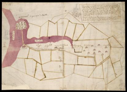
Radipole, near Weymouth, Dorset
This is a map of Radipole near Weymouth, Dorset, dating from the reign of Elizabeth I. It seems to illustrate a dispute over tithes, which was a direct tax on farming representing a percentage of annual agricultural production. This plan shows the shape of fields, although these are not to scale. The text is in a secretary hand. The Fleete is indicated by a red/purple wash. On the bank of the Fleet bulwarks are shown and labelled. This map predates the governments involvement in the process of redistribution and enclosure of communally held land in England. This occurred in 1604, when an Act of Parliament was obtained for the enclosure of the area of Radipole, Dorset. Enclosure and redistribution of communally held land aimed to introduce a more efficient farming structure.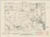
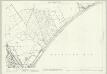
Dorset LIII.NW - OS Six-Inch Map
1 : 10560 Topographic maps Ordnance Survey Ordnance Survey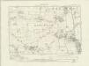
Dorset LIII.NW - OS Six-Inch Map
1 : 10560 Topographic maps Ordnance Survey Ordnance Survey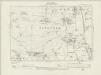
Dorset LIII.NW - OS Six-Inch Map
1 : 10560 Topographic maps Ordnance Survey Ordnance Survey
Dorset LIII.NW - OS Six-Inch Map
1 : 10560 Topographic maps Ordnance Survey Ordnance Survey
Dorset LIII.NW - OS Six-Inch Map
1 : 10560 Topographic maps Ordnance Survey Ordnance Survey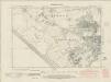
Dorset LIII.SW - OS Six-Inch Map
1 : 10560 Topographic maps Ordnance Survey Ordnance Survey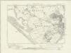
Dorset LIII.SW - OS Six-Inch Map
1 : 10560 Topographic maps Ordnance Survey Ordnance Survey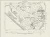
Dorset LIII.SW - OS Six-Inch Map
1 : 10560 Topographic maps Ordnance Survey Ordnance Survey
Dorset LIII.SW - OS Six-Inch Map
1 : 10560 Topographic maps Ordnance Survey Ordnance Survey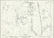
Dorset LIII.2 (includes: Bincombe; Weymouth) - 25 Inch Map
1 : 2500 Topographic maps Ordnance Survey Ordnance Survey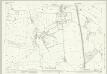
Dorset LIII.2 (includes: Bincombe; Weymouth) - 25 Inch Map
1 : 2500 Topographic maps Ordnance Survey Ordnance Survey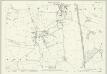
Dorset LIII.2 (includes: Bincombe; Weymouth) - 25 Inch Map
1 : 2500 Topographic maps Ordnance Survey Ordnance Survey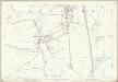
Dorset LIII.2 (includes: Bincombe; Weymouth) - 25 Inch Map
1 : 2500 Topographic maps Ordnance Survey Ordnance Survey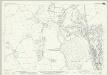
Dorset LIII.6 (includes: Chickerell; Weymouth) - 25 Inch Map
1 : 2500 Topographic maps Ordnance Survey Ordnance Survey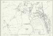
Dorset LIII.6 (includes: Chickerell; Weymouth) - 25 Inch Map
1 : 2500 Topographic maps Ordnance Survey Ordnance Survey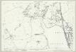
Dorset LIII.6 (includes: Chickerell; Weymouth) - 25 Inch Map
1 : 2500 Topographic maps Ordnance Survey Ordnance Survey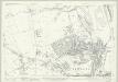
Dorset LIII.10 (includes: Chickerell; Weymouth) - 25 Inch Map
1 : 2500 Topographic maps Ordnance Survey Ordnance Survey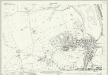
Dorset LIII.10 (includes: Chickerell; Weymouth) - 25 Inch Map
1 : 2500 Topographic maps Ordnance Survey Ordnance Survey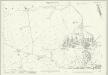
Dorset LIII.10 (includes: Chickerell; Weymouth) - 25 Inch Map
1 : 2500 Topographic maps Ordnance Survey Ordnance Survey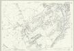
Dorset LIII.14 (includes: Chickerell; Weymouth) - 25 Inch Map
1 : 2500 Topographic maps Ordnance Survey Ordnance Survey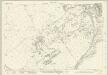
Dorset LIII.14 (includes: Chickerell; Weymouth) - 25 Inch Map
1 : 2500 Topographic maps Ordnance Survey Ordnance Survey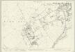
Dorset LIII.14 (includes: Chickerell; Weymouth) - 25 Inch Map
1 : 2500 Topographic maps Ordnance Survey Ordnance Survey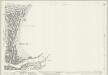
Dorset LIII.11 (includes: Weymouth) - 25 Inch Map
1 : 2500 Topographic maps Ordnance Survey Ordnance Survey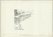
Dorset LIII.11 & 15 (includes: Weymouth) - 25 Inch Map
1 : 2500 Topographic maps Ordnance Survey Ordnance Survey
Dorset LIII.11 (includes: Weymouth) - 25 Inch Map
1 : 2500 Topographic maps Ordnance Survey Ordnance Survey
Dorset LIII.11 (includes: Weymouth) - 25 Inch Map
1 : 2500 Topographic maps Ordnance Survey Ordnance Survey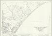
Dorset LIII.7 & 8 (includes: Osmington; Weymouth) - 25 Inch Map
1 : 2500 Topographic maps Ordnance Survey Ordnance Survey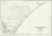
Dorset LIII.7 & 8 (includes: Osmington; Weymouth) - 25 Inch Map
1 : 2500 Topographic maps Ordnance Survey Ordnance Survey