Maps of Piedmont
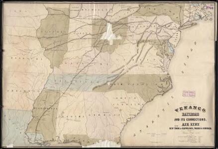
Venango railroad and its connections, air line from New York to Cleveland, Toledo & Chicago
1 : 2000000 J.H. Bufford's Lith.
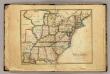
A Map of the United States of America, 1830.
from Whole
Southern provinces of the United States.
from Charts and maps
Map of the roads, canals and steam boat routes of the United States: with the distances from place to place carefully noticed ... / designed for the use of travellers by H.S. Tanner.
from Whole Henry S. Tanner,
Map of the Seat of Civil War in America, October, 1862
Map of the Seat of Civil War in America, October, 1862. In this map the enlarged segment detailing recent battles focuses on the area along the border of the Union and Confederacy between Maryland and Virginia, particularly from the Chesapeake Bay and Potomac River. Near the top of the enlarged portion, Sharpsburg is labelled, site of the Battle of Antietam in September 1862. Bull Run/Manassas is also marked, along with Fairfax Court House and Centreville, sights that were captured in photographs published by Alexander Gardner. Davies & Co.
Map of the United States of America.
1 : 5800000 Melish, John
United States.
1 : 8200000 Woodbridge, William C.
Map of the United States.
1 : 1900000 Bradley, Abraham Junior
A Map Of The Roads, Canals And Steam Boat Routes Of The United States
1 : 4118400 Tanner, Henry S.
Bacon's steel plate map of the American states north &south, showing the railways, forts, and fortifications
United States.
1 : 8000000 Seaman, James V.
Principal cities U.S.
Cornell, S. S. (Sarah S.)
Phelps's national map of the United States: a travellers guide: embracing the principal rail roads, canals, steam boat & stage routes, throughout the union / drawn & engraved by J.M. Atwood, New York; portraits & st. arms engd. by Wm. D. Smith.
from Whole J. M. Atwood; Phelps; William D. Smith,
Map of the United States of America / Gridley, sc.
from Whole Gridley,
Map of the United States of America / J. Melish, del.; H.S. Tanner, sc.
from Whole John Melish; Henry S. Tanner,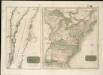
United States of America
Map of the Seat of Civil War in America, September, 1862
Map of the Seat of Civil War in America, September, 1862. Produced by Davies & Co. in London, this map shows ten of the Confederate states, outlined in red, the Border States of Kentucky and Missouri, which remained within the Union, and lower portion of the Union states, outlined in green. The lower righter corner has an enlarged segment of the country detailing the sites of recent battles around lower Maryland, Washington, D.C. and Virginia. This includes Manassas Junction, where both battles of Bull Run had been fought prior to the map’s publication. Davies & Co.
United States of Nth. America.
1 : 1584000 Tardieu, P.F.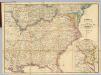
Map Of The Seat Of Civil War In America.
1 : 2534400 Davies & Co.
Mitchell's Reference & Distance Map Of The United States.
1 : 1584000 Young, James H.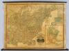
United States.
1 : 1964160 Woodbridge, J.L.
Mitchell's National Map of the United States.
1 : 3360000 Mitchell, Samuel Augustus
Map of the United States.
1 : 1950000 Bradley, Abraham Junior
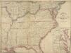
Map of the United States exhibiting the post-roads, the situations, connections & distances of the post-offices, stage roads, counties, ports of entry and delivery for foreign vessels, and the principal rivers

United States of America

Map of the United States.
1 : 6750000 Scott, Joseph
Etats-Unis d'Amerique.
1 : 4200000 Poussin, Guillaume Tell, 1794-1876
Mitchell's Reference & Distance Map Of The United States.
1 : 1584000 Young, James H.
Reference & Distance Map Of The United States.
1 : 1584000 Young, James H.