Maps of Massachusetts

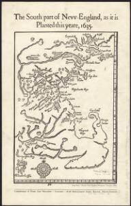
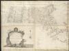
The south part of New-England, as it is planted this yeare, 1635
1 : 990000 Wood, William Frank Gair, Macomber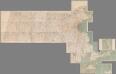
Composite Map: (Massachusetts).
1 : 63680 Walker, O.W.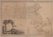
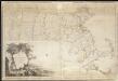
Map of Massachusetts proper : compiled from actual surveys made by order of the General Court
1 : 253440 Carleton, Osgood, 1742-1816 [B. & J. Loring]
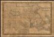
Massachusetts.
1 : 696960 Carey, Mathew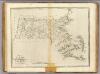
State of Massachusetts.
1 : 696960 Carey, Mathew
State of Massachusetts.
1 : 696960 Lewis, Samuel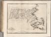
State of Massachusetts.
1 : 696960 Carey, Mathew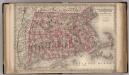
Massachusetts, Connecticut, and Rhode Island.
1 : 850000 Colton, G.W.
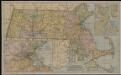
National topographic map of Massachusetts and Rhode Island : showing counties, townships, cities, villages and post offices ... according to the latest census.
1 : 253440 National Map Company National Map Company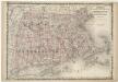
Johnson's Massachusetts Connecticut and Rhode Island
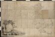
Map of Massachusetts proper compiled from actual surveys made by order of the General Court
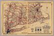
Mass., Conn., R.I.
1 : 910000 Rand McNally and Company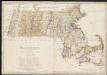
Massachusetts

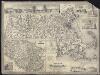
A new and accurate map of the Colony of Massachusetts Bay, in North America, from a late survey

Neueste Karte von Massachusetts und Rhode Island
Grosser Hand-Atlas über alle Theile der Erde in 170 Karten Meyer, J. Verlag des Bibliographischen Instituts
Massachusetts and Rhode Island.
1 : 800000 Tanner, Henry S.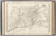
Connecticut, Massachusetts, and Rhode Island.
Rand McNally and Company
Carte géographique, statistique et historique de Massachusetts
Map of Massachusetts proper

State of Massachusetts.
1 : 680000 Winterbotham, W.
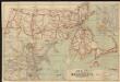
Old Colony Railroad and connections
1 : 633600 Winslow, E. N [s.n.]
Massachusetts.
1 : 1130000 Tanner, Henry S.
Massachusetts and Rhode Island.
1 : 785000 Colton, G.W.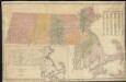
A map of Massachusetts showing the congressional districts, as proposed by the Senate of 1852
An accurate map of the Commonwealth of Massachusetts exclusive of the District of Maine, compiled pursuant to an act of the General Court from actual surveys of the several towns &c. taken by their order, exhibiting the boundary lines of the Commonwealth

Map of Massachsuetts showing state highways laid out & petitioned for
The Matthews-Northrup up-to-date map of Massachusetts
Map of Massachusetts
Map of Massachusetts