Maps of Metropolitan France

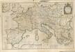
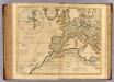
Orbis Romani pars occidentalis
1 : 10000000
Imperii Romani.
1 : 9850000 Vivien de St Martin, L.
Carte de la Germanie et les diferents etats ou ses peuples ont porté leurs conquestes
Evropa jižní Chatelain, Henri-Abraham Chatelain
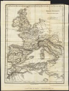
Orbis Romani Pars Occidentalis.
1 : 10137600 Lucas, Fielding Jr.
Orbis Romani, occidentalis.
1 : 11500000 Anville, Jean Baptiste Bourguignon d, 1697-1782; M'Dermut, Robert
Landtaflen
1 Atlas [von Johannes Stumpf] Christoffel Froschower, Zürych
Western Europe - communications.
1 : 5300000 John Bartholomew and Son
Imperii Romani, distracta
1 : 22200000 Evropa střední Bonne, Rigobert André
Patriarchatus Romanus
1 : 11100000 Mollova mapová sbírka Sanson, Nicolas Covens, Johannes I
Orbis Romani, pars occidentalis.
1 : 4300000 Anville, Jean Baptiste Bourguignon d, 1697-1782
Carte des costes maritimes de l'Europe
1 Karte : Kupferdruck ; 64 x 48 cm Nolin; Basset; Basset chez Basset rue St. Jacques
Carte des costes maritimes de l'Europe
1 Karte : Kupferdruck ; 64 x 48 cm Nolin; Daumont chez Daumont rue de la Feronnerie
Theatrum historicum ad annum Christi quadringentesimu. Pars occidentalis.
1 : 8500000 L'Isle, Guillaume de, 1675-1726
Europa Prima Nova Tabula [Karte], in: Geographia universalis vetus et nova complectens Claudii Ptolemaei Alexandrini enarrationis libros VIII, S. 302.
1 Karte aus Atlas Münster, Sebastian [und Ptolemaeus, Claudius]
Europa Prima Nova Tabula [Karte], in: Claud. Ptolemaeus. Geographia lat. cum mappis [...], S. 332.
1 Karte aus Atlas Münster, Sebastian [und Ptolemaeus, Claudius]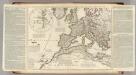
Theatrum historicum ad annum Christi quadringentesimu. Pars occidentalis.
1 : 8500000 L'Isle, Guillaume de, 1675-1726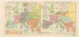
Rozsah panství Habsburků ... za Karla V. (1555) Říše Napoleonova (1810) a Evropa po kongresu Vídeňském (1815)

L'ocean pres d'Europe
1 Karte : Kupferdruck ; 46 x 34 cm Duval chez l'auteur
Orbis Romani pars occidentalis
1 : 10600000 Evropa západní Anville, Jean-Baptiste Bourguinon d' Küffner, Paul in officina Weigelia-Schneideriana
Orbis Romani pars occidentalis, auspiciis serenissimi principis Ludovici Philippi Aurelianorum ducis publici juris facta
1 : 4300000
Imperium Romanum
1 : 11100000 Evropa západní Bonne, Rigobert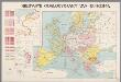
Nieuwste oorlogskaart van Europa
1 : 6000000 A[mster]dam : Meulenhoff
Europe 1.
1 : 2800000 Anville, Jean Baptiste Bourguignon d, 1697-1782
Europa Saeculo XVIII. Usque ad Annum 1789 (1795)
Europa
West-Europa
1 : 3000000 Evropa západní Georg Westermann
Carte d'Europe indiquant le canal maritime de l'océan à la Méditerranée
1 : 16000000 Perrin, Maurice [Paris] : [éditeur inconnu]
Europa im Zeitalter Wilhelms I.
1 : 15000000 Europa Wilhelm I., Deutsches Reich, Kaiser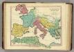
Patriarchati Occidentalis. (1826)
1 : 12100000 Tanner, Henry S.