Gecatalogiseerde kaart
A new and improved chart of the West India or Carribbee [sic] Islands


Volledige titel:A new and improved chart of the West India or Carribbee [sic] Islands
Jaar illustratie:1795
Uitgever:Heather, W. (William)
Fysieke grootte:20 x 30 cm
Schaal kaart:1:1 235 000
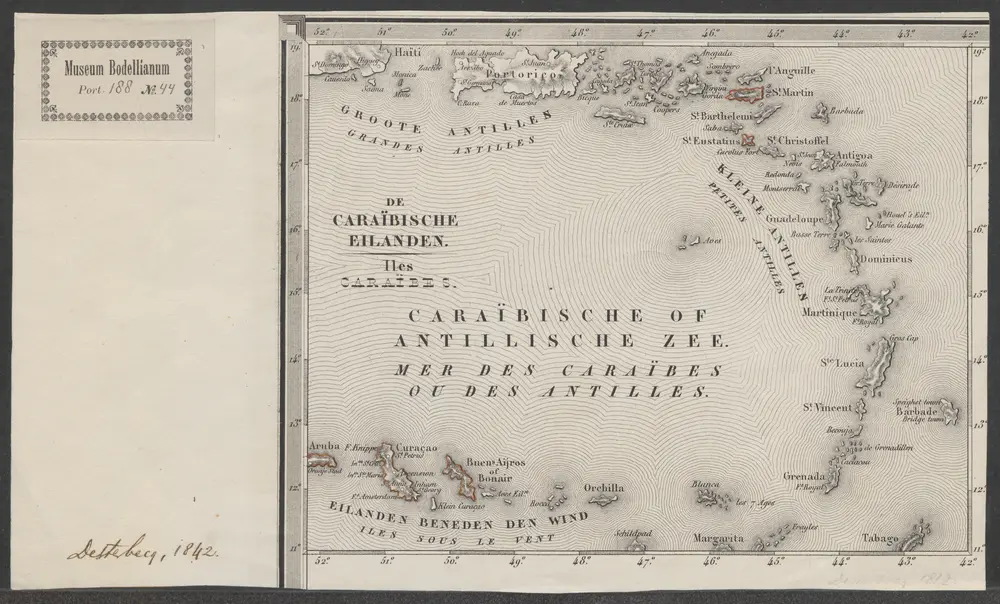
De Caraïbische eilanden = Iles Caraïbes
1842
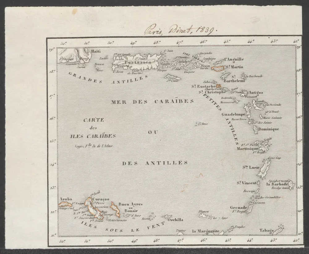
Carte des Iles Caraïbes
1839
[Paris : Binet]
Carte des Antilles
1797
1:3m
[Puerto Rico, Kleine Antillen, Trinidad]
1658
Doncker
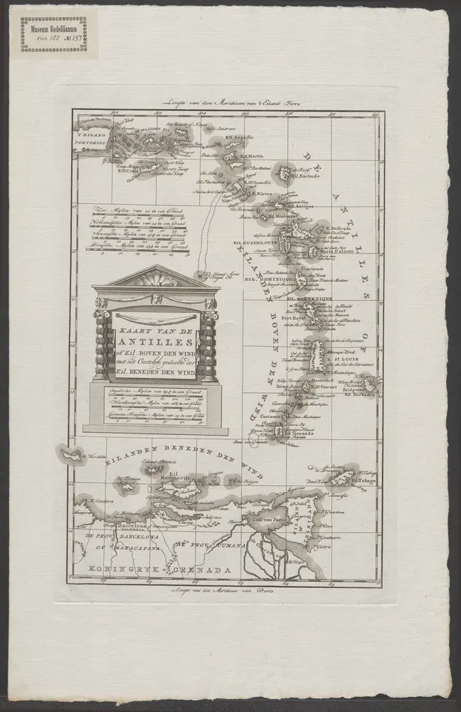
Kaart van de Antilles of eil. boven den wind met het oostelyk gedeelte der eil. beneden den wind
1785
[Amsterdam : Matthijs Schalekamp]
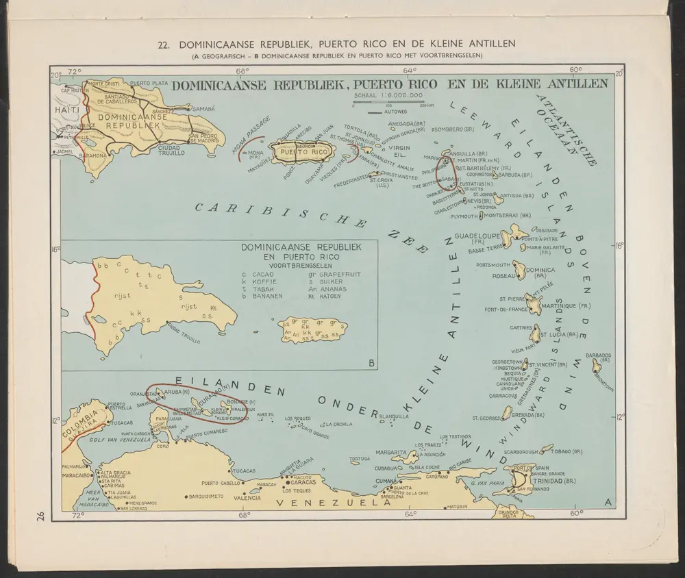
Dominicaanse Republiek, Puerto Rico en de Kleine Antillen [A]
1956
Arnoldus Johannes Cornelius Krafft (1892-)
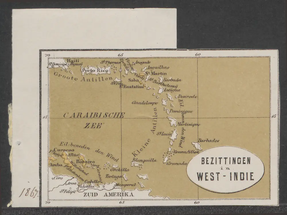
Bezittingen in West-Indie
1869
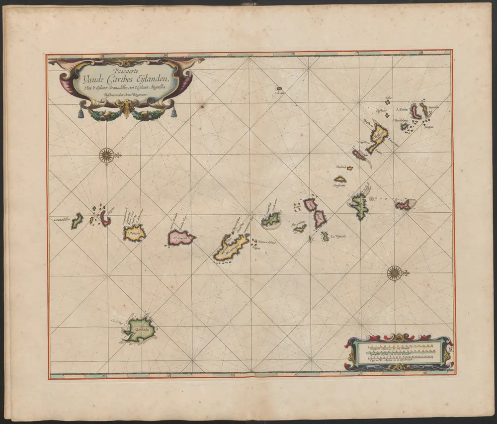
Pascaerte van de Caribes Eijlanden van 't Eÿlant Granadillos tot 't Eijlant Anguilla
1675
Arent Roggeveen (-1679)
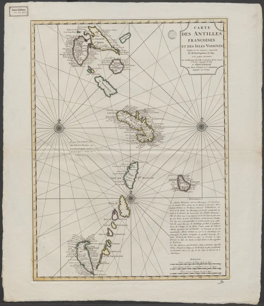
Carte des Antilles Françoises et des isles voisines : dressée sur des memoires manuscrits de Mr. Petit Ingenieur du Roy, et sur quelques observations / par Guillaume de L'Isle de l'Academie rle. des sciences, et Premier Géographe du Roy
1717
Guillaume de L'Isle
A new and improved chart of the West India or Carribbee [sic] Islands
1795
Heather, W. (William)
1:1m