Maps of Ireland

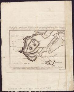
Plan for a complete new harbour, at Howth-town, for the use of his Majesty's mail packet-boats, fishing vessels & in case of a storm, merchant ships going to & fm. Dublin
1 : 44350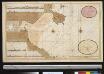
De baaij of rivier van Dublin geleegen aen de Oostcust van Irlandt
Ireland Gerard van Keulen
Irish Ports & Harbours.
1 : 887040 Fullarton, A. & Co.
Dublin environs.
1 : 85000 Society for the Diffusion of Useful Knowledge (Great Britain)
Geological map Dublin.
1 : 47520 Letts, Son & Co.
The environs of Dublin
1 : 15250 Davies, Benjamin Rees published under the superindentance of the Society for the Diffusion of Useful Knowledge [by] George Cox
Sheet 37. (Cary's England, Wales, and Scotland).
1 : 360000 Cary, John, ca. 1754-1835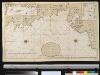
Een gedeelte van de Oost kust van IJrland van Dublin tot St. Johns Point
Ireland Gerard van Keulen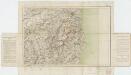
Sheet 11, uit: Ireland
1 : 253440 Annotatie: Voor aanwezige bladen zie overzichtsblad; Alle bladen met aantekeningen in kleurpotlood of inkt; Annotatie geografische gegevens: Maps on the scale of four miles to one inch; Op elk blad een diagram van aangrenzende bladen en een indexdiagram van de corresponderende bladen van de 'one inch map' Dublin : Ordnance Survey of Ireland
delineation of the strata of England and Wales, with part of Scotland
1 : 320000 Blatt 6 Smith, William Cary
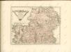
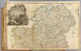
Lagenia; anglis Leinster
1 Karte : Kupferdruck ; 38 x 48 cm Blaeu Joan Blaeu
Comitatus Lageniae The Countie of Leinster. [Karte], in: Novus atlas absolutissimus, Bd. 8, S. 195.
1 Karte aus Atlas Janssonius Offizin
Comitatus Lageniae The Countie of Leinster. [Karte], in: Gerardi Mercatoris et I. Hondii Newer Atlas, oder, Grosses Weltbuch, Bd. 1, S. 57.
1 Karte aus Atlas Mercator, Gerhard und Hondius, Jodocus Jansson, Jan
Ireland SE.
1 : 486830 Stanford, Edward
Ireland NE.
1 : 486830 Stanford, Edward
Ireland 4.
1 : 760320 Letts, Son & Co.
Ireland 2.
1 : 760320 Letts, Son & Co.
LAGENIA; | Anglis | LEINSTER.
[Amsterdam : Joan Blaeu]
CUMBRIAE TYPUS auctore HVMFREDO LHVYD, Denbigiense Cambrobritanno
This is a map of Wales by Humpfry Lyde, after Ortelius. It forms part of an atlas that belonged to William Cecil Lord Burghley, Elizabeth I’s Secretary of State. Burghley used this atlas to illustrate domestic matters. Lyde, Humpfry
Comitatus Lageniae = The countie of Leinster
1 : 1200000 Amstelodami : apud Joannem Janssonium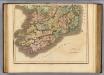
Ireland southern.
1 : 700000 Lizars, Daniel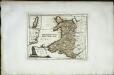
Das Fürstenthum Wales
1 Karte : Kupferdruck ; 19 x 26 cm Reilly F. J. J. von Reilly
Connachtia vulgo Connaughty
1 Karte : Kupferdruck ; 38 x 48 cm Blaeu Joan Blaeu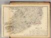
Ireland (south sheet)
1 : 785000 Society for the Diffusion of Useful Knowledge (Great Britain)
Cambriae typus
1 : 780000
Ireland (north)
1 : 380000 Rocque, John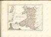
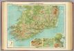
Ireland - southern section.
1 : 633600 John Bartholomew & Co.