Gecatalogiseerde kaart
A map of the island of St. Domingo


Volledige titel:A map of the island of St. Domingo
Jaar illustratie:1780
Fysieke grootte:20 x 30 cm
Schaal kaart:1:950 000
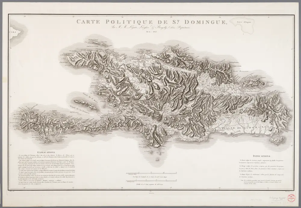
Carte politique de St. Domingue / par Leyritz, Levassor et Bourjolly
1976
Leyritz, ...; Levassor, ...; Bourjolly, ...
1:650k
The Geffrard map of the island of Hayti [cartographic material] : drawn for James Redpath's guide to Hayti
1861
G. Woolworth Colton
1:1m
A map of the island of St. Domingo
1780
1:950k
Spagnvola
1713
1:1
Spagnuola
1576
1:5m
Carte de L'Isle de St. Domingue une des Grandes Antilles, Colonies Francoise et Espagnole
1780
1:2m
Carte de l'isle de Saint Domingue : dressée en 1722 pour l'usage du Roy sur les mémoires de Mr. Frezier, Ingenieur de S.M. et autres
1725
L'Isle, Guillaume de, 1675-1726
1:1m
La partie Francoise de l'isle de Saint Domingue
1764
1:1
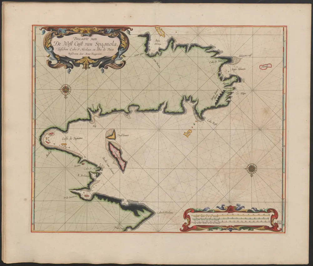
Pascaerte van De West Cust van Spagnola Tusschen Cabo St. Nicolaes en Ilha de Vaca
1675
Arent Roggeveen (-1679)
Carte de l'Isle de Saint Domingue : dressée en 1722 pour l'usage du Roy sur les memoires de Mr. Frezier, ingenieur de S.M. et autres
1730
L'Isle, Guillaume de, 1675-1726
1:310k