Maps of New York

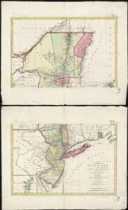
A map of the provinces of New-York and New Jersey, with a part of Pennsylvania and the Province of Quebec
1 : 1040000 Sauthier, Claude Joseph Lotter, Matthäus Albrecht
A chorographical map of the province of New-York in North America, divided into counties, manors, patents and townships.
from Whole
Mappa geographica Provinciae Novae Eboraci ab Anglis New-York dictae / ex ampliori delineatione ad exactas dimensiones concinnata in arctius spatium redacta cura Claudii Josephi Sauthier cui accedit Nova Jersey ex topographicis observationibus.
from Charts and maps Claude Joseph Sauthier,
A chorographical map of the province of New-York in North America, divided into counties, manors, patents and townships : exhibiting likewise all the private grants of land made and located in that Province / compiled from actual surveys deposited in the
from Whole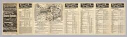
Rome, Watertown and Ogdensburg Railroad.
1 : 5514850 Rome, Watertown & Ogdensburg Railroad Company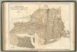
New York, Vermont, New Hampshire, Rhode Island, Massachusetts & Connecticut.
1 : 1570000 Black, Adam & Charles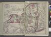
Railroads of the state.
from New topographical atlas and gazetteer of New York, comprising a topographical view of the several counties of the state, ... including ... map of the United States and territories ... Compiled from the latest astronomical observations, official surveys and records of the United States and territories ...
Map of the state of New York / by Simeon De Witt, surveyor general ; engraved by G. Fairman.
from Whole
Map of the state of New York: with the latest improvements / by H. Phelps.
from Whole H. Phelps,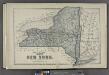
Plan of the State of New York.
from County atlas of Cayuga, New York. From recent and actual surveys and records under the superintendence of F. W. Beers.
An exact map of New England, New York, Pensylvania & New Jersey, from the latest surveys / J. Lodge, sculp.
from Parts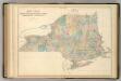
New York and New England.
1 : 1580000 Hughes, William
A chorographical map of the Province of New-York in North America, divided into counties, manors, patents and townships, exhibiting likewise all the private grants of land made and located in that Province
1 : 322000 Sauthier, Claude Joseph Faden, William
A map of the provinces of New-York and New-Jersey, with a part of Pennsylvania and the province of Quebec
1 : 1025000 New Jersey Lotter, Matthäus Albrecht Matthew Albert Lotter
State of New York / by D.H. Burr; engraved & printed by S. Stiles & Co.
from Whole David H. Burr; S. Stiles & Co.,
New-York / by David H. Burr; engraved & printed by S. Stiles.
from Whole David H. Burr; S. Stiles.,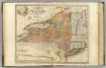
New-York State, surrounding country.
1 : 1300000 Burr, David H., 1803-1875
Map of the meetings constituting New York Yearly Meeting of Friends.
from Whole
A new and accurate map of the province of New York and part of the Jerseys, New England and Canada: shewing the scenes of our military operations during the present war: also the new erected state of Vermont / Jn. Lodge, sculp.
from (A-Z) John Lodge,,
Map of the state of New York : showing the boundaries of counties & townships, the location of cities, towns and villages, the courses of rail roads, canals & stage roads / by J. Calvin Smith ; engraved on steel by Sherman & Smith.
from Whole
Map of the rail-roads of the state of New York
1 : 1000000 Vaughan, David, fl. 1849-1864 C. Van Benthuysen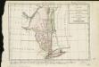
Carte de la Nouvelle York, y-compris les terres cédées du N. Hamp-Shire, sous le nom d'etat de Vermont
1 : 2500000 Hilliard d'Auberteuil, Michel René
Neueste Karte von New York mit seinen Canaelen, Strassen, Eisenbahnen, Entfernungen der Hauptpunkte und Routen für Dampfschiffe
Grosser Hand-Atlas über alle Theile der Erde in 170 Karten Meyer, J. Verlag des Bibliographischen Instituts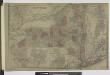
Oswego ; Buffalo ; Rochester ; Syracuse ; New York ; Albany ; Troy ; Vicinity of New York
from Atlas of Montgomery and Fulton counties, New York. From actual surveys / by and under the direction of B. Nichols ; assisted by H.B. Stranahan ... [et al.]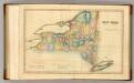
New York.
1 : 1740000 Lucas, Fielding Jr.
New York.
1 : 1280000 Asher & Adams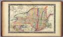
County Map Of The States Of New York, New Hampshire, Vermont. Massachusetts, Rhode Id. And Connecticut.
1 : 1900800 Mitchell, Samuel Augustus
New York.
1 : 2787840 Morse, Jedidiah
A map of the state of New York / J. Roper, sc.
J. Roper,