Maps of Malay Archipelago

East Indies from the best authorites
1 : 26000000
Kaart van de afdeeling, eiland Saleijer (Silaijara), uit: Kaart van Zuid Celebes met uitzondering van het Rijk Gowa
1 : 200000 Annotatie: Met administratieve indeling 's-Gravenhage : Topographische Inrichting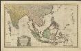
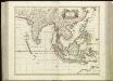
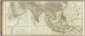
Carte des Indes Orientales
1 : 10000000 dessinée suivant les observations les plus recentes, dont le principal est tirée des cartes hydrographiques de Mr. D'Apres de Mannevillette dediée tres humblement à [...] Guillaume Charles Henry Friso [...] par [...] l'auteur et les Heritiers de Homan(n) ; S. Dorn fe. [Nürnberg] : Heritiers de Homann
India quae Orientalis dicitur, et Insulae Adiacentes. [Karte], in: Novus atlas absolutissimus, Bd. 6, S. 144.
1 Karte aus Atlas Janssonius Offizin
Indiae Orientalis, Insularumque Adiacientium Typus. [Karte], in: Theatrum orbis terrarum, S. 399.
1 Karte aus Atlas Ortelius, Abraham Vrients, Jan Baptista
India quae Orientalis dicitur, Et Insulae Adiacentes. [Karte], in: Theatrum orbis terrarum, sive, Atlas novus, Bd. 2, S. 248.
1 Karte aus Atlas Blaeu, Joan Blaeu, Willem Janszoon
India quae Orientalis dicitur, et Insulae Adiacentes. [Karte], in: Novus Atlas, das ist, Weltbeschreibung, Bd. 2, S. 263.
1 Karte aus Atlas Blaeu, Joan Blaeu, Willem Janszoon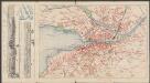
India quae Orientalis dicitur, Et Insulae Adiacentes. [Karte], in: Le théâtre du monde, ou, Nouvel atlas contenant les chartes et descriptions de tous les païs de la terre, Bd. 2, S. 239.
1 Karte aus Atlas Blaeu, Willem Janszoon und Blaeu, Joan Blaeu, Willem Janszoon
INDIA | quæ | ORIENTALIS | dicitur | ET | INSVLÆ | ADIACENTES.
[Amsterdam : Joan Blaeu]
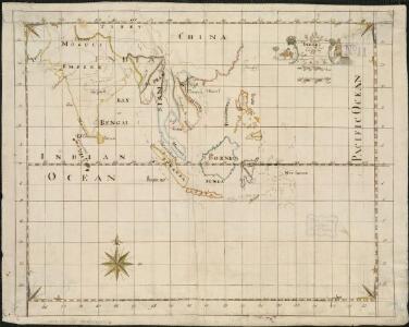
Siam, Malacca and the Indian Islands.
from A new systeme of the mathematicks: containing I. Arithmetick, as well natural and decimal, as in species, or the principles of algebra. II. Practical geometry, together with the first six books of Euclid's Elements, as also the eleventh and twelfth, symbo

(Asia and its islands according to d'Anville. Southern section)
1 : 11100000 Kitchin, Thomas
Indes, la Chine.
1 : 10700000 L'Isle, Guillaume de, 1675-1726
Indes, la Chine.
1 : 10700000 L'Isle, Guillaume de, 1675-1726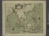
A chart of the eastermost part of the EAST INDIES and CHINA, from cape comarine to IAPAN, with all adjacent Islands
from The sea-atlas : containing an hydrographical description of most of the sea-coasts of the known parts of the world.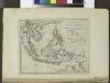
The islands of the East Indies with the channels between India, China & New Holland.
from Carey's general atlas, improved and enlarged : being a collection of maps of the world and quarters, their principal empires, kingdoms, &c.
Ost-Indien.
1 : 18500000 Stulpnagel, F.v.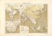
Atlas für Industrie- und Handelsgeographie: Für commercielle und technische Lehranstalten, für Kaufleute und Industrielle

Ostindien und China
1 : 25000000 Himálaj Kocen, Blaž Eduard Hölzel
CARTE DES INDES ORIENTALES
1 : 10700000 Asie jihovýchodní Mayer, Tobias Apres de Mannevillette, Jean-Baptiste-Nicolas-Denis d' Heritiers de Homan[n]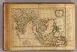
Les Indes Orientales.
1 : 29000000 Lattre, Jean

Indien und Ostasien
1 : 10000000 Asie východní Verlagsanstalt List & von Bressensdorf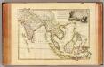
Indes Orientales.
1 : 16250000 Bonne, Rigobert, 1727-1794
India
1 : 19000000 Asie jihovýchodní Spruner, Karl von Justus Perthes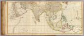
Asia (middle)
1 : 11000000 Anville, Jean Baptiste Bourguignon d, 1697-1782; Kitchin, Thomas; Robert Laurie & James Whittle
Ost-Indien
Hand-Atlas über alle Theile der Erde und über das Weltgebäude Stieler, Adolf Justus Perthes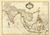
Composite: Indes.
1 : 10000000 Bonne, Rigobert, 1727-1794