Maps of New Jersey
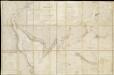
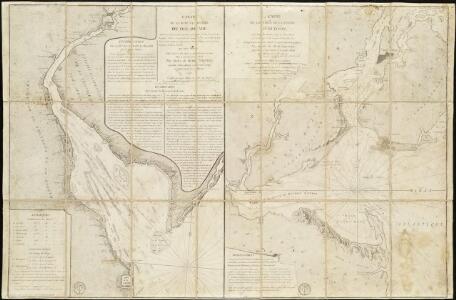
Carte de la Baye et Riviere de Délaware, contenant une éxacte et entiére description des rivages, criques, havres, sondes, bas-sonds, sables et gissements des marques ...
1 : 31000 France. Dépôt des cartes et plans de la marine France. Dépôt des cartes et plans de la marine
Map of the American Coast, from Lynhaven Bay to Narraganset Bay.
1 : 1267200 Melish, John
Map of the American Coast, from Lynhaven Bay to Narraganset Bay.
1 : 1267200 Melish, John
D'Engelze volkplanting in Virginie / door Iohan Smith bezogt en verder uytgeset; uytgevoerd te Leyden door Pieter vander Aa.
from Charts and maps Pieter vander Aa,
An exact map of New Jersey, Pensylvania, New York, Maryland & Virginia, from the latest surveys / J. Lodge, sculp.
from Parts John Lodge,
New Iarsey / by John Seller.
from A new system of geography : designed in a most plain and easie method, for the better understanding that science : accommodated with new maps of all the empires, kingdoms, principalities, dukedoms, provinces, and countries in the whole world : with geographical tables, explaining the divisions in each map / by John Seller, late hydrographer to the King.
A new map of Virginia, Mary-land and the improved parts of Penn-sylvania & New Jersey / revised by I. Senex.
from Charts and maps I. Senex,
A New and accurate map of New Jersey : from the best authorities.
from Whole
Pas-Kaart vande zee kusten van Niew Nederland anders genaamt Niew York : tusschen Renselaars Hoek en de Staaten Hoek / door C. J. Vooght, geometra.
from Charts and maps
Delaware, from the best authorities / W. Barker, sculp., Philada.
from Carey's American atlas.
A map of New Jersey, from the best authorities.
from The American geography; or, A view of the present situation of the United States of America: containing astronomical geography; geographical definitions, discovery, and general description ... By Jedidiah Morse, A.M.
A map of New Jersey: from the best authorities.

New Jersey.
from Supplement to the New York observer.
New Jersey
1 : 505000 Sotzmann, D. F Bey Carl Ernst Bohn
A chart of Delaware Bay and River : containing a full and exact description of the shores, creeks, harbours, soundings, shoals, sands, and bearings of the most considerable land marks &c. &c. / faithfully coppied [sic] from that published at Philadelphia
from Parts
Gay Head to Cape Henlopen
1 : 400000 Hassler, F. R.
Map of the state of Maryland : laid down from an actual survey of all the principal waters, public roads, and divisions of the counties therein : describing the situation of the cities, towns, villages, houses of worship and other public buildings, fu...
From Maryland
The Province of New Jersey, divided into East and West, commonly called the Jerseys / engraved & published by Wm. Faden.
from Charts and maps
The Province of New Jersey, divided into East and West, commonly called the Jerseys / engraved & published by Wm. Faden, Charing Cross, December 1st, 1777 ; Croisey, sculpt.
from Whole
Routes between New-York & Washington / drawn by I. Smith, geographer.
from Parts
Virginia and Maryland.
1 : 1340000 Moll, Herman, d. 1732
The State of New Jersey / compiled from the most accurate surveys / Martin sculpt.
from Whole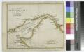
A chart of Delaware Bay and River / from the original by Mr. Fisher of Philadelphia, 1776.
from Charts and maps
The province of New Jersey, divided into east and west, commonly called the Jerseys
1 : 420000 Faden, William Faden, William
New Jersey.
1 : 860000 Schonberg & Co.
New Jersey.
1 : 778000 Tanner, Henry S.
New Jersey.
1 : 980000 Lucas, Fielding Jr.
New Jersey.
1 : 750000 Colton, G.W.
[Neueste Karte von New Jersey mit seinen Strassen, Entfernungen der Hauptpunkte und Routen für Dampfschiffe]
Grosser Hand-Atlas über alle Theile der Erde in 170 Karten Meyer, J. Verlag des Bibliographischen Instituts