Maps of Grand Est
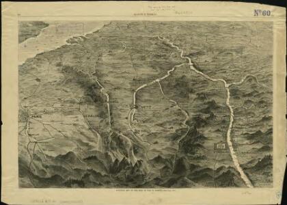
Pictorial map of the seat of war in Europe
1 : 1
Nordost Frankreich, Belgien und Luxemburg Deutsche Rheinländer

[Frankreich in 4 Blättern, Nordöstliches Frankreich]
Hand-Atlas über alle Theile der Erde und über das Weltgebäude Stieler, Adolf Justus Perthes
Carte de la France (NE)
1 : 345600 Cassini family
Le royaume de France orientale, dit autrement Austrasie
1 Karte : Kupferdruck ; 39 x 49 cm, Bildgrösse 39 x 56 cm Duval chez l'auteur en l'isle du Palais sur le quay de l'Orloge
France frontiére Nord-Est et alsace-lorraine
Vidal de La Blache, Paul
Severovýchodní Francie

Carte de la République française, 2
1 Blatt : 42 x 51 cm P.G. Chanlaire
Carte de la France, 2
1 Blatt : 60 x 82 cm de Belleyme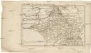
Belgica oder Nieder Teutschland
Belgie Baumgarten, Siegmund Jakob Johann Justinus Gebauer
France II.
1 : 1750000 Society for the Diffusion of Useful Knowledge (Great Britain)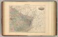
France N.E.
1 : 1615000 Migeon, J.
Neueste und aceurate Landkarte des volligen-Rheinstroms mit den daran gelegenen Landschafften und benachbarten Provinzien, auch einem grossen theil des Franzos: Konigreiches
Mollova mapová sbírka Lerch, Johann Martin Lerch, Johann Martin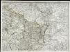
Carte de la France, 2
1 Blatt : 61 x 83 cm de Belleyme
[Frankreich, Blatt 2]
Adolf Stieler's Handatlas über alle Theile der Erde und über das Weltgebäude Stieler, Adolf Justus Perthes
Distribution of German forces on the Western Front
1 : 750000 First World War map of the distribution of German forces on the Western Front according to captured map dates 30th Oct. 1918. Title of base sheet 'Map of the Western Theatre of War'. War Office

Reliefkarte von Nordost-Frankreich


Carte des peuples riverains du Rhin au temps d’Auguste et de ses successeurs immédiats
Mitteleuropa Rhein-Gebiet ethnische Gruppe Germanen
[Frankreich in 4 Blättern, Blatt 2]
Handatlas über alle Theile der Erde und über das Weltgebäude Stieler, Adolf Justus Perthes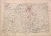
Territory in Western Germany occupied by the Allied Armies
1 : 1000000 First World War map of the territory in Western Germany occupied by the Allied Armies and the stages of evacuation according to article 429 of the peace treaty. Situation for July 1921. War Office
Allgemeine Uebersicht des Kriegsschauplazes am Rhein, der Mosel, Maas, Marne, Seine, Schelde [et].c.c
1 Karte : Kupferdruck ; 48 x 58 cm Güssefeld bey d. Homann. Erben
Carte de la France, 2
2 Blätter : mehrfarbig ; 71 x 83 cm de Belleyme
Nordost-Frankreich und Belgien
1 : 750000 Belgie Justus Perthes
Der Nordöstliche Theil von Frankreich
Hand-Atlas über alle Theile der Erde nach dem neuesten Zustande und über das Weltgebäude Stieler, Adolf bei Justus Perthes
Der Nordoestliche Theil von Frankreich
Stieler's Hand-Atlas Stieler, Adolf bei Justus Perthes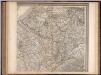
Frankreich. Upper right sheet
1 : 1200000 Geographisches Institut (Weimar, Germany)
France Régionale France de l’Est Jura-Bassin de la Saône carte politique
Gallois, Lucien