Maps of Hazlet Township
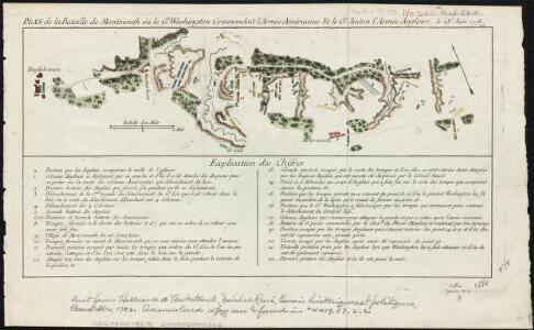
Plan de la bataille de Montmouth où le Gl. Washington commandait l'Armée Américaine et le Gl. Clinton l'Armée Anglaise, le 28 Juin 1778
1 : 30500 Hilliard d'Auberteuil, Michel René
Sandy Hook
1 : 62500
Sandy Hook
1 : 62500
Sandy Hook
1 : 62500
Sandy Hook
1 : 62500
Sandy Hook
1 : 62500
Sandy Hook
1 : 62500
Sandy Hook
1 : 62500
Sandy Hook
1 : 62500
Sandy Hook
1 : 62500
General map of the city of New York, consisting of boroughs of Manhattan, Brooklyn, Bronx, Queens and Richmond : consolidated into one municipality by act of the legislature of the state of New York (Chapter 378 of the laws of 1897) : showing in addition
from Whole
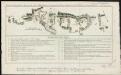
Monmouth County, Double Page Plate No. 30 [Map of Middle Township]
From Wolverton's atlas of Monmouth County, New Jersey : compiled from actual surveys, state and county official records and private plans.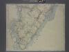
New map of Staten Island
from Staten Island
(Coast section no. 1. Sandy Hook to Shark River)
1 : 63360 Woolman, H. C.
Keyport
1 : 24000
Keyport
1 : 24000
Keyport
1 : 24000
Keyport
1 : 24000
Keyport
1 : 24000
Keyport
1 : 24000
Sandy Hook
1 : 24000
Sandy Hook
1 : 24000
Sandy Hook
1 : 24000
Sandy Hook
1 : 24000
Sandy Hook
1 : 24000
Sandy Hook
1 : 24000
General map of the borough of Richmond (Staten Island) in the city of New York : showing in addition to the existing topographical features of the borough a tentative and preliminary plan for a street system of the same.
from Staten Island
Staten Island (cont.)
From The Borough
Map of the Hudson ... from Sandy Hook to New York Harbor
from Map of the Hudson between Sandy Hook & Sandy Hill : with the post road between New York and Albany / Bridges delt. ; Rollinson sct.