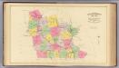
Maps of Worcester County

Map of 100 miles round Boston

[Map of eastern Massachusetts and vicinity]

Trolley wayfinder, birds eye view of trolley routes in New England
Geo. H. Walker & Co New England Street Railway Club
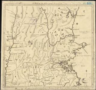
The seat of war in New England, by an American volunteer, with the marches of the several corps sent by the Colonies towards Boston, with the attack on Bunkers-Hill

Boston
1 : 250000
Boston
1 : 250000
Boston
1 : 250000
Boston
1 : 250000
Boston
1 : 250000
Boston
1 : 250000
Boston
1 : 250000
Boston
1 : 250000
Carte des environs de Boston, capitale de Nlle. Angleterre en Amerique

An accurate map of the country round Boston in New England : from the best authorities
1 : 362500 Hamilton, Archibald, d. 1792 Published as the Act directs by A. Hamilton, Junr. near St. John's Gate
Map of Worcester County, Massachusetts : based upon the trigonometrical survey of the state
1 : 63360 Walling, Henry Francis, 1825-1888 Wm. E. Baker & Co.
Die gegund um Boston

Thirty-miles round Boston
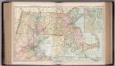
Map of Massachusetts. 70
1 : 633600 Appleton, D. & Co.
Map of Hillsboro Co., New Hampshire
1 : 53000 Chace, J Smith, Mason & Co.
Map of Middlesex County, Massachusetts : based upon the trigonometrical survey of the state
1 : 50000 Walling, Henry Francis, 1825-1888 Smith & Bumstead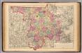
Middlesex County.
1 : 158400 Gray, Ormando Willis; Walling, H. F.
Worcester County.
1 : 158400 Gray, Ormando Willis; Walling, H. F.
A topographical map of Essex County, Massachusetts : based upon the trigonometrical survey of the state
1 : 50000 Walling, Henry Francis, 1825-1888 Smith and Morley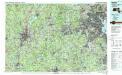
Boston
1 : 100000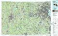
Boston
1 : 100000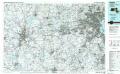
Boston
1 : 100000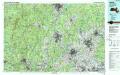
Lowell
1 : 100000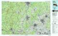
Lowell
1 : 100000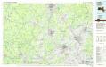
Lowell
1 : 100000