Maps of Appalachian Mountains

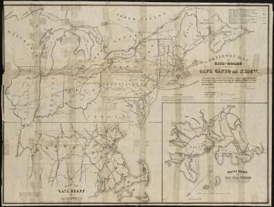
Skeleton map of the rail-roads between Cape Canso and St. Louis
Shell Highway Map Northeastern Section of the United States.
1 : 3231360 Shell Oil Company
American Atlantic ports N.
1 : 5000000 Philip, George
Etats Unis Flle. N.E.
1 : 5000000 Vivien St Martin, L.
Chicago & Grand Trunk R'y.
1 : 3830000 Chicago and Grand Trunk Railway Company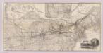
Grand Trunk Ry. of Canada.
1 : 3362700 Grand Trunk Railway Company of Canada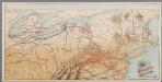
[Recto], uit: Reading railroad system and connections
Buffalo, N.Y. : The Matthews-Northrup Co.
Vereinigte Staaten von Nord-Amerika in 6 blattern, bl. 3

Copy of a map attached to Govr. Colden's History of the Five Indian Natio[ns] : printed in London, A.D. MDCCXLVII.
from Parts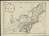
Nieuwe en nauwkeurige kaart van een gedeelte van Noord America, behelzende Nieuw England, New York, Pensylvania, New Jersey, Connecticut, Rhode Island, een stuck van Virginia, Kanda en Halifax, ter opheldering der reizen van den Heer P. Kalm
1 : 2000000 C.J. de Huyser direx. P. Mol geletterdt Te Utrecht : by de boekverkopers J. v. Schoonhoven & Comp. en G. v. d. Brink jz.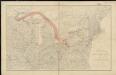
Distribution of the iron ores mined in the Lake Superior Region in year 1902
1 : 2500000 Birkinbine, John Geological Survey (U.S.)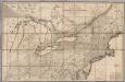
Map of the Canadas.
1 : 1267200 Taylor, David
Map New York Central Lines.
1 : 4200000 New York Central Railroad Company
Northern provinces of the United States / drawn & engraved for Thomson's New general atlas, 1817 ; Hewitt Sc. ...
from Charts and maps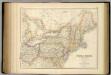
United States ... North Eastern States.
1 : 2851200 Fullarton, A. & Co.
[Die Vereinigten Staaten von Amerika in 6 Blättern, Blatt 3]
Adolf Stieler's Handatlas über alle Theile der Erde und über das Weltgebäude Stieler, Adolf Justus Perthes
[Die Vereinigten Staaten von Nord-Amerika, Blatt 3]
Handatlas über alle Theile der Erde und über das Weltgebäude Stieler, Adolf Justus Perthes

Map of the Seat of War in North America.
1 : 4118400 Melish, John
Map of the Seat of War in North America.
1 : 4118400 Melish, John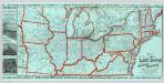
Lake Shore and Michigan So. Railway.
1 : 3431200 Lake Shore & Michigan Southern Railway
Map of the United States.
1 : 6750000 Scott, Joseph
Map of the northern parts of the United States of America / by Abraham Bradley.
from Parts Abraham Bradley,
Vereinigte Staaten Von Nord-Amerika In 6 Blattern, Bl. 3.
1 : 3700000 Petermann, A.
A new and general map of the middle dominions belonging to the United States of America: viz. Virginia, Maryland, the Delaware-counties, Pennsylvania, New Jersey &c. with the addition of New York, & of the greatest part of New England &c as also of the bordering parts of the British possessions in Canada.
from Parts Published by Laurie & Whittle, No. 53 Fleet Street ...: London; Robert Laurie and James Whittle,
This map of Upper and Lower Canada and United States.
1 : 3700000 Tardieu, P.F.
Northern provinces of the United States / drawn & engraved for Thomson's New general atlas, 1817 ; Hewitt Sc. ...
from Parts
Bowles's new one-sheet map of the independent states of Virginia, Maryland, Delaware, Pensylvania, New Jersey, New York, Connecticut, Rhode Island, &c. : comprehending also the habitations & hunting countries of the confederate Indians.
from Bowles's universal atlas. ...
Der Nördliche Theil der Vereinigten Staaten von Nord America
Hand-Atlas über alle Theile der Erde nach dem neuesten Zustande und über das Weltgebäude Stieler, Adolf bei Justus Perthes