Maps of Pontianak

[Peta Kalimantan (Indonesian Borneo)

Blad IX Soekadana, blad h, uit: Residentie Wester-Afdeeling van Borneo : weg- en rivierkaart / Topographisch Bureau
1 : 50000 Annotatie: Voor aanwezige bladen zie overzichtsblad Topographisch Bureau, Batavia Batavia : Topographisch Bureau
Tajan / Topographisch Bureau
Topographisch Bureau Batavia Batavia : Topographisch Bureau
Schetskaartje van het landschap Mandor
Koninlijk Instituut voor de Taal-, Land-, en Volkenkunde (KITLV) Den Haag [Den Haag : Koninklijk Instituut voor de Taal-, Land-, en Volkenkunde]
Schets van een gedeelte van de afdeeling Sambas
[S.l. : s.n.]
Blad II Singkawang, uit: Residentie Wester-Afdeeling van Borneo / Topographisch Bureau
1 : 200000 titelvariant: Residentie Westerafdeeling van Borneo; Annotatie: Titelvariant: Residentie Westerafdeeling van Borneo; Voor aanwezige bladen zie overzichtsblad; Annotatie geografische gegevens: Opname: 1886-1895 Topographisch Bureau, Batavia Batavia : Topographisch Bureau
Blad III Pontijanak, uit: Residentie Wester-Afdeeling van Borneo / Topographisch Bureau
1 : 200000 titelvariant: Residentie Westerafdeeling van Borneo; Annotatie: Titelvariant: Residentie Westerafdeeling van Borneo; Voor aanwezige bladen zie overzichtsblad; Annotatie geografische gegevens: Opname: 1886-1895 Topographisch Bureau, Batavia Batavia : Topographisch Bureau
Blad IV Padang Tikar, uit: Residentie Wester-Afdeeling van Borneo / Topographisch Bureau
1 : 200000 titelvariant: Residentie Westerafdeeling van Borneo; Annotatie: Titelvariant: Residentie Westerafdeeling van Borneo; Voor aanwezige bladen zie overzichtsblad; Annotatie geografische gegevens: Opname: 1886-1895 Topographisch Bureau, Batavia Batavia : Topographisch Bureau
Singkawang / Topographisch Bureau
Topographisch Bureau Batavia Batavia : Topographisch Bureau
Blad XVIII Batang Loepar, blad c, uit: Residentie Wester-Afdeeling van Borneo : weg- en rivierkaart / Topographisch Bureau
1 : 50000 Annotatie: Voor aanwezige bladen zie overzichtsblad Topographisch Bureau, Batavia Batavia : Topographisch Bureau
Soekadana / Topographisch Bureau
Topographisch Bureau Batavia Batavia : Topographisch Bureau
Poelau Laoet / Army Map Service
Army Map Service Washington D.C. Washington D.C. : Army Map Service
Mampawah / Army Map Service
Army Map Service Washington D.C. Washington D.C. : Army Map Service
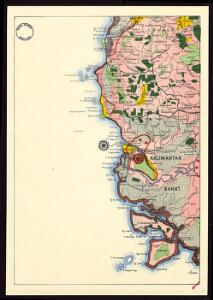
Pontianak / Army Map Service
Army Map Service Washington D.C. Washington D.C. : Army Map Service
Siding / Topographisch Bureau
Topographisch Bureau Batavia Batavia : Topographisch Bureau
Blad IX Soekadana, uit: Residentie Wester-Afdeeling van Borneo / Topographisch Bureau
1 : 200000 titelvariant: Residentie Westerafdeeling van Borneo; Annotatie: Titelvariant: Residentie Westerafdeeling van Borneo; Voor aanwezige bladen zie overzichtsblad; Annotatie geografische gegevens: Opname: 1886-1895 Topographisch Bureau, Batavia Batavia : Topographisch Bureau
Blad VIII Tajan, uit: Residentie Wester-Afdeeling van Borneo / Topographisch Bureau
1 : 200000 titelvariant: Residentie Westerafdeeling van Borneo; Annotatie: Titelvariant: Residentie Westerafdeeling van Borneo; Voor aanwezige bladen zie overzichtsblad; Annotatie geografische gegevens: Opname: 1886-1895 Topographisch Bureau, Batavia Batavia : Topographisch Bureau
Bangsal / Army Map Service
Army Map Service Washington D.C. Washington D.C. : Army Map Service
Poelau Padang Tikar / Army Map Service
Army Map Service Washington D.C. Washington D.C. : Army Map Service
Singkawang / Army Map Service
Army Map Service Washington D.C. Washington D.C. : Army Map Service
Bengkajang / Army Map Service
Army Map Service Washington D.C. Washington D.C. : Army Map Service
Mempawah Ilir / [nach eigenen Wahrnehmungen und denen der Bergingenieure C.J. van Schelle und M. Koperberg zusammengetellt vom Oberbergingenieure N. Wing Easton ; gezeichnet von A.L.E. Gaston]
Topographisch Bureau Batavia [Batavia : Landsdrukkerij]
Ledo-Seminis / [nach eigenen Wahrnehmungen und denen der Bergingenieure C.J. van Schelle und M. Koperberg zusammengetellt vom Oberbergingenieure N. Wing Easton ; gezeichnet von A.L.E. Gaston]
Topographisch Bureau Batavia [Batavia : Landsdrukkerij]
Pemangkat / [nach eigenen Wahrnehmungen und denen der Bergingenieure C.J. van Schelle und M. Koperberg zusammengetellt vom Oberbergingenieure N. Wing Easton ; gezeichnet von A.L.E. Gaston]
Topographisch Bureau Batavia [Batavia : Landsdrukkerij]
Sebadu / [nach eigenen Wahrnehmungen und denen der Bergingenieure C.J. van Schelle und M. Koperberg zusammengetellt vom Oberbergingenieure N. Wing Easton ; gezeichnet von A.L.E. Gaston]
Topographisch Bureau Batavia [Batavia : Landsdrukkerij]
Bengkajang / [nach eigenen Wahrnehmungen und denen der Bergingenieure C.J. van Schelle und M. Koperberg zusammengetellt vom Oberbergingenieure N. Wing Easton ; gezeichnet von A.L.E. Gaston]
Topographisch Bureau Batavia [Batavia : Landsdrukkerij]
Montrado / [nach eigenen Wahrnehmungen und denen der Bergingenieure C.J. van Schelle und M. Koperberg zusammengetellt vom Oberbergingenieure N. Wing Easton ; gezeichnet von A.L.E. Gaston]
Topographisch Bureau Batavia [Batavia : Landsdrukkerij]
Blad IX Soekadana, blad n, uit: Residentie Wester-Afdeeling van Borneo : weg- en rivierkaart / Topographisch Bureau
1 : 50000 Annotatie: Voor aanwezige bladen zie overzichtsblad Topographisch Bureau, Batavia Batavia : Topographisch Bureau
Blad III Pontijanak, blad d, uit: Residentie Wester-Afdeeling van Borneo : weg- en rivierkaart / Topographisch Bureau
1 : 50000 Annotatie: Voor aanwezige bladen zie overzichtsblad Topographisch Bureau, Batavia Batavia : Topographisch Bureau