خريطة مفهرسة
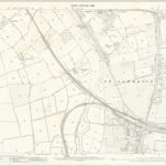
Worcestershire XLII.15 (includes: Charlton; Evesham; Norton and Lenchwick) - 25 Inch Map

المؤسسة:National Library of Scotland
العنوان الكامل:Worcestershire XLII.15 (includes: Charlton; Evesham; Norton and Lenchwick) - 25 Inch Map
مصورة:1883 - 1884
تاريخ النشر:1886
الناشر:Ordnance Survey
مقياس الخريطة:1:2 500