Cataloged map
SP66 - OS 1:25,000 Provisional Series Map
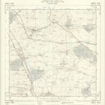

Institution:National Library of Scotland
Full title:SP66 - OS 1:25,000 Provisional Series Map
Depicted:1950
Pubdate:1954
Publisher:Ordnance Survey
Map scale:1:25 000
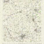
Northampton - OS One-Inch Map
1950
Ordnance Survey
1:63k
An accurate map of Northampton Shire
1752
Bowen; Hinton
Comitatvs Northantonensis vernacule Northamton Shire
1690
Valck; Schenk
Comitatvs Northantonensis; vernacule Northamton Shire
1646
Blaeu

Kettering (Hills) - OS One-Inch Revised New Series
1897
Ordnance Survey
1:63k

Kettering (Outline) - OS One-Inch Revised New Series
1897
Ordnance Survey
1:63k

Wellingborough (Hills) - OS One-Inch Revised New Series
1897
Ordnance Survey
1:63k

Wellingborough (Outline) - OS One-Inch Revised New Series
1897
Ordnance Survey
1:63k

Bedford (Hills) - OS One-Inch Revised New Series
1904
Ordnance Survey
1:63k

Bedford (Outline) - OS One-Inch Revised New Series
1893
Ordnance Survey
1:63k