Mapa catalogado
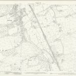
Glamorgan XXXIV.15 (includes: Coety Higher; Newcastle Higher; St Brides Minor; Ynysawdre) - 25 Inch Map

Institución:National Library of Scotland
Título completo:Glamorgan XXXIV.15 (includes: Coety Higher; Newcastle Higher; St Brides Minor; Ynysawdre) - 25 Inch Map
Año de ilustración:1914
Fecha de publicación:1918
Editorial:Ordnance Survey
Escala del mapa:1:2 500